
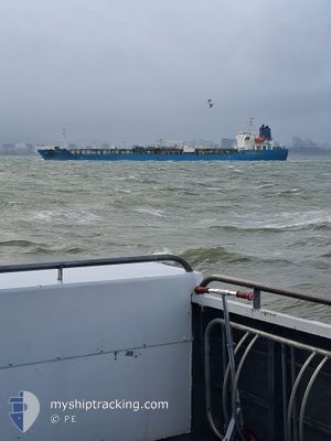
ORCHID MADEIRA
Oil/Chemical Tanker
Current Trip
CAVAN
| Time Travelled | 5 h, 15 mins |
|---|---|
| Remaining Time | --- |
| Distance Travelled | 2.79 nm |
| Remaining Distance | --- |
| AVG Speed | 4.8 Knots |
| MAX Speed | 5.7 Knots |
| AVG Wind | 7.9 knots |
| MAX Wind | 8 knots |
| MIN Temp | 6°C / 42.8°F |
| MAX Temp | 7.5°C / 45.5°F |
| Dybgang | 5.8 m |
| Position Modtaget | 2 m siden |
Current Position
| Longitude | -122.93815° |
|---|---|
| Latitude | 49.30714° |
| Status | At anchor |
| Fart | |
| Kurs | 138° |
| Område | The Coastal Waters of Southeast Alaska and British Columbia |
| Station | T-AIS |
| Position Modtaget | 2 m siden |
Info
Information
The current position of ORCHID MADEIRA is in The Coastal Waters of Southeast Alaska and British Columbia with coordinates 49.30714° / -122.93815° as reported on 2025-02-25 10:49 by AIS to our vessel tracker app. The vessel's current speed is 0 Knots
The vessel ORCHID MADEIRA (IMO: 9367401, MMSI: 538003481) is a Oil/Chemical Tanker that was built in 2009 ( 16 år gamle ). It's sailing under the flag of [MH] Marshall Is.
In this page you can find informations about the vessels current position, last detected port calls, and current voyage information. If the vessels is not in coverage by AIS you will find the latest position.
The current position of ORCHID MADEIRA is detected by our AIS receivers and we are not responsible for the reliability of the data. The last position was recorded while the vessel was in Coverage by the Ais receivers of our vessel tracking app.
The current draught of ORCHID MADEIRA as reported by AIS is 5.8 meters
Weather
| Temperature | 6.5°C / 43.7°F |
|---|---|
| Wind Speed | 6 knots |
| Direction | 64° ENE |
| Pressure | 1001 hPa |
| Humidity | 90.9 % |
| Cloud Coverage | 100 % |
Featured Company
Events
| Tid | Hændelsen | Detaljer | Position / Dest | Info |
|---|---|---|---|---|
| 2025-02-25 09:25 | Status er ændret | At anchor Default |
49.30699 / -122.93851
CAVAN
|
Fart: Kurs: 142° |
| 2025-02-25 09:22 | Status er ændret | Default At anchor |
49.30704 / -122.93855
CAVAN
|
Fart: Kurs: 139° |
| 2025-02-25 06:34 | Status er ændret | At anchor Under way using engine |
49.30721 / -122.93788
CAVAN
|
Fart: Kurs: 152° |
| 2025-02-25 06:15 | STOP Sejllads | 6.19 nm, East of VANCOUVER |
49.30629 / -122.93844
CAVAN
|
Fart: 0.3 kn Kurs: 118° |
| 2025-02-25 05:36 | Afsejlet fra sidste havn |
|
49.29573 / -123.00047
CAVAN
|
Fart: 7.7 kn Kurs: 73° |
| 2025-02-25 04:43 | Skibe i havn |
|
49.31658 / -123.14644
[CA] VANCOUVER
|
Fart: 8.8 kn Kurs: 105.7° |
| 2025-02-25 01:47 | Ændre havområde | Canadian part of the The Coastal Waters of Southeast Alaska and British Columbia United States part of the The Coastal Waters of Southeast Alaska and British Columbia |
49.00097 / -123.24001
The Coastal Waters of Southeast Alaska and British Columbia
CAVAN
|
Fart: 11.9 kn Kurs: 313.2° |
| 2025-02-25 00:47 | Ændre havområde | United States part of the The Coastal Waters of Southeast Alaska and British Columbia Canadian part of the The Coastal Waters of Southeast Alaska and British Columbia |
48.84170 / -123.02305
The Coastal Waters of Southeast Alaska and British Columbia
CAVAN
|
Fart: 13.5 kn Kurs: 335° |
| 2025-02-25 00:44 | Ændre havområde | Canadian part of the The Coastal Waters of Southeast Alaska and British Columbia United States part of the The Coastal Waters of Southeast Alaska and British Columbia |
48.83147 / -123.01602
The Coastal Waters of Southeast Alaska and British Columbia
CAVAN
|
Fart: 13.3 kn Kurs: 335.4° |
| 2025-02-25 00:35 | Ændre havområde | United States part of the The Coastal Waters of Southeast Alaska and British Columbia Canadian part of the The Coastal Waters of Southeast Alaska and British Columbia |
48.80224 / -123.00196
The Coastal Waters of Southeast Alaska and British Columbia
CAVAN
|
Fart: 11.2 kn Kurs: 14.9° |