
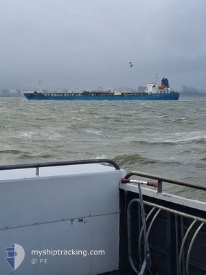
ORCHID MADEIRA
Oil/Chemical Tanker
Current Trip
| Time Travelled | 10 days |
|---|---|
| Remaining Time | --- |
| Distance Travelled | 3207.46 nm |
| Remaining Distance | --- |
| AVG Speed | 12 Knots |
| MAX Speed | 15.5 Knots |
| AVG Wind | 14.3 knots |
| MAX Wind | 26.9 knots |
| MIN Temp | 12.3°C / 54.14°F |
| MAX Temp | 26.1°C / 78.98°F |
| Draught | 10.4 m |
| Position Received | 6 d ago |
Current Position
| Longitude | -14.84119° |
|---|---|
| Latitude | 37.46230° |
| Status | Under way using engine |
| Speed | 13.1 Knots |
| Course | 203° |
| Area | North Atlantic Ocean |
| Station | T-AIS |
| Position Received | 6 d ago |
Information
The current position of ORCHID MADEIRA is in North Atlantic Ocean with coordinates 37.46230° / -14.84119° as reported on 2025-05-28 21:23 by AIS to our vessel tracker app. The vessel's current speed is 13.1 Knots and is heading at the port of ARATU. The estimated time of arrival as calculated by MyShipTracking vessel tracking app is 2025-06-09 11:00 LT
The vessel ORCHID MADEIRA (IMO: 9367401, MMSI: 538003481) is a Oil/Chemical Tanker that was built in 2009 ( 16 years old ). It's sailing under the flag of [MH] Marshall Is.
In this page you can find informations about the vessels current position, last detected port calls, and current voyage information. If the vessels is not in coverage by AIS you will find the latest position.
The current position of ORCHID MADEIRA is detected by our AIS receivers and we are not responsible for the reliability of the data. The last position was recorded while the vessel was in Coverage by the Ais receivers of our vessel tracking app.
The current draught of ORCHID MADEIRA as reported by AIS is 10.4 meters
Weather
| Temperature | 26.1°C / 78.98°F |
|---|---|
| Wind Speed | 11 knots |
| Direction | 38° NE |
| Pressure | 1013.8 hPa |
| Humidity | 82.3 % |
| Cloud Coverage | 16 % |
Featured Company
Last Port Calls
| Port | Arrival | Departure | Time In Port |
|---|---|---|---|
| 2025-05-21 19:39 | 2025-05-24 14:28 | 2 d | |
| 2025-05-16 05:14 | 2025-05-18 05:09 | 1 d | |
| 2025-05-12 20:58 | 2025-05-14 11:52 | 1 d | |
| 2025-05-03 21:22 | 2025-05-07 03:20 | 3 d | |
| 2025-04-27 11:55 | 2025-04-29 17:49 | 2 d | |
| 2025-04-13 22:06 | 2025-04-15 11:34 | 1 d | |
| 2025-04-03 09:02 | 2025-04-08 02:35 | 4 d |
Last Trips
| Origin | Departure | Destination | Arrival | Distance | |
|---|---|---|---|---|---|
| 2025-05-18 07:09 | 2025-05-21 21:39 | 563.74 nm | |||
| 2025-05-14 13:52 | 2025-05-16 07:14 | 110.32 nm | |||
| 2025-05-07 05:20 | 2025-05-12 22:58 | 1671.48 nm | |||
| 2025-04-29 18:49 | 2025-05-03 23:22 | 723.00 nm | |||
| 2025-04-15 14:34 | 2025-04-27 12:55 | 2813.89 nm | |||
| 2025-04-08 04:35 | 2025-04-14 01:06 | 1310.82 nm | |||
| 2025-03-16 18:59 | 2025-04-03 11:02 | 4900.60 nm |
Events
| Time | Event | Details | Position / Dest | Info |
|---|---|---|---|---|
| 2025-05-28 21:28 | Status Changed | Default Under way using engine |
37.44611 / -14.85002
BR ARB
|
Speed: 13.1 kn Course: 203° |
| 2025-05-28 21:23 | OUT of Coverage |
37.46230 / -14.84119
North Atlantic Ocean
BR ARB
|
Speed: 13.1 kn Course: 203° |
|
| 2025-05-28 20:57 | Status Changed | Under way using engine Default |
37.54737 / -14.79398
BR ARB
|
Speed: 13.5 kn Course: 204° |
| 2025-05-28 20:44 | Status Changed | Default Under way using engine |
37.59320 / -14.76898
BR ARB
|
Speed: 13.5 kn Course: 203.5° |
| 2025-05-28 20:42 | Status Changed | Under way using engine Default |
37.59960 / -14.76559
BR ARB
|
Speed: 13.6 kn Course: 202° |
| 2025-05-28 19:58 | Status Changed | Default Under way using engine |
37.75454 / -14.68241
BR ARB
|
Speed: 13.1 kn Course: 207.4° |
| 2025-05-28 19:22 | Status Changed | Under way using engine Default |
37.87049 / -14.60453
BR ARB
|
Speed: 13.2 kn Course: 208° |
| 2025-05-28 19:01 | Status Changed | Default Under way using engine |
37.93878 / -14.55619
BR ARB
|
Speed: 13.1 kn Course: 207.7° |
| 2025-05-28 18:18 | Status Changed | Under way using engine Default |
38.07624 / -14.45884
BR ARB
|
Speed: 13.2 kn Course: 209° |
| 2025-05-28 18:12 | IN Coverage |
38.07624 / -14.45884
North Atlantic Ocean
BR ARB
|
Speed: 13.2 kn Course: 209.5° |