
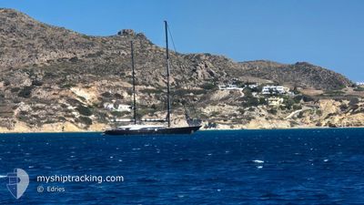
PANTHALASSA
Sailing Vessel
Current Trip
SAINT MAARTEN
| Time Travelled | 10 h, 44 mins |
|---|---|
| Remaining Time | --- |
| Distance Travelled | 37.49 nm |
| Remaining Distance | --- |
| AVG Speed | 9.4 Knots |
| MAX Speed | 12.2 Knots |
| AVG Wind | 18.4 knots |
| MAX Wind | 19 knots |
| MIN Temp | 25.8°C / 78.44°F |
| MAX Temp | 26.6°C / 79.88°F |
| Dybgang | 3.9 m |
| Position Modtaget | 2 h, 10 m siden |
Current Position
| Longitude | -64.14080° |
|---|---|
| Latitude | 18.12443° |
| Status | Under way using engine |
| Fart | 8 Knots |
| Kurs | 112.1° |
| Område | Caribbean Sea |
| Station | T-AIS |
| Position Modtaget | 2 h, 10 m siden |
Info
Information
The current position of PANTHALASSA is in Caribbean Sea with coordinates 18.12443° / -64.14080° as reported on 2025-02-08 05:11 by AIS to our vessel tracker app. The vessel's current speed is 8 Knots
The vessel PANTHALASSA (IMO: 9578103, MMSI: 229905000) is a Sailing Vessel that was built in 2010 ( 15 år gamle ). It's sailing under the flag of [MT] Malta.
In this page you can find informations about the vessels current position, last detected port calls, and current voyage information. If the vessels is not in coverage by AIS you will find the latest position.
The current position of PANTHALASSA is detected by our AIS receivers and we are not responsible for the reliability of the data. The last position was recorded while the vessel was in Coverage by the Ais receivers of our vessel tracking app.
The current draught of PANTHALASSA as reported by AIS is 3.9 meters
Weather
| Temperature | 26.1°C / 78.98°F |
|---|---|
| Wind Speed | 18 knots |
| Direction | 59° ENE |
| Pressure | 1016.5 hPa |
| Humidity | 74.3 % |
| Cloud Coverage | --- |
Featured Company
Last Port Calls
| Port | Arrival | Departure | Time In Port |
|---|---|---|---|
| 2025-02-07 20:37 | 2025-02-07 20:38 | 1 m | |
| 2025-02-04 12:33 | 2025-02-04 12:35 | 2 m | |
| 2025-02-02 21:11 | 2025-02-02 21:25 | 14 m | |
| 2025-01-19 12:06 | 2025-01-19 12:19 | 13 m | |
| 2025-01-19 12:02 | 2025-01-19 12:03 | 1 m | |
| 2025-01-18 18:09 | 2025-01-18 18:20 | 10 m | |
| 2025-01-17 11:41 | 2025-01-17 12:00 | 19 m | |
| 2025-01-12 13:44 | 2025-01-16 14:37 | 4 d | |
| 2025-01-08 17:48 | 2025-01-08 18:08 | 19 m | |
| 2025-01-05 11:36 | 2025-01-05 11:40 | 4 m |
Most Visited Ports (Last year)
| Port | Arrivals | |
|---|---|---|
| 9 | ||
| 7 | ||
| 5 | ||
| 5 | ||
| 4 | ||
| 4 |
Last Trips
| Origin | Departure | Destination | Arrival | Distance | |
|---|---|---|---|---|---|
| 2025-02-04 08:35 | 2025-02-07 16:37 | 79.35 nm | |||
| 2025-02-02 17:25 | 2025-02-04 08:33 | 137.80 nm | |||
| 2025-01-19 08:19 | 2025-02-02 17:11 | 542.36 nm | |||
| 2025-01-19 08:03 | 2025-01-19 08:06 | 0.56 nm | |||
| 2025-01-18 14:20 | 2025-01-19 08:02 | 103.10 nm | |||
| 2025-01-18 14:20 | 2025-01-18 14:09 | 103.10 nm | |||
| 2025-01-16 10:37 | 2025-01-17 07:41 | 22.24 nm | |||
| 2025-01-08 14:08 | 2025-01-12 09:44 | 136.47 nm | |||
| 2025-01-05 07:40 | 2025-01-08 13:48 | 170.36 nm | |||
| 2025-01-03 10:13 | 2025-01-05 07:36 | 116.83 nm |
Events
| Tid | Hændelsen | Detaljer | Position / Dest | Info |
|---|---|---|---|---|
| 2025-02-08 05:11 | Udenfor Dækning |
18.12443 / -64.14080
Caribbean Sea
SAINT MAARTEN
|
Fart: 8 kn Kurs: 112.1° |
|
| 2025-02-08 01:48 | START Sejllads | 2.45 nm, North East of NORMAN ISLAND |
18.34024 / -64.57963
SAINT MAARTEN
|
Fart: 9.8 kn Kurs: 210.6° |
| 2025-02-08 01:34 | Status er ændret | Under way using engine At anchor |
18.34248 / -64.57706
SAINT MAARTEN
|
Fart: 0.2 kn Kurs: 294° |
| 2025-02-07 21:40 | STOP Sejllads | 2.66 nm, North East of NORMAN ISLAND |
18.34249 / -64.57692
SAINT MAARTEN
|
Fart: Kurs: 326° |
| 2025-02-07 21:38 | Status er ændret | At anchor Under way using engine |
18.34245 / -64.57712
SAINT MAARTEN
|
Fart: 1 kn Kurs: 317° |
| 2025-02-07 21:13 | Ændre havområde | British Virgin Islands part of the Caribbean Sea Puerto Rican part of the Caribbean Sea |
18.34776 / -64.63419
Caribbean Sea
SAINT MAARTEN
|
Fart: 12 kn Kurs: 118° |
| 2025-02-07 20:58 | Ændre havområde | Puerto Rican part of the Caribbean Sea British Virgin Islands part of the Caribbean Sea |
18.36833 / -64.68305
Caribbean Sea
SAINT MAARTEN
|
Fart: 11 kn Kurs: 113° |
| 2025-02-07 20:47 | START Sejllads | 0.35 nm, West of SOPERS HOLE |
18.38528 / -64.71025
SAINT MAARTEN
|
Fart: 4.1 kn Kurs: 178° |
| 2025-02-07 20:40 | Status er ændret | Under way using engine Default |
18.38671 / -64.71181
SAINT MAARTEN
|
Fart: 0.3 kn Kurs: 93° |
| 2025-02-07 20:40 | Status er ændret | Default Under way using engine |
18.38665 / -64.71179
SAINT MAARTEN
|
Fart: 0.1 kn Kurs: 120° |