
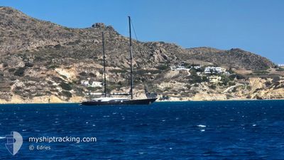
PANTHALASSA
Sailing Vessel
Current Trip
ST BARTHS
| Time Travelled | 1 day |
|---|---|
| Remaining Time | --- |
| Distance Travelled | 42.98 nm |
| Remaining Distance | --- |
| AVG Speed | 6 Knop |
| MAX Speed | 6 Knop |
| AVG Wind | 7.2 knots |
| MAX Wind | 9 knots |
| MIN Temp | 24.8°C / 76.64°F |
| MAX Temp | 26.2°C / 79.16°F |
| Djupgående | 3.9 m |
| Position mottagen | Nu |
Current Position
| Longitud | -62.87136° |
|---|---|
| Latitude | 17.91215° |
| Status | At anchor |
| Fart | |
| Kurs | 339° |
| Område | Caribbean Sea |
| Station | T-AIS |
| Position mottagen | Nu |
Info
Information
The current position of PANTHALASSA is in Caribbean Sea with coordinates 17.91215° / -62.87136° as reported on 2025-03-15 01:34 by AIS to our vessel tracker app. The vessel's current speed is 0 Knop
The vessel PANTHALASSA (IMO: 9578103, MMSI: 229905000) is a Sailing Vessel that was built in 2010 ( 15 År gammal ). It's sailing under the flag of [MT] Malta.
In this page you can find informations about the vessels current position, last detected port calls, and current voyage information. If the vessels is not in coverage by AIS you will find the latest position.
The current position of PANTHALASSA is detected by our AIS receivers and we are not responsible for the reliability of the data. The last position was recorded while the vessel was in Coverage by the Ais receivers of our vessel tracking app.
The current draught of PANTHALASSA as reported by AIS is 3.9 meters
Weather
| Temperature | 26.1°C / 78.98°F |
|---|---|
| Wind Speed | 7 knots |
| Direction | 103° ESE |
| Pressure | 1014.4 hPa |
| Humidity | 70.7 % |
| Cloud Coverage | --- |
Featured Company
Last Port Calls
| Port | Arrival | Departure | Time In Port |
|---|---|---|---|
| 2025-03-13 21:19 | 2025-03-13 21:23 | 3 m | |
| 2025-03-13 13:50 | 2025-03-13 14:09 | 18 m | |
| 2025-03-13 10:53 | 2025-03-13 11:08 | 15 m | |
| 2025-03-13 09:47 | 2025-03-13 09:59 | 11 m | |
| 2025-03-13 07:58 | 2025-03-13 07:59 | 1 m | |
| 2025-03-12 09:47 | 2025-03-12 10:05 | 17 m | |
| 2025-03-09 11:44 | 2025-03-11 08:34 | 1 d | |
| 2025-03-08 17:59 | 2025-03-09 11:38 | 17 h | |
| 2025-03-08 16:14 | 2025-03-08 17:45 | 1 h | |
| 2025-03-08 14:06 | 2025-03-08 15:34 | 1 h |
Most Visited Ports (Last year)
| Port | Arrivals | |
|---|---|---|
| 20 | ||
| 11 | ||
| 6 | ||
| 5 | ||
| 4 | ||
| 4 |
Last Trips
| Origin | Departure | Destination | Arrival | Distance | |
|---|---|---|---|---|---|
| 2025-03-13 14:09 | 2025-03-13 21:19 | 3.88 nm | |||
| 2025-03-13 11:08 | 2025-03-13 13:50 | 2.34 nm | |||
| 2025-03-13 09:59 | 2025-03-13 10:53 | 2.13 nm | |||
| 2025-03-13 07:59 | 2025-03-13 09:47 | 6.39 nm | |||
| 2025-03-12 10:05 | 2025-03-13 07:58 | 21.62 nm | |||
| 2025-03-11 08:34 | 2025-03-12 09:47 | 32.96 nm | |||
| 2025-03-09 11:38 | 2025-03-09 11:44 | 1.53 nm | |||
| 2025-03-08 17:45 | 2025-03-08 17:59 | 2.20 nm | |||
| 2025-03-08 15:34 | 2025-03-08 16:14 | 9.36 nm | |||
| 2025-03-07 16:22 | 2025-03-08 14:06 | 22.51 nm |
Events
| Tid | Event | Detaljer | Position / Dest | Information |
|---|---|---|---|---|
| 2025-03-14 21:04 | STOPPAR förflyttning | 1.27 nm, North West of GUSTAVIA |
17.91282 / -62.87138
ST BARTHS
|
Fart: 0.1 kn Kurs: 113° |
| 2025-03-14 20:56 | Status ändrad | At anchor Under way using engine |
17.91267 / -62.87152
ST BARTHS
|
Fart: 1 kn Kurs: 152° |
| 2025-03-14 20:32 | STARTAR förflyttning | 1.22 nm, South of GUSTAVIA |
17.87986 / -62.85113
ST BARTHS
|
Fart: 4 kn Kurs: 129° |
| 2025-03-14 20:28 | STOPPAR förflyttning | 1.17 nm, South of GUSTAVIA |
17.88072 / -62.85312
ST BARTHS
|
Fart: Kurs: 120° |
| 2025-03-14 20:27 | Status ändrad | Under way using engine Under way sailing |
17.88077 / -62.85321
ST BARTHS
|
Fart: 1.9 kn Kurs: 114° |
| 2025-03-14 14:33 | Status ändrad | Under way sailing Under way using engine |
17.87227 / -62.85560
ST BARTHS
|
Fart: 5.4 kn Kurs: 247.3° |
| 2025-03-14 13:58 | STARTAR förflyttning | 1.12 nm, North West of GUSTAVIA |
17.90968 / -62.87037
ST BARTHS
|
Fart: 5.6 kn Kurs: 156.5° |
| 2025-03-14 13:55 | ETA ändrat | 2025/03/14 00:00 2025/03/13 00:00 |
17.91269 / -62.87143
ST BARTHS
|
Fart: 0.2 kn Kurs: 168° |
| 2025-03-14 13:55 | Status ändrad | Under way using engine At anchor |
17.91269 / -62.87143
ST BARTHS
|
Fart: 0.1 kn Kurs: 172° |
| 2025-03-14 13:18 | Status ändrad | At anchor Default |
17.91312 / -62.87188
ST BARTHS
|
Fart: 1 kn Kurs: 146° |