
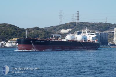
PROTEUS JESSICA
Tanker
Current Trip
MAP TA PHUT, TH
| Time Travelled | 17 h, 14 mins |
|---|---|
| Remaining Time | --- |
| Distance Travelled | 16.30 nm |
| Remaining Distance | --- |
| AVG Speed | 9.9 Knots |
| MAX Speed | 11.8 Knots |
| AVG Wind | 11.6 knots |
| MAX Wind | 12 knots |
| MIN Temp | 27.8°C / 82.04°F |
| MAX Temp | 30.9°C / 87.62°F |
| Dybgang | 12 m |
| Position Modtaget | 4 d siden |
Current Position
| Longitude | 104.13268° |
|---|---|
| Latitude | 1.25685° |
| Status | Under way using engine |
| Fart | 13.4 Knots |
| Kurs | 83.5° |
| Område | Singapore Strait |
| Station | T-AIS |
| Position Modtaget | 4 d siden |
Info
Information
The current position of PROTEUS JESSICA is in Singapore Strait with coordinates 1.25685° / 104.13268° as reported on 2025-02-24 05:22 by AIS to our vessel tracker app. The vessel's current speed is 13.4 Knots
The vessel PROTEUS JESSICA (IMO: 9914668, MMSI: 563162700) is a Tanker It's sailing under the flag of [SG] Singapore.
In this page you can find informations about the vessels current position, last detected port calls, and current voyage information. If the vessels is not in coverage by AIS you will find the latest position.
The current position of PROTEUS JESSICA is detected by our AIS receivers and we are not responsible for the reliability of the data. The last position was recorded while the vessel was in Coverage by the Ais receivers of our vessel tracking app.
The current draught of PROTEUS JESSICA as reported by AIS is 12 meters
Weather
| Temperature | 26.9°C / 80.42°F |
|---|---|
| Wind Speed | 4 knots |
| Direction | 194° SSW |
| Pressure | 1010.2 hPa |
| Humidity | 79.9 % |
| Cloud Coverage | 17 % |
Featured Company
Last Port Calls
| Port | Arrival | Departure | Time In Port |
|---|---|---|---|
| 2025-02-26 22:29 | 2025-02-28 09:49 | 1 d | |
| 2025-02-08 07:21 | 2025-02-10 17:21 | 2 d | |
| 2025-01-22 23:47 | 2025-01-24 09:27 | 1 d | |
| 2025-01-22 22:27 | 2025-01-22 22:34 | 7 m | |
| 2025-01-20 23:58 | 2025-01-22 22:20 | 1 d | |
| 2025-01-19 04:38 | 2025-01-20 01:26 | 20 h | |
| 2025-01-01 14:42 | 2025-01-04 21:47 | 3 d |
Most Visited Ports (Last year)
| Port | Arrivals | |
|---|---|---|
| 4 | ||
| 2 | ||
| 2 | ||
| 2 | ||
| 1 | ||
| 1 |
Last Trips
| Origin | Departure | Destination | Arrival | Distance | |
|---|---|---|---|---|---|
| 2025-02-10 20:21 | 2025-02-27 05:29 | 4496.72 nm | |||
| 2025-01-24 17:27 | 2025-02-08 10:21 | 3779.10 nm | |||
| 2025-01-23 06:34 | 2025-01-23 07:47 | 5.32 nm | |||
| 2025-01-23 06:20 | 2025-01-23 06:27 | 0.42 nm | |||
| 2025-01-20 09:26 | 2025-01-21 07:58 | 32.50 nm | |||
| 2025-01-05 06:47 | 2025-01-19 12:38 | 2591.45 nm | |||
| 2024-12-19 09:09 | 2025-01-01 23:42 | 1167.84 nm |
Events
| Tid | Hændelsen | Detaljer | Position / Dest | Info |
|---|---|---|---|---|
| 2025-02-28 09:49 | Afsejlet fra sidste havn |
|
12.62596 / 101.15587
MAP TA PHUT, TH
|
Fart: 9 kn Kurs: 170° |
| 2025-02-28 09:38 | START Sejllads |
12.65160 / 101.15050
[TH] MAP TA PHUT
|
Fart: 5 kn Kurs: 175° |
|
| 2025-02-26 23:01 | STOP Sejllads |
12.65681 / 101.15366
[TH] MAP TA PHUT
|
Fart: 0.3 kn Kurs: 268° |
|
| 2025-02-26 22:29 | Skibe i havn |
|
12.63785 / 101.15327
[TH] MAP TA PHUT
|
Fart: 6.9 kn Kurs: 350° |
| 2025-02-24 05:29 | Status er ændret | Default Under way using engine |
1.26018 / 104.16106
MAP TA PHUT, TH
|
Fart: 13.4 kn Kurs: 83.5° |
| 2025-02-24 05:22 | Udenfor Dækning |
1.25685 / 104.13268
Singapore Strait
MAP TA PHUT, TH
|
Fart: 13.4 kn Kurs: 83.5° |
|
| 2025-02-24 04:40 | Ændre havområde | Indonesian part of the Singapore Strait Singaporean part of the Singapore Strait |
1.24768 / 103.98571
Singapore Strait
MAP TA PHUT, TH
|
Fart: 10.5 kn Kurs: 92.2° |
| 2025-02-24 04:11 | START Sejllads | 4.7 nm, South West of TANAH MERAH |
1.27863 / 103.94717
MAP TA PHUT, TH
|
Fart: 3.1 kn Kurs: 199° |
| 2025-02-24 04:03 | Destination er ændret | MAP TA PHUT, TH SGSIN-AESPA |
1.28174 / 103.94806
MAP TA PHUT, TH
|
Fart: 0.2 kn Kurs: 241° |
| 2025-02-24 04:03 | ETA er ændret | 2025/02/26 22:00 2025/02/24 03:59 |
1.28174 / 103.94806
MAP TA PHUT, TH
|
Fart: 0.2 kn Kurs: 241° |