
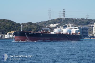
PROTEUS JESSICA
Tanker
Current Trip
MAP TA PHUT, TH
| Time Travelled | 17 h, 10 mins |
|---|---|
| Remaining Time | --- |
| Distance Travelled | 16.30 морская миля |
| Remaining Distance | --- |
| AVG Speed | 9.9 Узлы |
| MAX Speed | 11.8 Узлы |
| AVG Wind | 11.6 knots |
| MAX Wind | 12 knots |
| MIN Temp | 27.8°C / 82.04°F |
| MAX Temp | 30.9°C / 87.62°F |
| Осадка | 12 м |
| Позиция Получена | 4 d тому назад |
Current Position
| Долгота | 104.13268° |
|---|---|
| Широта | 1.25685° |
| Статус | Under way using engine |
| Скорость | 13.4 Узлы |
| Курс | 83.5° |
| Район | Singapore Strait |
| Станция | T-AIS |
| Позиция Получена | 4 d тому назад |
Info
Information
The current position of PROTEUS JESSICA is in Singapore Strait with coordinates 1.25685° / 104.13268° as reported on 2025-02-24 05:22 by AIS to our vessel tracker app. The vessel's current speed is 13.4 Узлы
The vessel PROTEUS JESSICA (IMO: 9914668, MMSI: 563162700) is a Tanker It's sailing under the flag of [SG] Singapore.
In this page you can find informations about the vessels current position, last detected port calls, and current voyage information. If the vessels is not in coverage by AIS you will find the latest position.
The current position of PROTEUS JESSICA is detected by our AIS receivers and we are not responsible for the reliability of the data. The last position was recorded while the vessel was in Coverage by the Ais receivers of our vessel tracking app.
The current draught of PROTEUS JESSICA as reported by AIS is 12 meters
Weather
| Temperature | 26.9°C / 80.42°F |
|---|---|
| Wind Speed | 4 knots |
| Direction | 194° SSW |
| Pressure | 1010.2 hPa |
| Humidity | 79.9 % |
| Cloud Coverage | 17 % |
Featured Company
Last Port Calls
| Port | Arrival | Departure | Time In Port |
|---|---|---|---|
| 2025-02-27 05:29 | 2025-02-28 16:49 | 1 d | |
| 2025-02-08 10:21 | 2025-02-10 20:21 | 2 d | |
| 2025-01-23 07:47 | 2025-01-24 17:27 | 1 d | |
| 2025-01-23 06:27 | 2025-01-23 06:34 | 7 m | |
| 2025-01-21 07:58 | 2025-01-23 06:20 | 1 d | |
| 2025-01-19 12:38 | 2025-01-20 09:26 | 20 h | |
| 2025-01-01 23:42 | 2025-01-05 06:47 | 3 d |
Last Trips
| Origin | Departure | Destination | Arrival | Distance | |
|---|---|---|---|---|---|
| 2025-02-10 20:21 | 2025-02-27 05:29 | 4496.72 морская миля | |||
| 2025-01-24 17:27 | 2025-02-08 10:21 | 3779.10 морская миля | |||
| 2025-01-23 06:34 | 2025-01-23 07:47 | 5.32 морская миля | |||
| 2025-01-23 06:20 | 2025-01-23 06:27 | 0.42 морская миля | |||
| 2025-01-20 09:26 | 2025-01-21 07:58 | 32.50 морская миля | |||
| 2025-01-05 06:47 | 2025-01-19 12:38 | 2591.45 морская миля | |||
| 2024-12-19 09:09 | 2025-01-01 23:42 | 1167.84 морская миля |
Events
| Время | Событие | Детали | Позиция / Направление | Информация |
|---|---|---|---|---|
| 2025-02-28 09:49 | ПОРТ ОТПРАВЛЕНИЯ |
|
12.62596 / 101.15587
MAP TA PHUT, TH
|
Скорость: 9 kn Курс: 170° |
| 2025-02-28 09:38 | Начало движения |
12.65160 / 101.15050
[TH] MAP TA PHUT
|
Скорость: 5 kn Курс: 175° |
|
| 2025-02-26 23:01 | Окончание движения |
12.65681 / 101.15366
[TH] MAP TA PHUT
|
Скорость: 0.3 kn Курс: 268° |
|
| 2025-02-26 22:29 | Порт |
|
12.63785 / 101.15327
[TH] MAP TA PHUT
|
Скорость: 6.9 kn Курс: 350° |
| 2025-02-24 05:29 | Статус изменился | Default Under way using engine |
1.26018 / 104.16106
MAP TA PHUT, TH
|
Скорость: 13.4 kn Курс: 83.5° |
| 2025-02-24 05:22 | Вне покрытия |
1.25685 / 104.13268
Singapore Strait
MAP TA PHUT, TH
|
Скорость: 13.4 kn Курс: 83.5° |
|
| 2025-02-24 04:40 | Изменение морского района | Indonesian part of the Singapore Strait Singaporean part of the Singapore Strait |
1.24768 / 103.98571
Singapore Strait
MAP TA PHUT, TH
|
Скорость: 10.5 kn Курс: 92.2° |
| 2025-02-24 04:11 | Начало движения | 4.7 nm, South West of TANAH MERAH |
1.27863 / 103.94717
MAP TA PHUT, TH
|
Скорость: 3.1 kn Курс: 199° |
| 2025-02-24 04:03 | Пункт назначения изменился | MAP TA PHUT, TH SGSIN-AESPA |
1.28174 / 103.94806
MAP TA PHUT, TH
|
Скорость: 0.2 kn Курс: 241° |
| 2025-02-24 04:03 | ETA изменился | 2025/02/26 22:00 2025/02/24 03:59 |
1.28174 / 103.94806
MAP TA PHUT, TH
|
Скорость: 0.2 kn Курс: 241° |