
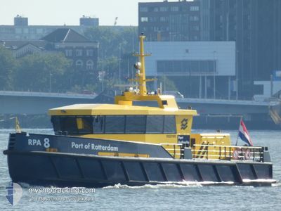
RPA8
Other Type
Current Trip
| Trip Time | 1 h, 44 mins |
|---|---|
| Trip Distance | 13.69 nm |
| AVG Speed | 11.2 Knots |
| MAX Speed | 15.5 Knots |
| Dybgang | 1.4 m |
| AVG Wind | 10.3 knots |
| MAX Wind | 14.4 knots |
| MIN Temp | 2.2°C / 35.96°F |
| MAX Temp | 3°C / 37.4°F |
| Position Modtaget | Nu |
Current Position
| Longitude | 4.41897° |
|---|---|
| Latitude | 51.88885° |
| Status | Moored |
| Fart | |
| Kurs | 108° |
| Område | North Sea |
| Station | T-AIS |
| Position Modtaget | Nu |
Info
Information
The current position of RPA8 is in North Sea with coordinates 51.88885° / 4.41897° as reported on 2025-02-20 22:55 by AIS to our vessel tracker app. The vessel's current speed is 0 Knots and is currently inside the port of ROTTERDAM WAALHAVEN.
The vessel RPA8 (MMSI: 244150340) is a Other Type It's sailing under the flag of [NL] Netherlands.
In this page you can find informations about the vessels current position, last detected port calls, and current voyage information. If the vessels is not in coverage by AIS you will find the latest position.
The current position of RPA8 is detected by our AIS receivers and we are not responsible for the reliability of the data. The last position was recorded while the vessel was in Coverage by the Ais receivers of our vessel tracking app.
The current draught of RPA8 as reported by AIS is 1.4 meters
Weather
| Temperature | 9.9°C / 49.82°F |
|---|---|
| Wind Speed | 10 knots |
| Direction | 207° SSW |
| Pressure | 1019.6 hPa |
| Humidity | 90.1 % |
| Cloud Coverage | 100 % |
Featured Company
Last Port Calls
| Port | Arrival | Departure | Time In Port |
|---|---|---|---|
| 2025-02-13 13:28 | |||
| 2025-02-13 10:34 | 2025-02-13 11:44 | 1 h | |
| 2025-01-16 14:22 | 2025-02-13 09:13 | 27 d | |
| 2025-01-16 13:22 | 2025-01-16 13:25 | 3 m | |
| 2025-01-03 09:23 | 2025-01-16 13:13 | 13 d | |
| 2025-01-03 08:23 | 2025-01-03 08:33 | 9 m | |
| 2024-12-11 14:29 | 2025-01-03 08:18 | 22 d | |
| 2024-12-11 12:58 | 2024-12-11 14:00 | 1 h | |
| 2024-12-11 10:52 | 2024-12-11 12:31 | 1 h | |
| 2024-12-11 08:27 | 2024-12-11 10:32 | 2 h |
Most Visited Ports (Last year)
| Port | Arrivals | |
|---|---|---|
| 228 | ||
| 208 | ||
| 185 | ||
| 119 | ||
| 90 | ||
| 72 |
Last Trips
| Origin | Departure | Destination | Arrival | Distance | |
|---|---|---|---|---|---|
| 2025-02-13 12:44 | 2025-02-13 14:28 | 13.69 nm | |||
| 2025-02-13 10:13 | 2025-02-13 11:34 | 12.95 nm | |||
| 2025-01-16 14:25 | 2025-01-16 15:22 | 9.47 nm | |||
| 2025-01-16 14:13 | 2025-01-16 14:22 | 2.05 nm | |||
| 2025-01-03 09:33 | 2025-01-03 10:23 | 7.95 nm | |||
| 2025-01-03 09:18 | 2025-01-03 09:23 | 0.75 nm | |||
| 2024-12-11 15:00 | 2024-12-11 15:29 | 3.84 nm | |||
| 2024-12-11 13:31 | 2024-12-11 13:58 | 4.44 nm | |||
| 2024-12-11 11:32 | 2024-12-11 11:52 | 2.54 nm | |||
| 2024-12-11 08:48 | 2024-12-11 09:27 | 3.78 nm |
Events
| Tid | Hændelsen | Detaljer | Position / Dest | Info |
|---|---|---|---|---|
| 2025-02-13 13:49 | STOP Sejllads |
51.88894 / 4.41904
[NL] ROTTERDAM WAALHAVEN
|
Fart: Kurs: 112° |
|
| 2025-02-13 13:28 | Skibe i havn |
|
51.88868 / 4.41932
[NL] ROTTERDAM WAALHAVEN
|
Fart: 2.4 kn Kurs: 112° |
| 2025-02-13 12:33 | START Sejllads | 1.21 nm, East of ROTTERDAM |
51.93797 / 4.19964
ROTTERDAM
|
Fart: 9.3 kn Kurs: 118.3° |
| 2025-02-13 12:32 | STOP Sejllads | 1.08 nm, East of ROTTERDAM |
51.93881 / 4.19596
ROTTERDAM
|
Fart: 0.3 kn Kurs: 140° |
| 2025-02-13 12:26 | START Sejllads | 0.76 nm, North of ROTTERDAM |
51.94751 / 4.17449
ROTTERDAM
|
Fart: 14.1 kn Kurs: 133.4° |
| 2025-02-13 12:24 | STOP Sejllads | 0.82 nm, North of ROTTERDAM |
51.94906 / 4.17111
ROTTERDAM
|
Fart: 0.2 kn Kurs: 98° |
| 2025-02-13 12:20 | START Sejllads | 1.43 nm, North of ROTTERDAM |
51.95803 / 4.15423
ROTTERDAM
|
Fart: 11.7 kn Kurs: 130.8° |
| 2025-02-13 12:12 | STOP Sejllads | 1.44 nm, South East of HOEK VAN HOLLAND |
51.95980 / 4.15155
ROTTERDAM
|
Fart: 0.3 kn Kurs: 276° |
| 2025-02-13 12:11 | START Sejllads | 1.36 nm, South East of HOEK VAN HOLLAND |
51.96071 / 4.14999
ROTTERDAM
|
Fart: 4.3 kn Kurs: 310° |
| 2025-02-13 12:00 | STOP Sejllads | 1.21 nm, South East of HOEK VAN HOLLAND |
51.96280 / 4.14776
ROTTERDAM
|
Fart: 0.2 kn Kurs: 301° |