

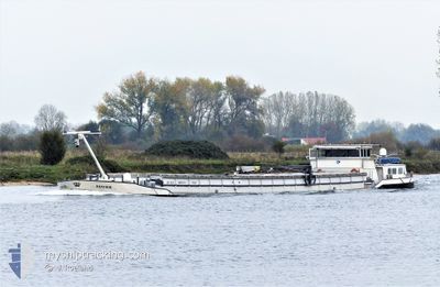
SAFFIER
Cargo

Current Trip
| Time Travelled | 4 days |
|---|---|
| Remaining Time | --- |
| Distance Travelled | 26.87 nm |
| Remaining Distance | --- |
| AVG Speed | 7.6 Knots |
| MAX Speed | 10.4 Knots |
| AVG Wind | 8.3 knots |
| MAX Wind | 10 knots |
| MIN Temp | 5.6°C / 42.08°F |
| MAX Temp | 21°C / 69.8°F |
| Dybgang | 0 m |
| Position Modtaget | 4 m siden |
Current Position
| Longitude | 4.30208° |
|---|---|
| Latitude | 51.11705° |
| Status | Under way using engine |
| Fart | 1 Knots |
| Kurs | --- |
| Område | North Sea |
| Station | T-AIS |
| Position Modtaget | 4 m siden |
Information
The current position of SAFFIER is in North Sea with coordinates 51.11705° / 4.30208° as reported on 2025-05-19 18:44 by AIS to our vessel tracker app. The vessel's current speed is 1 Knots and is heading at the port of VENLO. The estimated time of arrival as calculated by MyShipTracking vessel tracking app is 2025-05-21 00:33 LT
The vessel SAFFIER (MMSI: 205278090) is a Cargo It's sailing under the flag of [BE] Belgium.
In this page you can find informations about the vessels current position, last detected port calls, and current voyage information. If the vessels is not in coverage by AIS you will find the latest position.
The current position of SAFFIER is detected by our AIS receivers and we are not responsible for the reliability of the data. The last position was recorded while the vessel was in Coverage by the Ais receivers of our vessel tracking app.
Weather
| Temperature | 18.6°C / 65.48°F |
|---|---|
| Wind Speed | 9 knots |
| Direction | 76° ENE |
| Pressure | 1017 hPa |
| Humidity | 50.1 % |
| Cloud Coverage | 71 % |


Featured Company
Last Port Calls
| Port | Arrival | Departure | Time In Port |
|---|---|---|---|
| 2025-05-15 16:50 | 2025-05-15 20:48 | 3 h | |
| 2025-05-14 21:18 | 2025-05-15 05:34 | 8 h | |
| 2025-05-12 09:14 | |||
| 2025-05-09 09:19 | 2025-05-10 08:47 | 23 h | |
| 2025-05-01 17:17 | 2025-05-01 19:33 | 2 h | |
| 2025-04-30 20:06 | 2025-05-01 06:47 | 10 h | |
| 2025-04-24 14:24 | 2025-04-28 12:11 | 3 d | |
| 2025-04-23 20:56 | 2025-04-24 06:49 | 9 h | |
| 2025-04-23 15:16 | 2025-04-23 17:22 | 2 h | |
| 2025-04-15 12:25 | 2025-04-15 14:41 | 2 h |
Last Trips
| Origin | Departure | Destination | Arrival | Distance | |
|---|---|---|---|---|---|
| 2025-05-15 05:34 | 2025-05-15 16:50 | 88.47 nm | |||
| 2025-05-12 09:14 | 2025-05-14 21:18 | 87.75 nm | |||
| 2025-05-01 19:33 | 2025-05-09 09:19 | 108.17 nm | |||
| 2025-05-01 06:47 | 2025-05-01 17:17 | 76.80 nm | |||
| 2025-04-28 12:11 | 2025-04-30 20:06 | 85.46 nm | |||
| 2025-04-24 06:49 | 2025-04-24 14:24 | 46.61 nm | |||
| 2025-04-23 17:22 | 2025-04-23 20:56 | 21.92 nm | |||
| 2025-04-15 14:41 | 2025-04-23 15:16 | 131.24 nm | |||
| 2025-04-12 12:31 | 2025-04-15 12:25 | 143.97 nm | |||
| 2025-04-12 07:46 | 2025-04-12 11:17 | 36.80 nm |
Events
| Tid | Hændelsen | Detaljer | Position / Dest | Info |
|---|---|---|---|---|
| 2025-05-19 18:23 | START Sejllads | 3.34 nm, South East of RUPELMONDE |
51.08508 / 4.35076
VENLO
|
Fart: 7.4 kn Kurs: 321.7° |
| 2025-05-19 18:07 | STOP Sejllads | 3.45 nm, South East of RUPELMONDE |
51.08352 / 4.35231
VENLO
|
Fart: 0.1 kn Kurs: 511° |
| 2025-05-19 17:57 | START Sejllads | 4.52 nm, South East of RUPELMONDE |
51.06668 / 4.36463
VENLO
|
Fart: 8.6 kn Kurs: 5.6° |
| 2025-05-19 17:52 | STOP Sejllads | 4.61 nm, South East of RUPELMONDE |
51.06444 / 4.36405
VENLO
|
Fart: Kurs: 511° |
| 2025-05-19 17:40 | Destination er ændret | VENLO HALLE |
51.05483 / 4.36264
VENLO
|
Fart: 8.5 kn Kurs: 7.5° |
| 2025-05-19 17:40 | ETA er ændret | 2025/05/20 22:33 2025/05/16 13:48 |
51.05483 / 4.36264
VENLO
|
Fart: 8.5 kn Kurs: 7.5° |
| 2025-05-19 17:30 | Status er ændret | Under way using engine Default |
51.02982 / 4.35740
HALLE
|
Fart: 8.7 kn Kurs: 336° |
| 2025-05-19 17:18 | START Sejllads | 7.14 nm, South East of SINT AMANDS |
51.00313 / 4.36925
HALLE
|
Fart: 8.7 kn Kurs: 336° |
| 2025-05-19 17:17 | Indenfor Dækning |
51.03023 / 4.35730
North Sea
|
Fart: 8.8 kn Kurs: 351° |
|
| 2025-05-19 16:53 | STOP Sejllads | 7.42 nm, South East of SINT AMANDS |
50.99813 / 4.37361
HALLE
|
Fart: Kurs: -1° |