
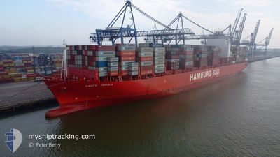
SANTA URSULA
Container Ship
Current Trip
| Time Travelled | 8 days |
|---|---|
| Remaining Time | 2 h, 22 mins |
| Distance Travelled | 1885.92 nm |
| Remaining Distance | 28.18 nm |
| AVG Speed | 10.7 Knots |
| MAX Speed | 16.7 Knots |
| AVG Wind | 10.9 knots |
| MAX Wind | 26 knots |
| MIN Temp | 4.8°C / 40.64°F |
| MAX Temp | 25°C / 77°F |
| Dybgang | 10.2 m |
| Position Modtaget | 13 h, 45 m siden |
Current Position
| Longitude | -94.53171° |
|---|---|
| Latitude | 29.27445° |
| Status | At anchor |
| Fart | |
| Kurs | 98° |
| Område | Gulf of Mexico |
| Station | T-AIS |
| Position Modtaget | 13 h, 45 m siden |
Info
Information
The current position of SANTA URSULA is in Gulf of Mexico with coordinates 29.27445° / -94.53171° as reported on 2025-02-12 06:14 by AIS to our vessel tracker app. The vessel's current speed is 0 Knots and is heading at the port of HOUSTON. The estimated time of arrival as calculated by MyShipTracking vessel tracking app is 2025-02-12 16:21 LT
The vessel SANTA URSULA (IMO: 9430387, MMSI: 219071000) is a Container Ship that was built in 2012 ( 13 år gamle ). It's sailing under the flag of [DK] Denmark.
In this page you can find informations about the vessels current position, last detected port calls, and current voyage information. If the vessels is not in coverage by AIS you will find the latest position.
The current position of SANTA URSULA is detected by our AIS receivers and we are not responsible for the reliability of the data. The last position was recorded while the vessel was in Coverage by the Ais receivers of our vessel tracking app.
The current draught of SANTA URSULA as reported by AIS is 10.2 meters
Weather
| Temperature | 18.9°C / 66.02°F |
|---|---|
| Wind Speed | 13 knots |
| Direction | 212° SSW |
| Pressure | 1005.3 hPa |
| Humidity | 96.6 % |
| Cloud Coverage | 100 % |
Featured Company
Most Visited Ports (Last year)
| Port | Arrivals | |
|---|---|---|
| 6 | ||
| 6 | ||
| 5 | ||
| 4 | ||
| 3 | ||
| 3 |
Events
| Tid | Hændelsen | Detaljer | Position / Dest | Info |
|---|---|---|---|---|
| 2025-02-12 19:31 | START Sejllads | 13.79 nm, East of GALVESTON |
29.27740 / -94.53523
USNWK>>>USHOU
|
Fart: 7.5 kn Kurs: 290° |
| 2025-02-12 06:17 | Status er ændret | Default At anchor |
29.27447 / -94.53167
USNWK>>>USHOU
|
Fart: Kurs: 98° |
| 2025-02-12 06:14 | Status er ændret | At anchor Default |
29.27445 / -94.53171
USNWK>>>USHOU
|
Fart: Kurs: 97° |
| 2025-02-12 06:14 | Udenfor Dækning |
29.27445 / -94.53171
Gulf of Mexico
|
Fart: Kurs: 295.4° |
|
| 2025-02-12 06:05 | Status er ændret | Default At anchor |
29.27451 / -94.53165
USNWK>>>USHOU
|
Fart: Kurs: 101° |
| 2025-02-12 05:56 | Status er ændret | At anchor Default |
29.27450 / -94.53166
USNWK>>>USHOU
|
Fart: Kurs: 96° |
| 2025-02-12 05:56 | Indenfor Dækning |
29.27450 / -94.53166
Gulf of Mexico
|
Fart: Kurs: 295.4° |
|
| 2025-02-12 04:53 | Status er ændret | Default At anchor |
29.27408 / -94.53169
USNWK>>>USHOU
|
Fart: Kurs: 89° |
| 2025-02-12 04:50 | Udenfor Dækning |
29.27406 / -94.53170
Gulf of Mexico
|
Fart: Kurs: 295.4° |
|
| 2025-02-12 04:41 | Status er ændret | At anchor Default |
29.27403 / -94.53168
USNWK>>>USHOU
|
Fart: Kurs: 88° |