
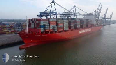
SANTA URSULA
Container Ship
Current Trip
| Time Travelled | 3 days |
|---|---|
| Remaining Time | 1 day |
| Distance Travelled | 1191.54 nm |
| Remaining Distance | 869.26 nm |
| AVG Speed | 12.2 Knopen |
| MAX Speed | 16.7 Knopen |
| AVG Wind | 10.8 knots |
| MAX Wind | 26 knots |
| MIN Temp | 4.8°C / 40.64°F |
| MAX Temp | 24.2°C / 75.56°F |
| Diepgang | 10 M |
| Positie ontvangen | 1 d geleden |
Current Position
| Lengtegraad | -80.33085° |
|---|---|
| Breedtegraat | 24.77499° |
| Status | Under way using engine |
| Snelheid | 14.6 Knopen |
| Koers | 232.6° |
| Gebied | North Atlantic Ocean |
| Station | T-AIS |
| Positie ontvangen | 1 d geleden |
Info
Information
The current position of SANTA URSULA is in North Atlantic Ocean with coordinates 24.77499° / -80.33085° as reported on 2025-02-07 05:18 by AIS to our vessel tracker app. The vessel's current speed is 14.6 Knopen and is heading at the port of HOUSTON. The estimated time of arrival as calculated by MyShipTracking vessel tracking app is 2025-02-09 20:42 LT
The vessel SANTA URSULA (IMO: 9430387, MMSI: 219071000) is a Container Ship that was built in 2012 ( 13 Jaar oud ). It's sailing under the flag of [DK] Denmark.
In this page you can find informations about the vessels current position, last detected port calls, and current voyage information. If the vessels is not in coverage by AIS you will find the latest position.
The current position of SANTA URSULA is detected by our AIS receivers and we are not responsible for the reliability of the data. The last position was recorded while the vessel was in Coverage by the Ais receivers of our vessel tracking app.
The current draught of SANTA URSULA as reported by AIS is 10 meters
Weather
| Temperature | 22.7°C / 72.86°F |
|---|---|
| Wind Speed | 15 knots |
| Direction | 55° NE |
| Pressure | 1019.5 hPa |
| Humidity | 84.1 % |
| Cloud Coverage | --- |
Featured Company
Most Visited Ports (Last year)
| Port | Arrivals | |
|---|---|---|
| 6 | ||
| 6 | ||
| 5 | ||
| 4 | ||
| 3 | ||
| 3 |
Events
| Tijd | Evenement | Details | Positie / Bestemming | Info |
|---|---|---|---|---|
| 2025-02-07 05:18 | Buitenbereik |
24.77499 / -80.33085
North Atlantic Ocean
USNWK>>>USHOU
|
Snelheid: 14.6 kn Koers: 232.6° |
|
| 2025-02-07 04:32 | Status Changed | Under way using engine Default |
24.88439 / -80.17520
USNWK>>>USHOU
|
Snelheid: 13.8 kn Koers: 233° |
| 2025-02-07 04:24 | Binnenbereik |
24.88439 / -80.17520
North Atlantic Ocean
USNWK>>>USHOU
|
Snelheid: 13.7 kn Koers: 232.8° |
|
| 2025-02-07 01:57 | Status Changed | Default Under way using engine |
25.37052 / -79.90118
USNWK>>>USHOU
|
Snelheid: 13 kn Koers: 193.2° |
| 2025-02-07 01:53 | Status Changed | Under way using engine Default |
25.38532 / -79.89737
USNWK>>>USHOU
|
Snelheid: 13.2 kn Koers: 193° |
| 2025-02-07 01:53 | Buitenbereik |
25.38532 / -79.89737
North Atlantic Ocean
USNWK>>>USHOU
|
Snelheid: 13 kn Koers: 193.2° |
|
| 2025-02-07 01:42 | Status Changed | Default Under way using engine |
25.42455 / -79.88744
USNWK>>>USHOU
|
Snelheid: 13.1 kn Koers: 192.4° |
| 2025-02-07 00:14 | Status Changed | Under way using engine Default |
25.74836 / -79.80844
USNWK>>>USHOU
|
Snelheid: 13.3 kn Koers: 192° |
| 2025-02-07 00:08 | Status Changed | Default Under way using engine |
25.77296 / -79.80292
USNWK>>>USHOU
|
Snelheid: 13.1 kn Koers: 191.5° |
| 2025-02-06 23:54 | ETA Changed | 2025/02/09 14:00 |
25.82233 / -79.79304
USNWK>>>USHOU
|
Snelheid: 12.6 kn Koers: 189.7° |