
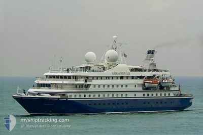
SEADREAM II
Passengers Ship
Current Trip
| Time Travelled | 6 days |
|---|---|
| Remaining Time | --- |
| Distance Travelled | 290.48 nm |
| Remaining Distance | --- |
| AVG Speed | 7.9 Knots |
| MAX Speed | 15.8 Knots |
| AVG Wind | 20.8 knots |
| MAX Wind | 24 knots |
| MIN Temp | 25.2°C / 77.36°F |
| MAX Temp | 26.4°C / 79.52°F |
| Dybgang | 4.4 m |
| Position Modtaget | Nu |
Current Position
| Longitude | -64.76456° |
|---|---|
| Latitude | 18.43695° |
| Status | At anchor |
| Fart | |
| Kurs | 55° |
| Område | Caribbean Sea |
| Station | T-AIS |
| Position Modtaget | Nu |
Info
Information
The current position of SEADREAM II is in Caribbean Sea with coordinates 18.43695° / -64.76456° as reported on 2025-02-15 01:07 by AIS to our vessel tracker app. The vessel's current speed is 0 Knots
The vessel SEADREAM II (IMO: 8203440, MMSI: 308311000) is a Passengers Ship that was built in 1985 ( 40 år gamle ). It's sailing under the flag of [BS] Bahamas.
In this page you can find informations about the vessels current position, last detected port calls, and current voyage information. If the vessels is not in coverage by AIS you will find the latest position.
The current position of SEADREAM II is detected by our AIS receivers and we are not responsible for the reliability of the data. The last position was recorded while the vessel was in Coverage by the Ais receivers of our vessel tracking app.
The current draught of SEADREAM II as reported by AIS is 4.4 meters
Weather
| Temperature | 25.8°C / 78.44°F |
|---|---|
| Wind Speed | 21 knots |
| Direction | 72° ENE |
| Pressure | 1019.1 hPa |
| Humidity | 74.4 % |
| Cloud Coverage | --- |
Featured Company
Last Port Calls
| Port | Arrival | Departure | Time In Port |
|---|---|---|---|
| 2025-02-08 11:02 | 2025-02-08 20:20 | 9 h | |
| 2025-02-07 11:11 | 2025-02-07 21:45 | 10 h | |
| 2025-01-21 09:49 | 2025-01-21 19:33 | 9 h | |
| 2025-01-18 03:35 | 2025-01-19 02:59 | 23 h | |
| 2025-01-12 11:41 | 2025-01-12 18:01 | 6 h | |
| 2025-01-11 04:28 | 2025-01-12 03:42 | 23 h | |
| 2025-01-08 08:34 | 2025-01-08 15:59 | 7 h | |
| 2025-01-02 09:39 | 2025-01-03 01:41 | 16 h | |
| 2024-12-14 10:52 | 2024-12-15 03:59 | 17 h | |
| 2024-12-01 13:33 | 2024-12-01 23:53 | 10 h |
Most Visited Ports (Last year)
| Port | Arrivals | |
|---|---|---|
| 53 | ||
| 37 | ||
| 19 | ||
| 15 | ||
| 13 | ||
| 12 |
Last Trips
| Origin | Departure | Destination | Arrival | Distance | |
|---|---|---|---|---|---|
| 2025-02-07 17:45 | 2025-02-08 07:02 | 87.55 nm | |||
| 2025-01-21 15:33 | 2025-02-07 07:11 | 1209.41 nm | |||
| 2025-01-18 22:59 | 2025-01-21 05:49 | 215.40 nm | |||
| 2025-01-12 14:01 | 2025-01-17 23:35 | 470.70 nm | |||
| 2025-01-11 23:42 | 2025-01-12 07:41 | 56.58 nm | |||
| 2025-01-08 11:59 | 2025-01-11 00:28 | 222.38 nm | |||
| 2025-01-02 21:41 | 2025-01-08 04:34 | 417.75 nm | |||
| 2024-12-14 23:59 | 2025-01-02 05:39 | 1061.49 nm | |||
| 2024-12-01 19:53 | 2024-12-14 06:52 | 834.74 nm | |||
| 2024-11-30 18:03 | 2024-12-01 09:33 | 177.37 nm |
Events
| Tid | Hændelsen | Detaljer | Position / Dest | Info |
|---|---|---|---|---|
| 2025-02-14 17:30 | Status er ændret | At anchor Default |
18.43696 / -64.76459
PR SJU
|
Fart: 0.7 kn Kurs: 43° |
| 2025-02-14 17:24 | Status er ændret | Default At anchor |
18.43680 / -64.76453
PR SJU
|
Fart: 0.3 kn Kurs: 74° |
| 2025-02-14 15:10 | Status er ændret | At anchor Default |
18.43672 / -64.76438
PR SJU
|
Fart: 0.5 kn Kurs: 119° |
| 2025-02-14 13:16 | Destination er ændret | PR SJU GREAT HARBOUR, JVD |
18.43663 / -64.76434
PR SJU
|
Fart: 0.5 kn Kurs: 103° |
| 2025-02-14 13:16 | ETA er ændret | 2025/02/15 11:00 2025/02/13 22:00 |
18.43663 / -64.76434
PR SJU
|
Fart: 0.5 kn Kurs: 103° |
| 2025-02-14 13:04 | Status er ændret | Default At anchor |
18.43664 / -64.76428
GREAT HARBOUR, JVD
|
Fart: 0.4 kn Kurs: 101° |
| 2025-02-14 12:11 | STOP Sejllads | 0.84 nm, South West of JOST VAN DYKE |
18.43667 / -64.76435
GREAT HARBOUR, JVD
|
Fart: 0.1 kn Kurs: 95° |
| 2025-02-14 11:41 | START Sejllads | 0.42 nm, South of JOST VAN DYKE |
18.43543 / -64.74931
GREAT HARBOUR, JVD
|
Fart: 5.1 kn Kurs: 173° |
| 2025-02-14 11:04 | Status er ændret | At anchor Default |
18.43652 / -64.75047
GREAT HARBOUR, JVD
|
Fart: 0.4 kn Kurs: 108° |
| 2025-02-14 10:58 | Status er ændret | Default At anchor |
18.43715 / -64.75042
GREAT HARBOUR, JVD
|
Fart: 0.2 kn Kurs: 103° |