
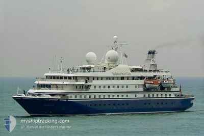
SEADREAM II
Passengers Ship
Current Trip
SPANISHTOWN BVI
| Time Travelled | 3 days |
|---|---|
| Remaining Time | --- |
| Distance Travelled | 225.35 nm |
| Remaining Distance | --- |
| AVG Speed | 9.8 Knopen |
| MAX Speed | 14.4 Knopen |
| AVG Wind | 19 knots |
| MAX Wind | 23 knots |
| MIN Temp | 25.2°C / 77.36°F |
| MAX Temp | 26.4°C / 79.52°F |
| Diepgang | 4.4 M |
| Positie ontvangen | 1 m geleden |
Current Position
| Lengtegraad | -64.44485° |
|---|---|
| Breedtegraat | 18.45201° |
| Status | At anchor |
| Snelheid | 0.2 Knopen |
| Koers | 106° |
| Gebied | Caribbean Sea |
| Station | T-AIS |
| Positie ontvangen | 1 m geleden |
Info
Information
The current position of SEADREAM II is in Caribbean Sea with coordinates 18.45201° / -64.44485° as reported on 2025-02-12 19:52 by AIS to our vessel tracker app. The vessel's current speed is 0.2 Knopen
The vessel SEADREAM II (IMO: 8203440, MMSI: 308311000) is a Passengers Ship that was built in 1985 ( 40 Jaar oud ). It's sailing under the flag of [BS] Bahamas.
In this page you can find informations about the vessels current position, last detected port calls, and current voyage information. If the vessels is not in coverage by AIS you will find the latest position.
The current position of SEADREAM II is detected by our AIS receivers and we are not responsible for the reliability of the data. The last position was recorded while the vessel was in Coverage by the Ais receivers of our vessel tracking app.
The current draught of SEADREAM II as reported by AIS is 4.4 meters
Weather
| Temperature | 25.8°C / 78.44°F |
|---|---|
| Wind Speed | 19 knots |
| Direction | 91° E |
| Pressure | 1017.5 hPa |
| Humidity | 74.4 % |
| Cloud Coverage | --- |
Featured Company
Last Port Calls
| Port | Arrival | Departure | Time In Port |
|---|---|---|---|
| 2025-02-08 11:02 | 2025-02-08 20:20 | 9 h | |
| 2025-02-07 11:11 | 2025-02-07 21:45 | 10 h | |
| 2025-01-21 09:49 | 2025-01-21 19:33 | 9 h | |
| 2025-01-18 03:35 | 2025-01-19 02:59 | 23 h | |
| 2025-01-12 11:41 | 2025-01-12 18:01 | 6 h | |
| 2025-01-11 04:28 | 2025-01-12 03:42 | 23 h | |
| 2025-01-08 08:34 | 2025-01-08 15:59 | 7 h | |
| 2025-01-02 09:39 | 2025-01-03 01:41 | 16 h | |
| 2024-12-14 10:52 | 2024-12-15 03:59 | 17 h | |
| 2024-12-01 13:33 | 2024-12-01 23:53 | 10 h |
Most Visited Ports (Last year)
| Port | Arrivals | |
|---|---|---|
| 56 | ||
| 37 | ||
| 19 | ||
| 15 | ||
| 13 | ||
| 12 |
Last Trips
| Origin | Departure | Destination | Arrival | Distance | |
|---|---|---|---|---|---|
| 2025-02-07 17:45 | 2025-02-08 07:02 | 87.55 nm | |||
| 2025-01-21 15:33 | 2025-02-07 07:11 | 1209.41 nm | |||
| 2025-01-18 22:59 | 2025-01-21 05:49 | 215.40 nm | |||
| 2025-01-12 14:01 | 2025-01-17 23:35 | 470.70 nm | |||
| 2025-01-11 23:42 | 2025-01-12 07:41 | 56.58 nm | |||
| 2025-01-08 11:59 | 2025-01-11 00:28 | 222.38 nm | |||
| 2025-01-02 21:41 | 2025-01-08 04:34 | 417.75 nm | |||
| 2024-12-14 23:59 | 2025-01-02 05:39 | 1061.49 nm | |||
| 2024-12-01 19:53 | 2024-12-14 06:52 | 834.74 nm | |||
| 2024-11-30 18:03 | 2024-12-01 09:33 | 177.37 nm |
Events
| Tijd | Evenement | Details | Positie / Bestemming | Info |
|---|---|---|---|---|
| 2025-02-12 16:21 | Status Changed | At anchor Under way using engine |
18.45272 / -64.44500
SPANISHTOWN BVI
|
Snelheid: 0.2 kn Koers: 140° |
| 2025-02-12 16:20 | Stop beweging | 0.36 nm, West of VIRGIN GORDA |
18.45282 / -64.44496
SPANISHTOWN BVI
|
Snelheid: 0.2 kn Koers: 140° |
| 2025-02-12 14:33 | Destination Changed | SPANISHTOWN BVI GUSTAVIA |
18.25942 / -64.27356
SPANISHTOWN BVI
|
Snelheid: 10.2 kn Koers: 303.2° |
| 2025-02-12 14:33 | ETA Changed | 2025/02/12 17:00 2025/02/08 21:55 |
18.25942 / -64.27356
SPANISHTOWN BVI
|
Snelheid: 10.2 kn Koers: 303.2° |
| 2025-02-12 13:33 | Gevonden in zee | British Virgin Islands part of the Caribbean Sea |
18.16804 / -64.12395
Caribbean Sea
|
Snelheid: 10.2 kn Koers: 305.1° |
| 2025-02-12 13:33 | Status Changed | Under way using engine Default |
18.16804 / -64.12395
GUSTAVIA
|
Snelheid: 10.4 kn Koers: 302° |
| 2025-02-12 13:15 | Binnenbereik |
18.16804 / -64.12395
Caribbean Sea
|
Snelheid: 10.2 kn Koers: 305.1° |
|
| 2025-02-12 09:16 | Status Changed | Default Under way using engine |
17.76289 / -63.47147
GUSTAVIA
|
Snelheid: 9.9 kn Koers: 309.4° |
| 2025-02-12 08:17 | Buitenbereik |
17.66560 / -63.33031
Caribbean Sea
|
Snelheid: 9.9 kn Koers: 309.4° |
|
| 2025-02-12 08:05 | Status Changed | Under way using engine Default |
17.64264 / -63.30584
GUSTAVIA
|
Snelheid: 9.7 kn Koers: 311° |