
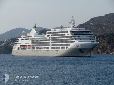
SILVER SPIRIT
Passengers Ship
Current Trip
| Trip Time | 17 h, 24 mins |
|---|---|
| Trip Distance | 260.80 nm |
| AVG Speed | 14.8 Knots |
| MAX Speed | 16.9 Knots |
| Dybgang | 6.7 m |
| AVG Wind | 21.9 knots |
| MAX Wind | 34 knots |
| MIN Temp | 15.7°C / 60.26°F |
| MAX Temp | 35°C / 95°F |
| Position Modtaget | 2 d siden |
Current Position
| Longitude | 17.55835° |
|---|---|
| Latitude | -33.06151° |
| Status | Under way using engine |
| Fart | 15.2 Knots |
| Kurs | 343° |
| Område | South Atlantic Ocean |
| Station | T-AIS |
| Position Modtaget | 2 d siden |
Info
Information
The current position of SILVER SPIRIT is in South Atlantic Ocean with coordinates -33.06151° / 17.55835° as reported on 2025-02-07 22:55 by AIS to our vessel tracker app. The vessel's current speed is 15.2 Knots and is currently inside the port of WALVIS BAY.
The vessel SILVER SPIRIT (IMO: 9437866, MMSI: 311022500) is a Passengers Ship that was built in 2009 ( 16 år gamle ). It's sailing under the flag of [BS] Bahamas.
In this page you can find informations about the vessels current position, last detected port calls, and current voyage information. If the vessels is not in coverage by AIS you will find the latest position.
The current position of SILVER SPIRIT is detected by our AIS receivers and we are not responsible for the reliability of the data. The last position was recorded while the vessel was in Coverage by the Ais receivers of our vessel tracking app.
The current draught of SILVER SPIRIT as reported by AIS is 6.7 meters
Weather
| Temperature | 21°C / 69.8°F |
|---|---|
| Wind Speed | 6 knots |
| Direction | 247° WSW |
| Pressure | 1007.7 hPa |
| Humidity | 62.8 % |
| Cloud Coverage | 37 % |
Featured Company
Last Port Calls
| Port | Arrival | Departure | Time In Port |
|---|---|---|---|
| 2025-02-10 05:48 | |||
| 2025-02-09 04:35 | 2025-02-09 12:24 | 7 h | |
| 2025-02-07 04:11 | 2025-02-07 18:09 | 13 h | |
| 2025-02-04 05:08 | 2025-02-04 17:18 | 12 h | |
| 2025-02-03 05:12 | 2025-02-03 18:00 | 12 h | |
| 2025-02-01 05:11 | 2025-02-01 21:03 | 15 h | |
| 2025-01-30 10:19 | 2025-01-31 18:15 | 1 d | |
| 2025-01-26 05:40 | 2025-01-27 12:28 | 1 d | |
| 2025-01-25 04:43 | 2025-01-25 12:13 | 7 h | |
| 2025-01-23 04:05 | 2025-01-23 19:32 | 15 h |
Last Trips
| Origin | Departure | Destination | Arrival | Distance | |
|---|---|---|---|---|---|
| 2025-02-09 14:24 | 2025-02-10 07:48 | 260.80 nm | |||
| 2025-02-07 20:09 | 2025-02-09 06:35 | 491.90 nm | |||
| 2025-02-04 19:18 | 2025-02-07 06:11 | 826.53 nm | |||
| 2025-02-03 20:00 | 2025-02-04 07:08 | 96.27 nm | |||
| 2025-02-01 23:03 | 2025-02-03 07:12 | 350.15 nm | |||
| 2025-01-31 20:15 | 2025-02-01 07:11 | 146.56 nm | |||
| 2025-01-27 14:28 | 2025-01-30 12:19 | 1172.90 nm | |||
| 2025-01-25 14:13 | 2025-01-26 07:40 | 260.27 nm | |||
| 2025-01-23 21:32 | 2025-01-25 06:43 | 491.58 nm | |||
| 2025-01-21 19:00 | 2025-01-23 06:05 | 439.01 nm |
Events
| Tid | Hændelsen | Detaljer | Position / Dest | Info |
|---|---|---|---|---|
| 2025-02-10 06:04 | STOP Sejllads |
-22.95468 / 14.48616
[NA] WALVIS BAY
|
Fart: 0.3 kn Kurs: 159° |
|
| 2025-02-10 05:48 | Skibe i havn |
|
-22.93651 / 14.49688
[NA] WALVIS BAY
|
Fart: 14.1 kn Kurs: 183° |
| 2025-02-09 12:24 | Afsejlet fra sidste havn |
|
-26.62828 / 15.15875
ZA LUD
|
Fart: 6.4 kn Kurs: 14° |
| 2025-02-09 12:20 | START Sejllads |
-26.63576 / 15.15685
[NA] LUDERITZ
|
Fart: 6.4 kn Kurs: 14° |
|
| 2025-02-09 04:49 | STOP Sejllads |
-26.63882 / 15.15489
[NA] LUDERITZ
|
Fart: 0.1 kn Kurs: 15° |
|
| 2025-02-09 04:35 | Skibe i havn |
|
-26.63264 / 15.15773
[NA] LUDERITZ
|
Fart: 2.1 kn Kurs: 15° |
| 2025-02-07 23:00 | Status er ændret | Default Under way using engine |
-33.03959 / 17.54873
ZA LUD
|
Fart: 15.2 kn Kurs: 343° |
| 2025-02-07 22:55 | Udenfor Dækning |
-33.06151 / 17.55835
South Atlantic Ocean
ZA LUD
|
Fart: 15.2 kn Kurs: 343° |
|
| 2025-02-07 22:51 | Status er ændret | Under way using engine Default |
-33.07831 / 17.56569
ZA LUD
|
Fart: 15.3 kn Kurs: 340° |
| 2025-02-07 21:45 | Udenfor Dækning |
-33.32203 / 17.70900
South Atlantic Ocean
ZA LUD
|
Fart: 14.7 kn Kurs: 338.1° |