
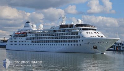
SILVER WIND
Passengers Ship
Current Trip
PLENAU BAY
| Time Travelled | 3 days |
|---|---|
| Remaining Time | --- |
| Distance Travelled | 813.08 nm |
| Remaining Distance | --- |
| AVG Speed | 9.3 Knots |
| MAX Speed | 17.6 Knots |
| AVG Wind | 10.2 knots |
| MAX Wind | 34.3 knots |
| MIN Temp | -12.7°C / 9.14°F |
| MAX Temp | 9.1°C / 48.38°F |
| Dybgang | 5.7 m |
| Position Modtaget | 1 h, 38 m siden |
Current Position
| Longitude | -64.14900° |
|---|---|
| Latitude | -65.19499° |
| Status | Under way using engine |
| Fart | 2.4 Knots |
| Kurs | 82° |
| Område | Southern Ocean |
| Station | T-AIS |
| Position Modtaget | 1 h, 38 m siden |
Info
Information
The current position of SILVER WIND is in Southern Ocean with coordinates -65.19499° / -64.14900° as reported on 2025-02-16 09:04 by AIS to our vessel tracker app. The vessel's current speed is 2.4 Knots
The vessel SILVER WIND (IMO: 8903935, MMSI: 308814000) is a Passengers Ship that was built in 1995 ( 30 år gamle ). It's sailing under the flag of [BS] Bahamas.
In this page you can find informations about the vessels current position, last detected port calls, and current voyage information. If the vessels is not in coverage by AIS you will find the latest position.
The current position of SILVER WIND is detected by our AIS receivers and we are not responsible for the reliability of the data. The last position was recorded while the vessel was in Coverage by the Ais receivers of our vessel tracking app.
The current draught of SILVER WIND as reported by AIS is 5.7 meters
Weather
| Temperature | -1.8°C / 28.76°F |
|---|---|
| Wind Speed | 7 knots |
| Direction | 41° NE |
| Pressure | 997.9 hPa |
| Humidity | 92.8 % |
| Cloud Coverage | 99 % |
Featured Company
Last Port Calls
| Port | Arrival | Departure | Time In Port |
|---|---|---|---|
| 2025-02-11 18:56 | 2025-02-13 00:25 | 1 d | |
| 2025-01-24 22:29 | 2025-01-26 01:17 | 1 d | |
| 2025-01-14 19:20 | 2025-01-16 06:55 | 1 d | |
| 2025-01-04 22:29 | 2025-01-05 23:03 | 1 d | |
| 2024-12-17 15:16 | 2024-12-19 00:29 | 1 d | |
| 2024-12-07 20:33 | 2024-12-08 23:23 | 1 d |
Most Visited Ports (Last year)
| Port | Arrivals | |
|---|---|---|
| 8 | ||
| 4 | ||
| 2 | ||
| 2 | ||
| 2 | ||
| 1 |
Last Trips
| Origin | Departure | Destination | Arrival | Distance | |
|---|---|---|---|---|---|
| 2025-01-25 22:17 | 2025-02-11 15:56 | 3699.25 nm | |||
| 2025-01-16 03:55 | 2025-01-24 19:29 | 1796.18 nm | |||
| 2025-01-05 20:03 | 2025-01-14 16:20 | 1935.81 nm | |||
| 2024-12-18 21:29 | 2025-01-04 19:29 | 3716.79 nm | |||
| 2024-12-08 20:23 | 2024-12-17 12:16 | 1752.65 nm | |||
| 2024-11-28 18:04 | 2024-12-07 17:33 | 1871.42 nm |
Events
| Tid | Hændelsen | Detaljer | Position / Dest | Info |
|---|---|---|---|---|
| 2025-02-16 09:23 | STOP Sejllads |
-65.19417 / -64.13010
PLENAU BAY
|
Fart: Kurs: 81° |
|
| 2025-02-16 09:20 | Status er ændret | Default Under way using engine |
-65.19421 / -64.13110
PLENAU BAY
|
Fart: 2.4 kn Kurs: 82° |
| 2025-02-16 09:04 | Udenfor Dækning |
-65.19499 / -64.14900
Southern Ocean
PLENAU BAY
|
Fart: 2.4 kn Kurs: 85.3° |
|
| 2025-02-16 06:29 | Status er ændret | Under way using engine Default |
-65.03343 / -64.59202
PLENAU BAY
|
Fart: 8.4 kn Kurs: 187° |
| 2025-02-16 06:25 | Status er ændret | Default Under way using engine |
-65.02495 / -64.59360
PLENAU BAY
|
Fart: 8.4 kn Kurs: 196.5° |
| 2025-02-16 06:12 | Status er ændret | Under way using engine Default |
-65.00140 / -64.55472
PLENAU BAY
|
Fart: 7.3 kn Kurs: 226° |
| 2025-02-16 05:38 | Status er ændret | Default Under way using engine |
-64.95611 / -64.42890
PLENAU BAY
|
Fart: 7.4 kn Kurs: 239.5° |
| 2025-02-16 05:12 | Status er ændret | Under way using engine Default |
-64.92646 / -64.32480
PLENAU BAY
|
Fart: 7.4 kn Kurs: 235° |
| 2025-02-16 05:07 | Status er ændret | Default Under way using engine |
-64.92033 / -64.30570
PLENAU BAY
|
Fart: 7.1 kn Kurs: 235.1° |
| 2025-02-16 04:59 | Status er ændret | Under way using engine Default |
-64.91249 / -64.27445
PLENAU BAY
|
Fart: 8 kn Kurs: 246° |