
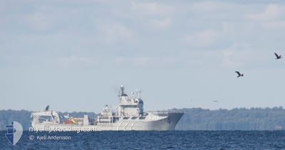
SWEDISH WARSHIP A214
Naval Salvage Vessel
Current Trip
Unknown
| Time Travelled | 9 days |
|---|---|
| Remaining Time | --- |
| Distance Travelled | 37.42 nm |
| Remaining Distance | --- |
| AVG Speed | 11.2 Knots |
| MAX Speed | 12.1 Knots |
| AVG Wind | 20.2 knots |
| MAX Wind | 26.5 knots |
| MIN Temp | 4.9°C / 40.82°F |
| MAX Temp | 9.1°C / 48.38°F |
| Dybgang | 0 m |
| Position Modtaget | 9 d siden |
Current Position
| Longitude | 16.48607° |
|---|---|
| Latitude | 56.12172° |
| Status | Under way using engine |
| Fart | 12.3 Knots |
| Kurs | 42.8° |
| Område | Baltic Sea |
| Station | T-AIS |
| Position Modtaget | 9 d siden |
Info
Information
The current position of SWEDISH WARSHIP A214 is in Baltic Sea with coordinates 56.12172° / 16.48607° as reported on 2025-03-05 19:54 by AIS to our vessel tracker app. The vessel's current speed is 12.3 Knots
The vessel SWEDISH WARSHIP A214 (IMO: 8308288, MMSI: 265402000) is a Naval Salvage Vessel that was built in 1985 ( 40 år gamle ). It's sailing under the flag of [SE] Sweden.
In this page you can find informations about the vessels current position, last detected port calls, and current voyage information. If the vessels is not in coverage by AIS you will find the latest position.
The current position of SWEDISH WARSHIP A214 is detected by our AIS receivers and we are not responsible for the reliability of the data. The last position was recorded while the vessel was in Coverage by the Ais receivers of our vessel tracking app.
Weather
| Temperature | 5°C / 41°F |
|---|---|
| Wind Speed | 27 knots |
| Direction | 244° WSW |
| Pressure | 1012 hPa |
| Humidity | 79.6 % |
| Cloud Coverage | 100 % |
Featured Company
Last Port Calls
| Port | Arrival | Departure | Time In Port |
|---|---|---|---|
| 2025-03-05 17:02 | 2025-03-05 17:31 | 28 m | |
| 2025-03-03 14:57 | |||
| 2025-01-04 10:55 |
Most Visited Ports (Last year)
| Port | Arrivals | |
|---|---|---|
| 7 | ||
| 4 | ||
| 1 | ||
| 1 |
Last Trips
| Origin | Departure | Destination | Arrival | Distance | |
|---|---|---|---|---|---|
| 2025-03-03 14:57 | 2025-03-05 17:02 | 98.75 nm |
Events
| Tid | Hændelsen | Detaljer | Position / Dest | Info |
|---|---|---|---|---|
| 2025-03-05 19:54 | Udenfor Dækning |
56.12172 / 16.48607
Baltic Sea
|
Fart: 12.3 kn Kurs: 42.8° |
|
| 2025-03-05 16:31 | Afsejlet fra sidste havn |
|
56.15226 / 15.57670
|
Fart: 7.4 kn Kurs: 145° |
| 2025-03-05 16:29 | START Sejllads |
56.15511 / 15.57275
[SE] KARLSKRONA
|
Fart: 3.3 kn Kurs: 141° |
|
| 2025-03-05 16:03 | STOP Sejllads |
56.15811 / 15.57401
[SE] KARLSKRONA
|
Fart: 0.3 kn Kurs: 15° |
|
| 2025-03-05 16:02 | Skibe i havn |
|
56.15811 / 15.57401
[SE] KARLSKRONA
|
Fart: 0.6 kn Kurs: 15° |
| 2025-03-05 12:47 | Status er ændret | Under way using engine Restricted manoeuverability |
55.58686 / 15.58806
|
Fart: 11.2 kn Kurs: 359.3° |
| 2025-03-05 12:40 | Ændre havområde | Swedish part of the Baltic Sea Danish part of the Kattegat |
55.56671 / 15.58665
Baltic Sea
|
Fart: 11.2 kn Kurs: 358° |
| 2025-03-05 12:28 | START Sejllads |
55.53101 / 15.58231
|
Fart: 6.7 kn Kurs: 356.2° |
|
| 2025-03-05 10:08 | STOP Sejllads |
55.52916 / 15.58139
|
Fart: 0.1 kn Kurs: 258° |
|
| 2025-03-05 10:07 | Status er ændret | Restricted manoeuverability Under way using engine |
55.52907 / 15.58100
|
Fart: 1.4 kn Kurs: 253° |