
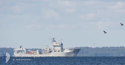
SWEDISH WARSHIP A214
Naval Salvage Vessel
Current Trip
Unknown
| Time Travelled | 9 days |
|---|---|
| Remaining Time | --- |
| Distance Travelled | 37.42 морская миля |
| Remaining Distance | --- |
| AVG Speed | 11.2 Узлы |
| MAX Speed | 12.1 Узлы |
| AVG Wind | 20.2 knots |
| MAX Wind | 26.5 knots |
| MIN Temp | 4.9°C / 40.82°F |
| MAX Temp | 9.1°C / 48.38°F |
| Осадка | 0 м |
| Позиция Получена | 9 d тому назад |
Current Position
| Долгота | 16.48607° |
|---|---|
| Широта | 56.12172° |
| Статус | Under way using engine |
| Скорость | 12.3 Узлы |
| Курс | 42.8° |
| Район | Baltic Sea |
| Станция | T-AIS |
| Позиция Получена | 9 d тому назад |
Info
Information
The current position of SWEDISH WARSHIP A214 is in Baltic Sea with coordinates 56.12172° / 16.48607° as reported on 2025-03-05 19:54 by AIS to our vessel tracker app. The vessel's current speed is 12.3 Узлы
The vessel SWEDISH WARSHIP A214 (IMO: 8308288, MMSI: 265402000) is a Naval Salvage Vessel that was built in 1985 ( 40 лет ). It's sailing under the flag of [SE] Sweden.
In this page you can find informations about the vessels current position, last detected port calls, and current voyage information. If the vessels is not in coverage by AIS you will find the latest position.
The current position of SWEDISH WARSHIP A214 is detected by our AIS receivers and we are not responsible for the reliability of the data. The last position was recorded while the vessel was in Coverage by the Ais receivers of our vessel tracking app.
Weather
| Temperature | 5°C / 41°F |
|---|---|
| Wind Speed | 27 knots |
| Direction | 244° WSW |
| Pressure | 1012 hPa |
| Humidity | 79.6 % |
| Cloud Coverage | 100 % |
Featured Company
Last Port Calls
| Port | Arrival | Departure | Time In Port |
|---|---|---|---|
| 2025-03-05 17:02 | 2025-03-05 17:31 | 28 m | |
| 2025-03-03 14:57 | |||
| 2025-01-04 10:55 |
Most Visited Ports (Last year)
| Port | Arrivals | |
|---|---|---|
| 7 | ||
| 4 | ||
| 1 | ||
| 1 |
Last Trips
| Origin | Departure | Destination | Arrival | Distance | |
|---|---|---|---|---|---|
| 2025-03-03 14:57 | 2025-03-05 17:02 | 98.75 морская миля |
Events
| Время | Событие | Детали | Позиция / Направление | Информация |
|---|---|---|---|---|
| 2025-03-05 19:54 | Вне покрытия |
56.12172 / 16.48607
Baltic Sea
|
Скорость: 12.3 kn Курс: 42.8° |
|
| 2025-03-05 16:31 | ПОРТ ОТПРАВЛЕНИЯ |
|
56.15226 / 15.57670
|
Скорость: 7.4 kn Курс: 145° |
| 2025-03-05 16:29 | Начало движения |
56.15511 / 15.57275
[SE] KARLSKRONA
|
Скорость: 3.3 kn Курс: 141° |
|
| 2025-03-05 16:03 | Окончание движения |
56.15811 / 15.57401
[SE] KARLSKRONA
|
Скорость: 0.3 kn Курс: 15° |
|
| 2025-03-05 16:02 | Порт |
|
56.15811 / 15.57401
[SE] KARLSKRONA
|
Скорость: 0.6 kn Курс: 15° |
| 2025-03-05 12:47 | Статус изменился | Under way using engine Restricted manoeuverability |
55.58686 / 15.58806
|
Скорость: 11.2 kn Курс: 359.3° |
| 2025-03-05 12:40 | Изменение морского района | Swedish part of the Baltic Sea Danish part of the Kattegat |
55.56671 / 15.58665
Baltic Sea
|
Скорость: 11.2 kn Курс: 358° |
| 2025-03-05 12:28 | Начало движения |
55.53101 / 15.58231
|
Скорость: 6.7 kn Курс: 356.2° |
|
| 2025-03-05 10:08 | Окончание движения |
55.52916 / 15.58139
|
Скорость: 0.1 kn Курс: 258° |
|
| 2025-03-05 10:07 | Статус изменился | Restricted manoeuverability Under way using engine |
55.52907 / 15.58100
|
Скорость: 1.4 kn Курс: 253° |