
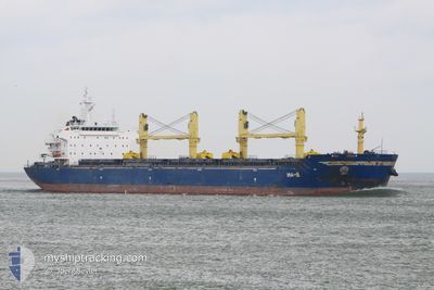
TANZANITE
Bulk Carrier
Current Trip
| Time Travelled | 3 days |
|---|---|
| Remaining Time | --- |
| Distance Travelled | 894.18 nm |
| Remaining Distance | --- |
| AVG Speed | 11.3 Knots |
| MAX Speed | 13.8 Knots |
| AVG Wind | 15.2 knots |
| MAX Wind | 32 knots |
| MIN Temp | -0.6°C / 30.92°F |
| MAX Temp | 17°C / 62.6°F |
| Dybgang | 9 m |
| Position Modtaget | 3 m siden |
Current Position
| Longitude | 29.65858° |
|---|---|
| Latitude | 40.75854° |
| Status | At anchor |
| Fart | 0.1 Knots |
| Kurs | 282° |
| Område | Sea of Marmara |
| Station | T-AIS |
| Position Modtaget | 3 m siden |
Info
Information
The current position of TANZANITE is in Sea of Marmara with coordinates 40.75854° / 29.65858° as reported on 2025-02-05 23:07 by AIS to our vessel tracker app. The vessel's current speed is 0.1 Knots
The vessel TANZANITE (IMO: 9456147, MMSI: 636019478) is a Bulk Carrier that was built in 2010 ( 15 år gamle ). It's sailing under the flag of [LR] Liberia.
In this page you can find informations about the vessels current position, last detected port calls, and current voyage information. If the vessels is not in coverage by AIS you will find the latest position.
The current position of TANZANITE is detected by our AIS receivers and we are not responsible for the reliability of the data. The last position was recorded while the vessel was in Coverage by the Ais receivers of our vessel tracking app.
The current draught of TANZANITE as reported by AIS is 9 meters
Weather
| Temperature | 2.3°C / 36.14°F |
|---|---|
| Wind Speed | 9 knots |
| Direction | 7° N |
| Pressure | 1027.5 hPa |
| Humidity | 66 % |
| Cloud Coverage | 98 % |
Featured Company
Last Port Calls
| Port | Arrival | Departure | Time In Port |
|---|---|---|---|
| 2025-01-28 00:07 | 2025-02-02 15:25 | 5 d | |
| 2025-01-26 06:12 | 2025-01-26 15:33 | 9 h | |
| 2024-12-08 09:12 | 2024-12-29 09:00 | 20 d |
Events
| Tid | Hændelsen | Detaljer | Position / Dest | Info |
|---|---|---|---|---|
| 2025-02-05 19:58 | Status er ændret | At anchor Default |
40.75886 / 29.65861
TR DIL
|
Fart: 0.2 kn Kurs: 282° |
| 2025-02-05 19:49 | Status er ændret | Default At anchor |
40.75854 / 29.65847
TR DIL
|
Fart: 0.1 kn Kurs: 289° |
| 2025-02-05 18:52 | Status er ændret | At anchor Default |
40.75774 / 29.65572
TR DIL
|
Fart: 0.3 kn Kurs: 65° |
| 2025-02-05 18:43 | Status er ændret | Default At anchor |
40.75761 / 29.65445
TR DIL
|
Fart: 0.2 kn Kurs: 63° |
| 2025-02-05 18:35 | Status er ændret | At anchor Under way using engine |
40.75742 / 29.65408
TR DIL
|
Fart: 0.3 kn Kurs: 58° |
| 2025-02-05 18:34 | STOP Sejllads | 2.27 nm, South East of HEREKE |
40.75745 / 29.65411
TR DIL
|
Fart: 0.3 kn Kurs: 58° |
| 2025-02-05 12:53 | Status er ændret | Under way using engine Default |
40.74061 / 28.33731
TR DIL
|
Fart: 12.2 kn Kurs: 96° |
| 2025-02-05 12:42 | Status er ændret | Default Under way using engine |
40.74492 / 28.29003
TR DIL
|
Fart: 12.1 kn Kurs: 96.2° |
| 2025-02-05 12:11 | Status er ændret | Under way using engine Default |
40.75652 / 28.15346
TR DIL
|
Fart: 12.1 kn Kurs: 96° |
| 2025-02-05 11:55 | Status er ændret | Default Under way using engine |
40.76231 / 28.08560
TR DIL
|
Fart: 12.2 kn Kurs: 96.1° |