
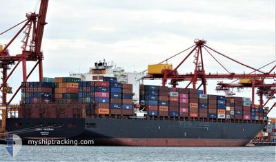
TOCONAO
Container Ship
Current Trip
| Time Travelled | 10 days |
|---|---|
| Remaining Time | --- |
| Distance Travelled | 3396.16 nm |
| Remaining Distance | --- |
| AVG Speed | 12.8 Knots |
| MAX Speed | 17 Knots |
| AVG Wind | 13.3 knots |
| MAX Wind | 22.7 knots |
| MIN Temp | 25.5°C / 77.9°F |
| MAX Temp | 28.5°C / 83.3°F |
| Dybgang | 11.9 m |
| Position Modtaget | 11 m siden |
Current Position
| Longitude | 103.98137° |
|---|---|
| Latitude | 1.27597° |
| Status | At anchor |
| Fart | |
| Kurs | 59° |
| Område | Singapore Strait |
| Station | T-AIS |
| Position Modtaget | 11 m siden |
Info
Information
The current position of TOCONAO is in Singapore Strait with coordinates 1.27597° / 103.98137° as reported on 2026-01-07 18:35 by AIS to our vessel tracker app. The vessel's current speed is 0 Knots
The vessel TOCONAO (IMO: 9627899, MMSI: 636015980) is a Container Ship that was built in 2013 ( 13 år gamle ). It's sailing under the flag of [LR] Liberia.
In this page you can find informations about the vessels current position, last detected port calls, and current voyage information. If the vessels is not in coverage by AIS you will find the latest position.
The current position of TOCONAO is detected by our AIS receivers and we are not responsible for the reliability of the data. The last position was recorded while the vessel was in Coverage by the Ais receivers of our vessel tracking app.
The current draught of TOCONAO as reported by AIS is 11.9 meters
Weather
| Temperature | 26.1°C / 78.98°F |
|---|---|
| Wind Speed | 16 knots |
| Direction | 23° NNE |
| Pressure | 1011.4 hPa |
| Humidity | 84.7 % |
| Cloud Coverage | 100 % |
Featured Company
Last Port Calls
| Port | Arrival | Departure | Time In Port |
|---|---|---|---|
| 2025-12-27 14:22 | 2025-12-28 08:45 | 18 h | |
| 2025-12-14 20:51 | 2025-12-19 23:56 | 5 d | |
| 2025-12-07 22:32 | 2025-12-09 11:56 | 1 d | |
| 2025-11-28 08:30 | 2025-11-29 11:31 | 1 d | |
| 2025-11-22 10:48 | 2025-11-23 13:04 | 1 d | |
| 2025-11-16 11:00 | 2025-11-17 12:21 | 1 d | |
| 2025-11-04 14:46 | 2025-11-05 11:28 | 20 h |
Most Visited Ports (Last year)
| Port | Arrivals | |
|---|---|---|
| 5 | ||
| 5 | ||
| 4 | ||
| 3 | ||
| 3 | ||
| 3 |
Last Trips
| Origin | Departure | Destination | Arrival | Distance | |
|---|---|---|---|---|---|
| 2025-12-19 23:56 | 2025-12-27 14:22 | 1622.23 nm | |||
| 2025-12-09 11:56 | 2025-12-14 20:51 | 1575.74 nm | |||
| 2025-11-29 11:31 | 2025-12-07 22:32 | 3359.20 nm | |||
| 2025-11-23 13:04 | 2025-11-28 08:30 | 1506.58 nm | |||
| 2025-11-17 12:21 | 2025-11-22 10:48 | 965.95 nm | |||
| 2025-11-05 11:28 | 2025-11-16 11:00 | 2337.46 nm | |||
| 2025-10-24 17:15 | 2025-11-04 14:46 | 3363.30 nm |
Events
| Tid | Hændelsen | Detaljer | Position / Dest | Info |
|---|---|---|---|---|
| 2026-01-07 18:38 | Status er ændret | Default At anchor |
1.27602 / 103.98151
SGSIN
|
Fart: Kurs: 59° |
| 2026-01-07 18:29 | Status er ændret | At anchor Default |
1.27596 / 103.98136
SGSIN
|
Fart: Kurs: 57° |
| 2026-01-07 18:23 | Status er ændret | Default At anchor |
1.27596 / 103.98148
SGSIN
|
Fart: 0.1 kn Kurs: 54° |
| 2026-01-07 17:14 | Status er ændret | At anchor Under way using engine |
1.27597 / 103.98222
SGSIN
|
Fart: 0.1 kn Kurs: 61° |
| 2026-01-07 17:06 | STOP Sejllads | 3.01 nm, South West of TANAH MERAH |
1.27637 / 103.98272
SGSIN
|
Fart: 0.3 kn Kurs: 67° |
| 2026-01-07 15:01 | Ændre havområde | Singaporean part of the Singapore Strait Indonesian part of the Singapore Strait |
1.26568 / 104.02284
Singapore Strait
SGSIN
|
Fart: 6.7 kn Kurs: 260.7° |
| 2026-01-07 11:56 | ETA er ændret | 2026/01/07 16:00 2026/01/07 14:30 |
1.13089 / 103.76775
SGSIN
|
Fart: 8.7 kn Kurs: 48.5° |
| 2026-01-07 10:50 | Status er ændret | Under way using engine Default |
1.04790 / 103.64611
SGSIN
|
Fart: 6.2 kn Kurs: 124° |
| 2026-01-07 10:32 | Status er ændret | Default Under way using engine |
1.06709 / 103.61592
SGSIN
|
Fart: 10.5 kn Kurs: 122.2° |
| 2026-01-07 09:30 | Destination er ændret | SGSIN MYTPP |
1.15642 / 103.45750
SGSIN
|
Fart: 10.5 kn Kurs: 120.9° |