
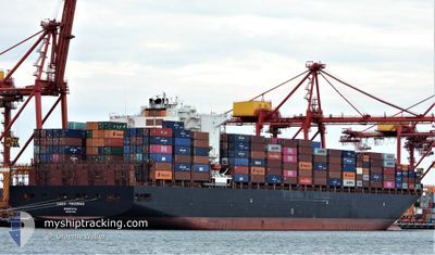
TOCONAO
Container Ship
Current Trip
| Time Travelled | 5 days |
|---|---|
| Remaining Time | 1 h, 30 mins |
| Distance Travelled | 1562.80 nm |
| Remaining Distance | 5.13 nm |
| AVG Speed | 11.3 Knots |
| MAX Speed | 16.6 Knots |
| AVG Wind | 14.1 knots |
| MAX Wind | 26.8 knots |
| MIN Temp | 22.1°C / 71.78°F |
| MAX Temp | 29.8°C / 85.64°F |
| Draught | 11 m |
| Position Received | 1 m ago |
Current Position
| Longitude | 31.13597° |
|---|---|
| Latitude | -29.80083° |
| Status | Under way using engine |
| Speed | 2.3 Knots |
| Course | 270° |
| Area | Indian Ocean |
| Station | T-AIS |
| Position Received | 1 m ago |
Info
Information
The current position of TOCONAO is in Indian Ocean with coordinates -29.80083° / 31.13597° as reported on 2025-12-14 14:47 by AIS to our vessel tracker app. The vessel's current speed is 2.3 Knots and is heading at the port of DURBAN. The estimated time of arrival as calculated by MyShipTracking vessel tracking app is 2025-12-14 18:18 LT
The vessel TOCONAO (IMO: 9627899, MMSI: 636015980) is a Container Ship that was built in 2013 ( 12 years old ). It's sailing under the flag of [LR] Liberia.
In this page you can find informations about the vessels current position, last detected port calls, and current voyage information. If the vessels is not in coverage by AIS you will find the latest position.
The current position of TOCONAO is detected by our AIS receivers and we are not responsible for the reliability of the data. The last position was recorded while the vessel was in Coverage by the Ais receivers of our vessel tracking app.
The current draught of TOCONAO as reported by AIS is 11 meters
Weather
| Temperature | 22.7°C / 72.86°F |
|---|---|
| Wind Speed | 16 knots |
| Direction | 52° NE |
| Pressure | 1018.4 hPa |
| Humidity | 69.9 % |
| Cloud Coverage | --- |
Featured Company
Last Port Calls
| Port | Arrival | Departure | Time In Port |
|---|---|---|---|
| 2025-12-07 22:32 | 2025-12-09 11:56 | 1 d | |
| 2025-11-28 08:30 | 2025-11-29 11:31 | 1 d | |
| 2025-11-22 10:48 | 2025-11-23 13:04 | 1 d | |
| 2025-11-16 11:00 | 2025-11-17 12:21 | 1 d | |
| 2025-11-04 14:46 | 2025-11-05 11:28 | 20 h | |
| 2025-10-23 18:23 | 2025-10-24 17:15 | 22 h | |
| 2025-10-13 20:51 | 2025-10-19 20:30 | 5 d | |
| 2025-10-06 23:30 | 2025-10-08 04:24 | 1 d |
Most Visited Ports (Last year)
| Port | Arrivals | |
|---|---|---|
| 5 | ||
| 4 | ||
| 4 | ||
| 4 | ||
| 3 | ||
| 2 |
Last Trips
| Origin | Departure | Destination | Arrival | Distance | |
|---|---|---|---|---|---|
| 2025-11-29 11:31 | 2025-12-07 22:32 | 3359.20 nm | |||
| 2025-11-23 13:04 | 2025-11-28 08:30 | 1506.58 nm | |||
| 2025-11-17 12:21 | 2025-11-22 10:48 | 965.95 nm | |||
| 2025-11-05 11:28 | 2025-11-16 11:00 | 2337.46 nm | |||
| 2025-10-24 17:15 | 2025-11-04 14:46 | 3363.30 nm | |||
| 2025-10-19 20:30 | 2025-10-23 18:23 | 1564.61 nm | |||
| 2025-10-08 04:24 | 2025-10-13 20:51 | 1586.03 nm | |||
| 2025-09-27 17:04 | 2025-10-06 23:30 | 3379.60 nm |
Events
| Time | Event | Details | Position / Dest | Info |
|---|---|---|---|---|
| 2025-12-14 13:40 | STOP Moving | 7 nm, North East of DURBAN |
-29.80311 / 31.12817
ZADUR
|
Speed: 0.3 kn Course: 243° |
| 2025-12-14 07:51 | ETA Changed | 2025/12/14 10:00 2025/12/16 08:00 |
-29.66893 / 31.52572
ZADUR
|
Speed: 12.5 kn Course: 258.6° |
| 2025-12-14 07:24 | Change Sea Area | South African part of the Indian Ocean Malaysian part of the Malacca Strait |
-29.64900 / 31.63494
Indian Ocean
ZADUR
|
Speed: 13.8 kn Course: 255.7° |
| 2025-12-14 07:24 | Status Changed | Under way using engine Default |
-29.64900 / 31.63494
ZADUR
|
Speed: 13.7 kn Course: 255° |
| 2025-12-14 07:24 | IN Coverage |
-29.64900 / 31.63494
Indian Ocean
ZADUR
|
Speed: 13.8 kn Course: 255.7° |
|
| 2025-12-09 07:56 | PORT DEPARTURE |
|
-20.13084 / 57.47226
ZADUR
|
Speed: 2.1 kn Course: 328° |
| 2025-12-09 07:40 | Status Changed | Default Under way using engine |
-20.13965 / 57.47881
[MU] PORT LOUIS
|
Speed: 3.4 kn Course: 88° |
| 2025-12-09 07:29 | START Moving |
-20.14009 / 57.48740
[MU] PORT LOUIS
|
Speed: 3.4 kn Course: 88° |
|
| 2025-12-09 07:29 | OUT of Coverage |
-20.14009 / 57.48740
Malacca Strait
ZADUR
|
Speed: 3.4 kn Course: 268.8° |
|
| 2025-12-09 07:13 | Status Changed | Under way using engine Moored |
-20.13998 / 57.49350
[MU] PORT LOUIS
|
Speed: Course: 58° |