
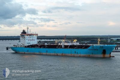
TONDA
Oil/Chemical Tanker
Current Trip
IN IXY
| Time Travelled | 6 days |
|---|---|
| Remaining Time | --- |
| Distance Travelled | 815.52 nm |
| Remaining Distance | --- |
| AVG Speed | 12.3 Knots |
| MAX Speed | 15.5 Knots |
| AVG Wind | 9.6 knots |
| MAX Wind | 22 knots |
| MIN Temp | 20.9°C / 69.62°F |
| MAX Temp | 31°C / 87.8°F |
| Dybgang | 10.2 m |
| Position Modtaget | 12 d siden |
Current Position
| Longitude | 57.27766° |
|---|---|
| Latitude | 25.40779° |
| Status | Under way using engine |
| Fart | 12.5 Knots |
| Kurs | 120.4° |
| Område | Gulf of Oman |
| Station | T-AIS |
| Position Modtaget | 12 d siden |
Info
Information
The current position of TONDA is in Gulf of Oman with coordinates 25.40779° / 57.27766° as reported on 2025-01-27 12:21 by AIS to our vessel tracker app. The vessel's current speed is 12.5 Knots
The vessel TONDA (IMO: 9274654, MMSI: 538009156) is a Oil/Chemical Tanker that was built in 2005 ( 20 år gamle ). It's sailing under the flag of [MH] Marshall Is.
In this page you can find informations about the vessels current position, last detected port calls, and current voyage information. If the vessels is not in coverage by AIS you will find the latest position.
The current position of TONDA is detected by our AIS receivers and we are not responsible for the reliability of the data. The last position was recorded while the vessel was in Coverage by the Ais receivers of our vessel tracking app.
The current draught of TONDA as reported by AIS is 10.2 meters
Weather
| Temperature | 27°C / 80.6°F |
|---|---|
| Wind Speed | 6 knots |
| Direction | 12° NNE |
| Pressure | 1013.2 hPa |
| Humidity | 65.1 % |
| Cloud Coverage | --- |
Featured Company
Last Port Calls
| Port | Arrival | Departure | Time In Port |
|---|---|---|---|
| 2025-02-01 00:25 | 2025-02-02 06:55 | 1 d | |
| 2025-01-21 23:00 | 2025-01-25 22:30 | 3 d | |
| 2025-01-06 12:31 | 2025-01-08 01:11 | 1 d | |
| 2024-12-17 22:41 | 2024-12-19 09:21 | 1 d |
Last Trips
| Origin | Departure | Destination | Arrival | Distance | |
|---|---|---|---|---|---|
| 2025-01-26 01:30 | 2025-02-01 05:55 | 1230.99 nm | |||
| 2025-01-08 06:11 | 2025-01-22 02:00 | 1348.14 nm | |||
| 2024-12-19 14:51 | 2025-01-06 17:31 | 318.13 nm | |||
| 2024-12-01 00:44 | 2024-12-18 04:11 | 3011.78 nm |
Events
| Tid | Hændelsen | Detaljer | Position / Dest | Info |
|---|---|---|---|---|
| 2025-02-07 08:53 | START Sejllads | 1.96 nm, North West of NHAVA SHEVA |
18.97783 / 72.91939
IN IXY
|
Fart: 4.7 kn Kurs: 219° |
| 2025-02-06 13:20 | STOP Sejllads | 2.02 nm, North West of NHAVA SHEVA |
18.98221 / 72.92245
IN IXY
|
Fart: Kurs: 227° |
| 2025-02-06 10:49 | START Sejllads | 18.56 nm, South West of MUMBAI |
18.79238 / 72.61572
IN IXY
|
Fart: 10.9 kn Kurs: 45° |
| 2025-02-06 08:04 | STOP Sejllads | 19.46 nm, South West of MUMBAI |
18.77747 / 72.60819
IN IXY
|
Fart: Kurs: 349° |
| 2025-02-05 19:42 | START Sejllads |
21.08623 / 72.60884
IN IXY
|
Fart: 10.3 kn Kurs: 252° |
|
| 2025-02-04 19:49 | STOP Sejllads |
21.08168 / 72.62862
IN IXY
|
Fart: 0.3 kn Kurs: 135° |
|
| 2025-02-04 16:39 | START Sejllads |
20.89324 / 72.61108
IN IXY
|
Fart: 5.3 kn Kurs: 306° |
|
| 2025-02-03 17:13 | STOP Sejllads |
20.87526 / 72.63080
IN IXY
|
Fart: 0.3 kn Kurs: 354° |
|
| 2025-02-02 06:55 | Afsejlet fra sidste havn |
|
22.95094 / 70.24201
IN IXY
|
Fart: 12.1 kn Kurs: 163° |
| 2025-02-02 06:30 | START Sejllads |
23.02643 / 70.22755
[IN] KANDLA
|
Fart: 5 kn Kurs: 170° |