

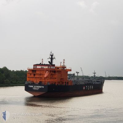
TORM STRENGTH
Tanker
Current Trip
| Time Travelled | 48 days |
|---|---|
| Remaining Time | 10 days |
| Distance Travelled | 7933.52 nm |
| Remaining Distance | 3424.27 nm |
| AVG Speed | 11.4 Knots |
| MAX Speed | 16.1 Knots |
| AVG Wind | 9.1 knots |
| MAX Wind | 33 knots |
| MIN Temp | 13.9°C / 57.02°F |
| MAX Temp | 30.4°C / 86.72°F |
| Dybgang | 11.5 m |
| Position Modtaget | 5 h, 15 m siden |
Current Position
| Longitude | 103.56859° |
|---|---|
| Latitude | 1.20787° |
| Status | Under way using engine |
| Fart | 13.6 Knots |
| Kurs | 286.8° |
| Område | Singapore Strait |
| Station | T-AIS |
| Position Modtaget | 5 h, 15 m siden |
Information
The current position of TORM STRENGTH is in Singapore Strait with coordinates 1.20787° / 103.56859° as reported on 2025-06-11 20:25 by AIS to our vessel tracker app. The vessel's current speed is 13.6 Knots and is heading at the port of JEBEL ALI. The estimated time of arrival as calculated by MyShipTracking vessel tracking app is 2025-06-22 14:46 LT
The vessel TORM STRENGTH (IMO: 9836036, MMSI: 219024902) is a Tanker It's sailing under the flag of [DK] Denmark.
In this page you can find informations about the vessels current position, last detected port calls, and current voyage information. If the vessels is not in coverage by AIS you will find the latest position.
The current position of TORM STRENGTH is detected by our AIS receivers and we are not responsible for the reliability of the data. The last position was recorded while the vessel was in Coverage by the Ais receivers of our vessel tracking app.
The current draught of TORM STRENGTH as reported by AIS is 11.5 meters
Weather
| Temperature | 28.1°C / 82.58°F |
|---|---|
| Wind Speed | 8 knots |
| Direction | 188° S |
| Pressure | 1008.9 hPa |
| Humidity | 76.3 % |
| Cloud Coverage | 100 % |
Featured Company
Last Port Calls
| Port | Arrival | Departure | Time In Port |
|---|---|---|---|
| 2025-04-23 07:40 | 2025-04-25 00:22 | 1 d | |
| 2025-04-13 12:21 | 2025-04-15 00:23 | 1 d | |
| 2025-04-06 05:58 | 2025-04-08 06:58 | 2 d |
Last Trips
| Origin | Departure | Destination | Arrival | Distance | |
|---|---|---|---|---|---|
| 2025-04-15 00:23 | 2025-04-23 07:40 | 2375.75 nm | |||
| 2025-04-08 06:58 | 2025-04-13 12:21 | 479.11 nm | |||
| 2025-03-30 02:34 | 2025-04-06 05:58 | 1550.49 nm |
Events
| Tid | Hændelsen | Detaljer | Position / Dest | Info |
|---|---|---|---|---|
| 2025-06-11 20:31 | Status er ændret | Default Under way using engine |
1.21403 / 103.54862
AE JEA
|
Fart: 13.6 kn Kurs: 286.8° |
| 2025-06-11 20:25 | Udenfor Dækning |
1.20787 / 103.56859
Singapore Strait
AE JEA
|
Fart: 13.6 kn Kurs: 286.8° |
|
| 2025-06-11 20:19 | Ændre havområde | Malaysian part of the Singapore Strait Indonesian part of the Singapore Strait |
1.20104 / 103.59075
Singapore Strait
AE JEA
|
Fart: 13.4 kn Kurs: 286.9° |
| 2025-06-11 19:46 | Ændre havområde | Indonesian part of the Singapore Strait Singaporean part of the Singapore Strait |
1.15874 / 103.69866
Singapore Strait
AE JEA
|
Fart: 11.6 kn Kurs: 298.5° |
| 2025-06-11 17:32 | START Sejllads | 3.91 nm, East of SINGAPORE |
1.25082 / 103.91924
AE JEA
|
Fart: 3.1 kn Kurs: 201° |
| 2025-06-11 17:26 | Status er ændret | Under way using engine At anchor |
1.25419 / 103.91978
AE JEA
|
Fart: 0.7 kn Kurs: 218° |
| 2025-06-11 14:16 | Status er ændret | At anchor Default |
1.25350 / 103.91871
AE JEA
|
Fart: Kurs: 29° |
| 2025-06-11 14:13 | Status er ændret | Default At anchor |
1.25347 / 103.91863
AE JEA
|
Fart: Kurs: 28° |
| 2025-06-11 10:16 | Status er ændret | At anchor Default |
1.25425 / 103.91801
AE JEA
|
Fart: 0.1 kn Kurs: 72° |
| 2025-06-11 10:13 | Status er ændret | Default At anchor |
1.25429 / 103.91791
AE JEA
|
Fart: 0.1 kn Kurs: 72° |