

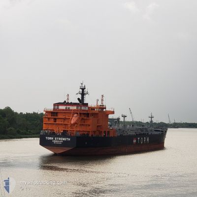
TORM STRENGTH
Tanker

Current Trip
SG SIN FOR ORDER
| Time Travelled | 40 days |
|---|---|
| Remaining Time | --- |
| Distance Travelled | 5915.10 nm |
| Remaining Distance | --- |
| AVG Speed | 12 Knots |
| MAX Speed | 16.1 Knots |
| AVG Wind | 9 knots |
| MAX Wind | 33 knots |
| MIN Temp | 13.9°C / 57.02°F |
| MAX Temp | 30.4°C / 86.72°F |
| Draught | 11.1 m |
| Position Received | 6 d ago |
Current Position
| Longitude | 125.71317° |
|---|---|
| Latitude | 31.90366° |
| Status | Under way using engine |
| Speed | 1 Knots |
| Course | 316° |
| Area | Eastern China Sea |
| Station | T-AIS |
| Position Received | 6 d ago |
Information
The current position of TORM STRENGTH is in Eastern China Sea with coordinates 31.90366° / 125.71317° as reported on 2025-05-29 02:38 by AIS to our vessel tracker app. The vessel's current speed is 1 Knots
The vessel TORM STRENGTH (IMO: 9836036, MMSI: 219024902) is a Tanker It's sailing under the flag of [DK] Denmark.
In this page you can find informations about the vessels current position, last detected port calls, and current voyage information. If the vessels is not in coverage by AIS you will find the latest position.
The current position of TORM STRENGTH is detected by our AIS receivers and we are not responsible for the reliability of the data. The last position was recorded while the vessel was in Coverage by the Ais receivers of our vessel tracking app.
The current draught of TORM STRENGTH as reported by AIS is 11.1 meters
Weather
| Temperature | 25.5°C / 77.9°F |
|---|---|
| Wind Speed | 12 knots |
| Direction | 74° ENE |
| Pressure | 1009.4 hPa |
| Humidity | 65.9 % |
| Cloud Coverage | 48 % |


Featured Company
Last Port Calls
| Port | Arrival | Departure | Time In Port |
|---|---|---|---|
| 2025-04-23 07:40 | 2025-04-25 00:22 | 1 d | |
| 2025-04-13 12:21 | 2025-04-15 00:23 | 1 d | |
| 2025-04-06 05:58 | 2025-04-08 06:58 | 2 d |
Last Trips
| Origin | Departure | Destination | Arrival | Distance | |
|---|---|---|---|---|---|
| 2025-04-15 00:23 | 2025-04-23 07:40 | 2375.75 nm | |||
| 2025-04-08 06:58 | 2025-04-13 12:21 | 479.11 nm | |||
| 2025-03-30 02:34 | 2025-04-06 05:58 | 1550.49 nm |
Events
| Time | Event | Details | Position / Dest | Info |
|---|---|---|---|---|
| 2025-06-03 08:31 | START Moving | 14.87 nm, North of JINTANG |
30.30088 / 121.92826
SG SIN FOR ORDER
|
Speed: 3.9 kn Course: 138° |
| 2025-06-02 06:28 | STOP Moving | 15.15 nm, North of JINTANG |
30.30681 / 121.92451
SG SIN FOR ORDER
|
Speed: Course: 121° |
| 2025-06-02 03:43 | START Moving | 21.01 nm, North of JINTANG |
30.40899 / 121.77795
SG SIN FOR ORDER
|
Speed: 3.3 kn Course: 160° |
| 2025-06-02 00:43 | STOP Moving | 21.26 nm, North of JINTANG |
30.41233 / 121.77224
SG SIN FOR ORDER
|
Speed: 0.3 kn Course: 308° |
| 2025-06-01 10:49 | START Moving |
29.99106 / 123.02425
SG SIN FOR ORDER
|
Speed: 4.1 kn Course: 48° |
|
| 2025-05-30 05:50 | STOP Moving |
29.99116 / 123.02199
SG SIN FOR ORDER
|
Speed: 0.2 kn Course: 199° |
|
| 2025-05-29 09:26 | START Moving |
31.55031 / 125.25600
SG SIN FOR ORDER
|
Speed: 3.7 kn Course: 264° |
|
| 2025-05-29 07:33 | STOP Moving |
31.61151 / 125.24961
SG SIN FOR ORDER
|
Speed: 0.2 kn Course: 323° |
|
| 2025-05-29 02:44 | Status Changed | Default Under way using engine |
31.90516 / 125.71248
SG SIN FOR ORDER
|
Speed: 1 kn Course: 316° |
| 2025-05-29 02:38 | OUT of Coverage |
31.90366 / 125.71317
Eastern China Sea
|
Speed: 1 kn Course: 337.7° |