
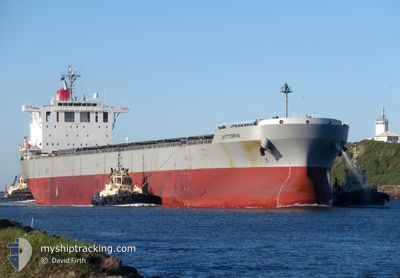
VITTORIA
Bulk Carrier
Current Trip
| Time Travelled | 35 days |
|---|---|
| Remaining Time | 2 days |
| Distance Travelled | 6705.13 nm |
| Remaining Distance | 865.14 nm |
| AVG Speed | 10.9 Knots |
| MAX Speed | 13.8 Knots |
| AVG Wind | 8.8 knots |
| MAX Wind | 23 knots |
| MIN Temp | 23.3°C / 73.94°F |
| MAX Temp | 30.5°C / 86.9°F |
| Dybgang | 14.1 m |
| Position Modtaget | 3 d siden |
Current Position
| Longitude | 103.33698° |
|---|---|
| Latitude | 1.29817° |
| Status | Under way using engine |
| Fart | 10.2 Knots |
| Kurs | 305.9° |
| Område | Malacca Strait |
| Station | T-AIS |
| Position Modtaget | 3 d siden |
Info
Information
The current position of VITTORIA is in Malacca Strait with coordinates 1.29817° / 103.33698° as reported on 2025-03-05 18:14 by AIS to our vessel tracker app. The vessel's current speed is 10.2 Knots and is heading at the port of TUTICORIN. The estimated time of arrival as calculated by MyShipTracking vessel tracking app is 2025-03-11 17:50 LT
The vessel VITTORIA (IMO: 9620645, MMSI: 354314000) is a Bulk Carrier that was built in 2013 ( 12 år gamle ). It's sailing under the flag of [PA] Panama.
In this page you can find informations about the vessels current position, last detected port calls, and current voyage information. If the vessels is not in coverage by AIS you will find the latest position.
The current position of VITTORIA is detected by our AIS receivers and we are not responsible for the reliability of the data. The last position was recorded while the vessel was in Coverage by the Ais receivers of our vessel tracking app.
The current draught of VITTORIA as reported by AIS is 14.1 meters
Weather
| Temperature | 28°C / 82.4°F |
|---|---|
| Wind Speed | 13 knots |
| Direction | 32° NNE |
| Pressure | 1008.1 hPa |
| Humidity | 80.2 % |
| Cloud Coverage | 100 % |
Featured Company
Last Trips
Events
| Tid | Hændelsen | Detaljer | Position / Dest | Info |
|---|---|---|---|---|
| 2025-03-05 18:22 | Status er ændret | Default Under way using engine |
1.31169 / 103.31847
INTUT
|
Fart: 10.2 kn Kurs: 305.9° |
| 2025-03-05 18:14 | Udenfor Dækning |
1.29817 / 103.33698
Malacca Strait
INTUT
|
Fart: 10.2 kn Kurs: 305.9° |
|
| 2025-03-05 17:58 | Status er ændret | Under way using engine Default |
1.27131 / 103.37395
INTUT
|
Fart: 10.1 kn Kurs: 305° |
| 2025-03-05 17:54 | Status er ændret | Default Under way using engine |
1.26470 / 103.38317
INTUT
|
Fart: 9.9 kn Kurs: 305° |
| 2025-03-05 17:21 | Fundet i havområde | Malaysian part of the Malacca Strait |
1.22473 / 103.46501
Malacca Strait
INTUT
|
Fart: 10.3 kn Kurs: 287.7° |
| 2025-03-05 16:37 | Ændre havområde | Malaysian part of the Singapore Strait Indonesian part of the Singapore Strait |
1.19628 / 103.58455
Singapore Strait
INTUT
|
Fart: 8.9 kn Kurs: 276.5° |
| 2025-03-05 16:13 | Ændre havområde | Indonesian part of the Singapore Strait Singaporean part of the Singapore Strait |
1.18931 / 103.65513
Singapore Strait
INTUT
|
Fart: 10.4 kn Kurs: 279.1° |
| 2025-03-05 16:07 | Ændre havområde | Singaporean part of the Singapore Strait Indonesian part of the Singapore Strait |
1.18046 / 103.67051
Singapore Strait
INTUT
|
Fart: 11.2 kn Kurs: 310.6° |
| 2025-03-05 16:04 | Ændre havområde | Indonesian part of the Singapore Strait Singaporean part of the Singapore Strait |
1.17414 / 103.67818
Singapore Strait
INTUT
|
Fart: 11.2 kn Kurs: 307.6° |
| 2025-03-05 16:01 | Ændre havområde | Singaporean part of the Singapore Strait Indonesian part of the Singapore Strait |
1.16900 / 103.68596
Singapore Strait
INTUT
|
Fart: 11 kn Kurs: 300.9° |