
WAN HAI A03
Cargo
Current Trip
| Trip Time | 19 days |
|---|---|
| Trip Distance | 6640.83 nm |
| AVG Speed | 16.9 Knots |
| MAX Speed | 20.9 Knots |
| Dybgang | 10.9 m |
| AVG Wind | 14.9 knots |
| MAX Wind | 29.8 knots |
| MIN Temp | 4.2°C / 39.56°F |
| MAX Temp | 21.7°C / 71.06°F |
| Position Modtaget | 19 d siden |
Current Position
| Longitude | -128.24612° |
|---|---|
| Latitude | 36.02613° |
| Status | Under way using engine |
| Fart | 16.9 Knots |
| Kurs | 250.8° |
| Område | North Pacific Ocean |
| Station | T-AIS |
| Position Modtaget | 19 d siden |
Info
Information
The current position of WAN HAI A03 is in North Pacific Ocean with coordinates 36.02613° / -128.24612° as reported on 2025-01-15 18:51 by AIS to our vessel tracker app. The vessel's current speed is 16.9 Knots and is currently inside the port of TAIPEI.
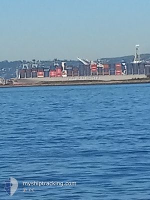
The vessel WAN HAI A03 (IMO: 9935105, MMSI: 563194900) is a Cargo It's sailing under the flag of [SG] Singapore.
In this page you can find informations about the vessels current position, last detected port calls, and current voyage information. If the vessels is not in coverage by AIS you will find the latest position.
The current position of WAN HAI A03 is detected by our AIS receivers and we are not responsible for the reliability of the data. The last position was recorded while the vessel was in Coverage by the Ais receivers of our vessel tracking app.
The current draught of WAN HAI A03 as reported by AIS is 10.9 meters
Weather
| Temperature | 10.4°C / 50.72°F |
|---|---|
| Wind Speed | 13 knots |
| Direction | 55° NE |
| Pressure | 1024.5 hPa |
| Humidity | 61.8 % |
| Cloud Coverage | 49 % |
Featured Company
Last Trips
| Origin | Departure | Destination | Arrival | Distance | |
|---|---|---|---|---|---|
| 2025-01-14 15:58 | 2025-02-04 05:57 | 6640.83 nm | |||
| 2025-01-07 04:31 | 2025-01-13 04:09 | 830.49 nm | |||
| 2024-12-05 17:46 | 2024-12-30 03:13 | 7094.88 nm | |||
| 2024-12-03 23:12 | 2024-12-05 05:13 | 484.76 nm | |||
| 2024-11-28 13:04 | 2024-12-02 20:24 | 1084.66 nm |
Events
| Tid | Hændelsen | Detaljer | Position / Dest | Info |
|---|---|---|---|---|
| 2025-02-03 22:25 | STOP Sejllads |
25.16085 / 121.38377
[TW] TAIPEI
|
Fart: 0.3 kn Kurs: 244° |
|
| 2025-02-03 21:57 | Skibe i havn |
|
25.15382 / 121.36831
[TW] TAIPEI
|
Fart: 8.6 kn Kurs: 94° |
| 2025-02-02 11:29 | START Sejllads | 4.22 nm, East of NINGBO |
29.94427 / 121.92759
CNSHA
|
Fart: 3.9 kn Kurs: 333° |
| 2025-02-01 15:25 | STOP Sejllads | 4.33 nm, East of NINGBO |
29.93715 / 121.92931
CNSHA
|
Fart: 0.1 kn Kurs: 233° |
| 2025-01-31 13:13 | START Sejllads | 6.4 nm, North West of YANGSHAN |
30.65002 / 122.02125
CNSHA
|
Fart: 3.1 kn Kurs: 130° |
| 2025-01-30 03:05 | STOP Sejllads | 6.53 nm, North West of YANGSHAN |
30.65315 / 122.02001
CNSHA
|
Fart: 0.2 kn Kurs: 106° |
| 2025-01-29 23:25 | START Sejllads | 16.08 nm, South of SHENGSI |
30.47703 / 122.48391
CNSHA
|
Fart: 3.7 kn Kurs: 10° |
| 2025-01-28 08:11 | STOP Sejllads | 16.45 nm, South of SHENGSI |
30.47081 / 122.48479
CNSHA
|
Fart: 0.1 kn Kurs: 293° |