

WASHINGTON
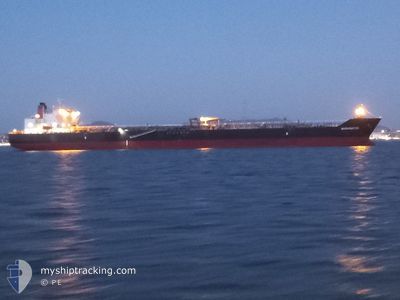
Crude Oil Tanker
Current Trip
| Trip Time | 3 days |
|---|---|
| Trip Distance | 1292.76 nm |
| AVG Speed | 13.1 Knots |
| MAX Speed | 16.2 Knots |
| Dybgang | 7.2 m |
| AVG Wind | 12.1 knots |
| MAX Wind | 28.4 knots |
| MIN Temp | 3.9°C / 39.02°F |
| MAX Temp | 12.3°C / 54.14°F |
| Position Modtaget | 3 d siden |
Current Position
| Longitude | -127.21743° |
|---|---|
| Latitude | 48.61853° |
| Status | Under way using engine |
| Fart | 14.5 Knots |
| Kurs | 299.7° |
| Område | North Pacific Ocean |
| Station | T-AIS |
| Position Modtaget | 3 d siden |
Information
The current position of WASHINGTON is in North Pacific Ocean with coordinates 48.61853° / -127.21743° as reported on 2025-05-30 20:13 by AIS to our vessel tracker app. The vessel's current speed is 14.5 Knots and is currently inside the port of VALDEZ.
The vessel WASHINGTON (IMO: 9642083, MMSI: 368127000) is a Crude Oil Tanker that was built in 2014 ( 11 år gamle ). It's sailing under the flag of [US] USA.
In this page you can find informations about the vessels current position, last detected port calls, and current voyage information. If the vessels is not in coverage by AIS you will find the latest position.
The current position of WASHINGTON is detected by our AIS receivers and we are not responsible for the reliability of the data. The last position was recorded while the vessel was in Coverage by the Ais receivers of our vessel tracking app.
The current draught of WASHINGTON as reported by AIS is 7.2 meters
Weather
| Temperature | 3.7°C / 38.66°F |
|---|---|
| Wind Speed | 2 knots |
| Direction | 233° SW |
| Pressure | 1020.7 hPa |
| Humidity | 99.2 % |
| Cloud Coverage | 100 % |
Featured Company
Last Port Calls
| Port | Arrival | Departure | Time In Port |
|---|---|---|---|
| 2025-06-02 21:08 | |||
| 2025-05-29 00:36 | 2025-05-29 22:45 | 22 h | |
| 2025-05-27 22:03 | 2025-05-28 21:35 | 23 h | |
| 2025-05-24 13:12 | 2025-05-27 16:36 | 3 d | |
| 2025-05-19 14:32 | 2025-05-20 11:36 | 21 h | |
| 2025-05-16 16:44 | 2025-05-18 07:32 | 1 d | |
| 2025-05-13 07:24 | 2025-05-14 03:36 | 20 h | |
| 2025-05-04 07:50 | 2025-05-05 09:00 | 1 d | |
| 2025-05-01 01:38 | 2025-05-02 02:33 | 1 d | |
| 2025-04-21 18:04 | 2025-04-22 15:12 | 21 h |
Most Visited Ports (Last year)
| Port | Arrivals | |
|---|---|---|
| 20 | ||
| 8 | ||
| 8 | ||
| 7 | ||
| 3 | ||
| 3 |
Last Trips
| Origin | Departure | Destination | Arrival | Distance | |
|---|---|---|---|---|---|
| 2025-05-29 22:45 | 2025-06-02 21:08 | 1292.76 nm | |||
| 2025-05-28 21:35 | 2025-05-29 00:36 | 24.79 nm | |||
| 2025-05-27 16:36 | 2025-05-27 22:03 | 57.49 nm | |||
| 2025-05-20 11:36 | 2025-05-24 13:12 | 1252.87 nm | |||
| 2025-05-18 07:32 | 2025-05-19 14:32 | 395.68 nm | |||
| 2025-05-14 03:36 | 2025-05-16 16:44 | 414.42 nm | |||
| 2025-05-05 09:00 | 2025-05-13 07:24 | 1826.67 nm | |||
| 2025-05-02 02:33 | 2025-05-04 07:50 | 484.83 nm | |||
| 2025-04-22 15:12 | 2025-05-01 01:38 | 2178.51 nm | |||
| 2025-04-19 19:32 | 2025-04-21 18:04 | 413.32 nm |
Events
| Tid | Hændelsen | Detaljer | Position / Dest | Info |
|---|---|---|---|---|
| 2025-06-03 05:31 | STOP Sejllads |
61.09055 / -146.40492
[US] VALDEZ
|
Fart: Kurs: 109° |
|
| 2025-06-03 05:08 | Skibe i havn |
|
61.09202 / -146.40742
[US] VALDEZ
|
Fart: 7 kn Kurs: 95° |
| 2025-05-30 20:21 | Status er ændret | Default Under way using engine |
48.63418 / -127.25723
US CLM>US VDZ
|
Fart: 14.5 kn Kurs: 299.7° |
| 2025-05-30 20:13 | Udenfor Dækning |
48.61853 / -127.21743
North Pacific Ocean
US CLM>US VDZ
|
Fart: 14.5 kn Kurs: 299.7° |
|
| 2025-05-30 19:57 | Status er ændret | Under way using engine Default |
48.58573 / -127.13606
US CLM>US VDZ
|
Fart: 14.7 kn Kurs: 300° |
| 2025-05-30 19:56 | Status er ændret | Default Under way using engine |
48.58345 / -127.13037
US CLM>US VDZ
|
Fart: 14.4 kn Kurs: 300.8° |
| 2025-05-30 19:49 | Status er ændret | Under way using engine Default |
48.56861 / -127.09310
US CLM>US VDZ
|
Fart: 14.4 kn Kurs: 302° |
| 2025-05-30 19:28 | Status er ændret | Default Under way using engine |
48.52533 / -126.98455
US CLM>US VDZ
|
Fart: 14.5 kn Kurs: 286.3° |
| 2025-05-30 19:06 | Status er ændret | Under way using engine Default |
48.51125 / -126.85413
US CLM>US VDZ
|
Fart: 14.5 kn Kurs: 269° |
| 2025-05-30 19:01 | Status er ændret | Default Under way using engine |
48.51127 / -126.82171
US CLM>US VDZ
|
Fart: 14.4 kn Kurs: 269.8° |