

WASHINGTON
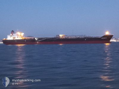
Crude Oil Tanker

Current Trip
US CLM>US VDZ
| Time Travelled | 10 h, 10 mins |
|---|---|
| Remaining Time | --- |
| Distance Travelled | 99.29 морская миля |
| Remaining Distance | --- |
| AVG Speed | 10 Узлы |
| MAX Speed | 12.2 Узлы |
| AVG Wind | 10.8 knots |
| MAX Wind | 21.1 knots |
| MIN Temp | 1.8°C / 35.24°F |
| MAX Temp | 8.2°C / 46.76°F |
| Осадка | 7.2 м |
| Позиция Получена | 4 d тому назад |
Current Position
| Долгота | -127.21743° |
|---|---|
| Широта | 48.61853° |
| Статус | Under way using engine |
| Скорость | 14.5 Узлы |
| Курс | 299.7° |
| Район | North Pacific Ocean |
| Станция | T-AIS |
| Позиция Получена | 4 d тому назад |
Information
The current position of WASHINGTON is in North Pacific Ocean with coordinates 48.61853° / -127.21743° as reported on 2025-05-30 20:13 by AIS to our vessel tracker app. The vessel's current speed is 14.5 Узлы
The vessel WASHINGTON (IMO: 9642083, MMSI: 368127000) is a Crude Oil Tanker that was built in 2014 ( 11 лет ). It's sailing under the flag of [US] USA.
In this page you can find informations about the vessels current position, last detected port calls, and current voyage information. If the vessels is not in coverage by AIS you will find the latest position.
The current position of WASHINGTON is detected by our AIS receivers and we are not responsible for the reliability of the data. The last position was recorded while the vessel was in Coverage by the Ais receivers of our vessel tracking app.
The current draught of WASHINGTON as reported by AIS is 7.2 meters
Weather
| Temperature | 7.8°C / 46.04°F |
|---|---|
| Wind Speed | 9 knots |
| Direction | 162° SSE |
| Pressure | 1015.6 hPa |
| Humidity | 94.1 % |
| Cloud Coverage | 100 % |


Featured Company
Last Port Calls
| Port | Arrival | Departure | Time In Port |
|---|---|---|---|
| 2025-06-02 21:08 | 2025-06-03 17:04 | 19 h | |
| 2025-05-29 00:36 | 2025-05-29 22:45 | 22 h | |
| 2025-05-27 22:03 | 2025-05-28 21:35 | 23 h | |
| 2025-05-24 13:12 | 2025-05-27 16:36 | 3 d | |
| 2025-05-19 14:32 | 2025-05-20 11:36 | 21 h | |
| 2025-05-16 16:44 | 2025-05-18 07:32 | 1 d | |
| 2025-05-13 07:24 | 2025-05-14 03:36 | 20 h | |
| 2025-05-04 07:50 | 2025-05-05 09:00 | 1 d | |
| 2025-05-01 01:38 | 2025-05-02 02:33 | 1 d | |
| 2025-04-21 18:04 | 2025-04-22 15:12 | 21 h |
Most Visited Ports (Last year)
| Port | Arrivals | |
|---|---|---|
| 20 | ||
| 8 | ||
| 8 | ||
| 7 | ||
| 3 | ||
| 3 |
Last Trips
| Origin | Departure | Destination | Arrival | Distance | |
|---|---|---|---|---|---|
| 2025-05-29 22:45 | 2025-06-02 21:08 | 1292.76 морская миля | |||
| 2025-05-28 21:35 | 2025-05-29 00:36 | 24.79 морская миля | |||
| 2025-05-27 16:36 | 2025-05-27 22:03 | 57.49 морская миля | |||
| 2025-05-20 11:36 | 2025-05-24 13:12 | 1252.87 морская миля | |||
| 2025-05-18 07:32 | 2025-05-19 14:32 | 395.68 морская миля | |||
| 2025-05-14 03:36 | 2025-05-16 16:44 | 414.42 морская миля | |||
| 2025-05-05 09:00 | 2025-05-13 07:24 | 1826.67 морская миля | |||
| 2025-05-02 02:33 | 2025-05-04 07:50 | 484.83 морская миля | |||
| 2025-04-22 15:12 | 2025-05-01 01:38 | 2178.51 морская миля | |||
| 2025-04-19 19:32 | 2025-04-21 18:04 | 413.32 морская миля |
Events
| Время | Событие | Детали | Позиция / Направление | Информация |
|---|---|---|---|---|
| 2025-06-04 01:04 | ПОРТ ОТПРАВЛЕНИЯ |
|
61.10391 / -146.44167
US CLM>US VDZ
|
Скорость: 8.6 kn Курс: 284° |
| 2025-06-04 00:56 | Начало движения |
61.09766 / -146.40585
[US] VALDEZ
|
Скорость: 6.1 kn Курс: 308° |
|
| 2025-06-03 05:31 | Окончание движения |
61.09055 / -146.40492
[US] VALDEZ
|
Скорость: Курс: 109° |
|
| 2025-06-03 05:08 | Порт |
|
61.09202 / -146.40742
[US] VALDEZ
|
Скорость: 7 kn Курс: 95° |
| 2025-05-30 20:21 | Статус изменился | Default Under way using engine |
48.63418 / -127.25723
US CLM>US VDZ
|
Скорость: 14.5 kn Курс: 299.7° |
| 2025-05-30 20:13 | Вне покрытия |
48.61853 / -127.21743
North Pacific Ocean
US CLM>US VDZ
|
Скорость: 14.5 kn Курс: 299.7° |
|
| 2025-05-30 19:57 | Статус изменился | Under way using engine Default |
48.58573 / -127.13606
US CLM>US VDZ
|
Скорость: 14.7 kn Курс: 300° |
| 2025-05-30 19:56 | Статус изменился | Default Under way using engine |
48.58345 / -127.13037
US CLM>US VDZ
|
Скорость: 14.4 kn Курс: 300.8° |
| 2025-05-30 19:49 | Статус изменился | Under way using engine Default |
48.56861 / -127.09310
US CLM>US VDZ
|
Скорость: 14.4 kn Курс: 302° |
| 2025-05-30 19:28 | Статус изменился | Default Under way using engine |
48.52533 / -126.98455
US CLM>US VDZ
|
Скорость: 14.5 kn Курс: 286.3° |