

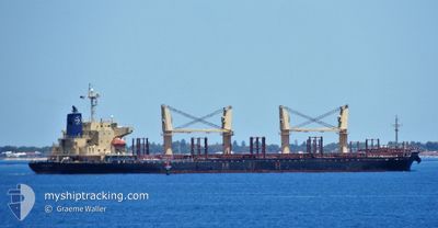
AFRICAN GANNET
Cargo
Current Trip
| Time Travelled | 13 days |
|---|---|
| Remaining Time | --- |
| Distance Travelled | 1374.43 nm |
| Remaining Distance | --- |
| AVG Speed | 6 Noeuds |
| MAX Speed | 13.8 Noeuds |
| AVG Wind | 10 knots |
| MAX Wind | 27 knots |
| MIN Temp | 9.2°C / 48.56°F |
| MAX Temp | 22.7°C / 72.86°F |
| Tirant d eau | 7 m |
| Position reçue | 5 d depuis |
Current Position
| Longitude | -49.04514° |
|---|---|
| Latitude | -29.10322° |
| Etat | Under way using engine |
| Vitesse | 13 Noeuds |
| Parcours | 209.8° |
| Zone | South Atlantic Ocean |
| Station | T-AIS |
| Position reçue | 5 d depuis |
Information
The current position of AFRICAN GANNET is in South Atlantic Ocean with coordinates -29.10322° / -49.04514° as reported on 2025-06-05 04:03 by AIS to our vessel tracker app. The vessel's current speed is 13 Noeuds
The vessel AFRICAN GANNET (IMO: 9749233, MMSI: 311000813) is a Cargo It's sailing under the flag of [BS] Bahamas.
In this page you can find informations about the vessels current position, last detected port calls, and current voyage information. If the vessels is not in coverage by AIS you will find the latest position.
The current position of AFRICAN GANNET is detected by our AIS receivers and we are not responsible for the reliability of the data. The last position was recorded while the vessel was in Coverage by the Ais receivers of our vessel tracking app.
The current draught of AFRICAN GANNET as reported by AIS is 7 meters
Weather
| Temperature | 12.4°C / 54.32°F |
|---|---|
| Wind Speed | 14 knots |
| Direction | 80° E |
| Pressure | 1020.9 hPa |
| Humidity | 78.6 % |
| Cloud Coverage | --- |
Featured Company
Last Port Calls
| Port | Arrival | Departure | Time In Port |
|---|---|---|---|
| 2025-05-24 21:15 | 2025-05-28 12:58 | 3 d | |
| 2025-04-28 23:10 | 2025-04-29 16:11 | 17 h | |
| 2025-04-22 17:23 | 2025-04-23 10:42 | 17 h | |
| 2025-04-05 19:28 |
Most Visited Ports (Last year)
| Port | Arrivals | |
|---|---|---|
| 2 | ||
| 1 | ||
| 1 | ||
| 1 | ||
| 1 | ||
| 1 |
Last Trips
| Origin | Departure | Destination | Arrival | Distance | |
|---|---|---|---|---|---|
| 2025-04-29 16:11 | 2025-05-24 21:15 | 4355.76 nm | |||
| 2025-04-23 10:42 | 2025-04-28 23:10 | 1629.97 nm | |||
| 2025-04-05 19:28 | 2025-04-22 17:23 | 1985.27 nm |
Events
| Heure | Evenement | Détails | Position/ Destination | Info |
|---|---|---|---|---|
| 2025-06-08 19:43 | Arret |
-39.30038 / -61.55381
AR BHI
|
Vitesse: 0.1 kn Parcours: 290° |
|
| 2025-06-06 18:55 | Démarrage |
-34.98521 / -53.65580
AR BHI
|
Vitesse: 5.3 kn Parcours: 179° |
|
| 2025-06-06 16:35 | Arret |
-34.98680 / -53.71424
AR BHI
|
Vitesse: 0.3 kn Parcours: 245° |
|
| 2025-06-05 04:11 | Etat Changé | Default Under way using engine |
-29.12731 / -49.06136
AR BHI
|
Vitesse: 13 kn Parcours: 209.8° |
| 2025-06-05 04:03 | Hors de la zone couverte |
-29.10322 / -49.04514
South Atlantic Ocean
AR BHI
|
Vitesse: 13 kn Parcours: 209.8° |
|
| 2025-06-05 02:44 | Etat Changé | Under way using engine Default |
-28.85913 / -48.87795
AR BHI
|
Vitesse: 13.1 kn Parcours: 209° |
| 2025-06-05 02:42 | Etat Changé | Default Under way using engine |
-28.85073 / -48.87226
AR BHI
|
Vitesse: 13.2 kn Parcours: 209.7° |
| 2025-06-05 01:55 | Etat Changé | Under way using engine Default |
-28.70596 / -48.77364
AR BHI
|
Vitesse: 13 kn Parcours: 210° |
| 2025-06-05 01:26 | Etat Changé | Default Under way using engine |
-28.61596 / -48.71237
AR BHI
|
Vitesse: 12.9 kn Parcours: 212° |
| 2025-06-05 01:26 | Etat Changé | Under way using engine Default |
-28.61447 / -48.71135
AR BHI
|
Vitesse: 12.9 kn Parcours: 211° |