
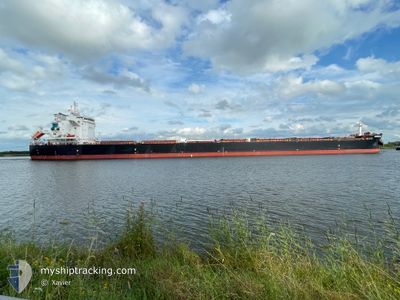
ANDREAS JR
Cargo
Current Trip
IR BKM
| Time Travelled | 3 days |
|---|---|
| Remaining Time | --- |
| Distance Travelled | 925.29 nm |
| Remaining Distance | --- |
| AVG Speed | 9.6 Noeuds |
| MAX Speed | 12.6 Noeuds |
| AVG Wind | 19 knots |
| MAX Wind | 28.8 knots |
| MIN Temp | 15.4°C / 59.72°F |
| MAX Temp | 20.3°C / 68.54°F |
| Tirant d eau | 13.3 m |
| Position reçue | 1 m depuis |
Current Position
| Longitude | 118.31082° |
|---|---|
| Latitude | -35.49756° |
| Etat | Under way using engine |
| Vitesse | 7.3 Noeuds |
| Parcours | 272.4° |
| Zone | Indian Ocean |
| Station | T-AIS |
| Position reçue | 1 m depuis |
Info
Information
The current position of ANDREAS JR is in Indian Ocean with coordinates -35.49756° / 118.31082° as reported on 2025-02-22 03:31 by AIS to our vessel tracker app. The vessel's current speed is 7.3 Noeuds
The vessel ANDREAS JR (IMO: 9949352, MMSI: 538010386) is a Cargo It's sailing under the flag of [MH] Marshall Is.
In this page you can find informations about the vessels current position, last detected port calls, and current voyage information. If the vessels is not in coverage by AIS you will find the latest position.
The current position of ANDREAS JR is detected by our AIS receivers and we are not responsible for the reliability of the data. The last position was recorded while the vessel was in Coverage by the Ais receivers of our vessel tracking app.
The current draught of ANDREAS JR as reported by AIS is 13.3 meters
Weather
| Temperature | 16.2°C / 61.16°F |
|---|---|
| Wind Speed | 19 knots |
| Direction | 228° SW |
| Pressure | 1019.2 hPa |
| Humidity | 65.9 % |
| Cloud Coverage | 84 % |
Featured Company
Last Port Calls
| Port | Arrival | Departure | Time In Port |
|---|---|---|---|
| 2025-02-14 22:12 | 2025-02-18 11:36 | 3 d | |
| 2025-02-03 21:43 | 2025-02-06 11:51 | 2 d | |
| 2025-01-17 10:26 | 2025-01-24 04:16 | 6 d | |
| 2024-12-09 02:57 | 2024-12-09 23:37 | 20 h | |
| 2024-12-01 16:43 | 2024-12-09 02:34 | 7 d |
Most Visited Ports (Last year)
| Port | Arrivals | |
|---|---|---|
| 1 | ||
| 1 | ||
| 1 | ||
| 1 | ||
| 1 | ||
| 1 |
Last Trips
| Origin | Departure | Destination | Arrival | Distance | |
|---|---|---|---|---|---|
| 2025-02-06 19:51 | 2025-02-15 08:42 | 1327.35 nm | |||
| 2025-01-24 11:16 | 2025-02-04 05:43 | 2775.06 nm | |||
| 2024-12-09 20:37 | 2025-01-17 17:26 | 9945.83 nm | |||
| 2024-12-08 23:34 | 2024-12-08 23:57 | 1.18 nm | |||
| 2024-10-24 03:04 | 2024-12-01 13:43 | 8414.89 nm |
Events
| Heure | Evenement | Détails | Position/ Destination | Info |
|---|---|---|---|---|
| 2025-02-22 00:22 | Changement de zone | Australian part of the Indian Ocean Australian part of the Great Australian Bight |
-35.48816 / 118.79335
Indian Ocean
IR BKM
|
Vitesse: 7.6 kn Parcours: 275.3° |
| 2025-02-21 23:56 | Tirant d'eau modifié | 13.3 7.1 |
-35.48937 / 118.85666
IR BKM
|
Vitesse: 7.3 kn Parcours: 266.4° |
| 2025-02-21 23:56 | Changement de destination | IR BKM AU PLO |
-35.48937 / 118.85666
IR BKM
|
Vitesse: 7.3 kn Parcours: 266.4° |
| 2025-02-21 23:56 | Changement d'ETA | 2025/03/13 08:30 2025/02/12 07:30 |
-35.48937 / 118.85666
IR BKM
|
Vitesse: 7.3 kn Parcours: 266.4° |
| 2025-02-21 23:06 | Etat Changé | Under way using engine Default |
-35.48531 / 118.97480
AU PLO
|
Vitesse: 6.8 kn Parcours: 267° |
| 2025-02-21 22:56 | Etat Changé | Default Under way using engine |
-35.48430 / 118.99830
AU PLO
|
Vitesse: 6.7 kn Parcours: 269.6° |
| 2025-02-21 22:48 | Etat Changé | Under way using engine Default |
-35.48407 / 119.01632
AU PLO
|
Vitesse: 7.2 kn Parcours: 266° |
| 2025-02-21 22:48 | Dans la zone couverte |
-35.48407 / 119.01632
Great Australian Bight
|
Vitesse: 6.7 kn Parcours: 269.6° |
|
| 2025-02-20 14:22 | Etat Changé | Default Under way using engine |
-35.34685 / 125.46741
AU PLO
|
Vitesse: 12 kn Parcours: 267.9° |
| 2025-02-20 14:19 | Hors de la zone couverte |
-35.34663 / 125.47907
Great Australian Bight
|
Vitesse: 12 kn Parcours: 267.9° |