
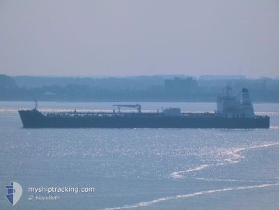
AQUILA L
Tanker
Current Trip
| Time Travelled | 8 days |
|---|---|
| Remaining Time | --- |
| Distance Travelled | 2490.01 nm |
| Remaining Distance | --- |
| AVG Speed | 12.9 Noeuds |
| MAX Speed | 14.9 Noeuds |
| AVG Wind | 11.1 knots |
| MAX Wind | 22 knots |
| MIN Temp | 16.9°C / 62.42°F |
| MAX Temp | 27.9°C / 82.22°F |
| Tirant d eau | 8 m |
| Position reçue | 33 m depuis |
Current Position
| Longitude | -79.51292° |
|---|---|
| Latitude | 8.86723° |
| Etat | At anchor |
| Vitesse | 0.2 Noeuds |
| Parcours | 3° |
| Zone | North Pacific Ocean |
| Station | T-AIS |
| Position reçue | 33 m depuis |
Info
Information
The current position of AQUILA L is in North Pacific Ocean with coordinates 8.86723° / -79.51292° as reported on 2025-02-04 14:09 by AIS to our vessel tracker app. The vessel's current speed is 0.2 Noeuds
The vessel AQUILA L (IMO: 9829411, MMSI: 636018640) is a Tanker It's sailing under the flag of [LR] Liberia.
In this page you can find informations about the vessels current position, last detected port calls, and current voyage information. If the vessels is not in coverage by AIS you will find the latest position.
The current position of AQUILA L is detected by our AIS receivers and we are not responsible for the reliability of the data. The last position was recorded while the vessel was in Coverage by the Ais receivers of our vessel tracking app.
The current draught of AQUILA L as reported by AIS is 8 meters
Weather
| Temperature | 26.1°C / 78.98°F |
|---|---|
| Wind Speed | 9 knots |
| Direction | 358° N |
| Pressure | 1010.8 hPa |
| Humidity | 79.6 % |
| Cloud Coverage | 36 % |
Featured Company
Most Visited Ports (Last year)
| Port | Arrivals | |
|---|---|---|
| 5 | ||
| 5 | ||
| 3 | ||
| 2 | ||
| 2 | ||
| 2 |
Last Trips
| Origin | Departure | Destination | Arrival | Distance | |
|---|---|---|---|---|---|
| 2025-01-22 11:01 | 2025-01-26 08:03 | 212.84 nm | |||
| 2025-01-20 16:17 | 2025-01-21 15:51 | 258.01 nm | |||
| 2024-12-21 02:10 | 2025-01-17 10:01 | 4147.74 nm | |||
| 2024-12-11 01:22 | 2024-12-17 18:47 | 1589.97 nm | |||
| 2024-11-26 07:10 | 2024-12-09 18:58 | 1067.16 nm |
Events
| Heure | Evenement | Détails | Position/ Destination | Info |
|---|---|---|---|---|
| 2025-02-04 14:14 | Etat Changé | Default At anchor |
8.86729 / -79.51301
PA BLB
|
Vitesse: 0.2 kn Parcours: 3° |
| 2025-02-04 14:09 | Etat Changé | At anchor Default |
8.86723 / -79.51292
PA BLB
|
Vitesse: 0.2 kn Parcours: 3° |
| 2025-02-04 13:38 | Etat Changé | Default At anchor |
8.86726 / -79.51238
PA BLB
|
Vitesse: 0.1 kn Parcours: 345° |
| 2025-02-04 13:29 | Etat Changé | At anchor Default |
8.86729 / -79.51239
PA BLB
|
Vitesse: 0.1 kn Parcours: 346° |
| 2025-02-04 13:26 | Etat Changé | Default At anchor |
8.86724 / -79.51241
PA BLB
|
Vitesse: Parcours: 352° |
| 2025-02-04 13:20 | Etat Changé | At anchor Default |
8.86727 / -79.51251
PA BLB
|
Vitesse: 0.2 kn Parcours: 353° |
| 2025-02-04 13:18 | Etat Changé | Default At anchor |
8.86731 / -79.51253
PA BLB
|
Vitesse: 0.1 kn Parcours: 352° |
| 2025-02-04 13:14 | Etat Changé | At anchor Default |
8.86731 / -79.51254
PA BLB
|
Vitesse: 0.2 kn Parcours: 349° |
| 2025-02-04 12:35 | Etat Changé | Default At anchor |
8.86731 / -79.51225
PA BLB
|
Vitesse: Parcours: 348° |
| 2025-02-04 12:26 | Etat Changé | At anchor Default |
8.86731 / -79.51224
PA BLB
|
Vitesse: 0.2 kn Parcours: 339° |