
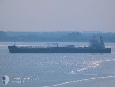
AQUILA L
Tanker
Current Trip
| Time Travelled | 13 days |
|---|---|
| Remaining Time | --- |
| Distance Travelled | 3887.00 nm |
| Remaining Distance | --- |
| AVG Speed | 12.8 Knop |
| MAX Speed | 16.8 Knop |
| AVG Wind | 11.5 knots |
| MAX Wind | 22 knots |
| MIN Temp | 16.9°C / 62.42°F |
| MAX Temp | 29.2°C / 84.56°F |
| Djupgående | 8 m |
| Position mottagen | 4 d sen |
Current Position
| Longitud | -80.00382° |
|---|---|
| Latitude | 9.80211° |
| Status | Under way using engine |
| Fart | 12.2 Knop |
| Kurs | 345° |
| Område | Caribbean Sea |
| Station | T-AIS |
| Position mottagen | 4 d sen |
Info
Information
The current position of AQUILA L is in Caribbean Sea with coordinates 9.80211° / -80.00382° as reported on 2025-02-05 19:43 by AIS to our vessel tracker app. The vessel's current speed is 12.2 Knop and is heading at the port of BALBOA. The estimated time of arrival as calculated by MyShipTracking vessel tracking app is 2025-02-04 10:00 LT
The vessel AQUILA L (IMO: 9829411, MMSI: 636018640) is a Tanker It's sailing under the flag of [LR] Liberia.
In this page you can find informations about the vessels current position, last detected port calls, and current voyage information. If the vessels is not in coverage by AIS you will find the latest position.
The current position of AQUILA L is detected by our AIS receivers and we are not responsible for the reliability of the data. The last position was recorded while the vessel was in Coverage by the Ais receivers of our vessel tracking app.
The current draught of AQUILA L as reported by AIS is 8 meters
Weather
| Temperature | 23.3°C / 73.94°F |
|---|---|
| Wind Speed | 5 knots |
| Direction | 150° SSE |
| Pressure | 1017.8 hPa |
| Humidity | 78.9 % |
| Cloud Coverage | --- |
Featured Company
Most Visited Ports (Last year)
| Port | Arrivals | |
|---|---|---|
| 5 | ||
| 4 | ||
| 3 | ||
| 2 | ||
| 2 | ||
| 2 |
Last Trips
| Origin | Departure | Destination | Arrival | Distance | |
|---|---|---|---|---|---|
| 2025-01-22 11:01 | 2025-01-26 08:03 | 212.84 nm | |||
| 2025-01-20 16:17 | 2025-01-21 15:51 | 258.01 nm | |||
| 2024-12-21 02:10 | 2025-01-17 10:01 | 4147.74 nm | |||
| 2024-12-11 01:22 | 2024-12-17 18:47 | 1589.97 nm | |||
| 2024-11-26 07:10 | 2024-12-09 18:58 | 1067.16 nm |
Events
| Tid | Event | Detaljer | Position / Dest | Information |
|---|---|---|---|---|
| 2025-02-05 19:59 | Status ändrad | Default Under way using engine |
9.85666 / -80.01382
PA BLB
|
Fart: 12.2 kn Kurs: 345° |
| 2025-02-05 19:43 | Status ändrad | Under way using engine Default |
9.80211 / -80.00382
PA BLB
|
Fart: 12 kn Kurs: 0° |
| 2025-02-05 19:43 | UTANFÖR täckningsområde |
9.80211 / -80.00382
Caribbean Sea
|
Fart: 12.2 kn Kurs: 345° |
|
| 2025-02-05 19:36 | Status ändrad | Default Under way using engine |
9.77924 / -80.00069
PA BLB
|
Fart: 12.4 kn Kurs: 353° |
| 2025-02-05 19:12 | Status ändrad | Under way using engine Default |
9.69891 / -79.98448
PA BLB
|
Fart: 11.8 kn Kurs: 348° |
| 2025-02-05 19:10 | Status ändrad | Default Under way using engine |
9.69446 / -79.98323
PA BLB
|
Fart: 12.2 kn Kurs: 338° |
| 2025-02-05 17:58 | Byter havsområde | Panamanian part of the Caribbean Sea Panamanian part of the North Pacific Ocean |
9.46164 / -79.92037
Caribbean Sea
|
Fart: 12.1 kn Kurs: 357.3° |
| 2025-02-05 17:58 | Status ändrad | Under way using engine Default |
9.46164 / -79.92037
PA BLB
|
Fart: 11.8 kn Kurs: 359° |
| 2025-02-05 17:58 | I täckningsområde |
9.46164 / -79.92037
Caribbean Sea
|
Fart: 12.1 kn Kurs: 357.3° |
|
| 2025-02-05 16:27 | STARTAR förflyttning | 3.74 nm, South of CRISTOBAL |
9.28478 / -79.92114
PA BLB
|
Fart: 6.2 kn Kurs: 9° |