

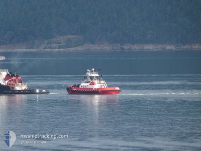
ATHENA
Tug

Current Trip
Current Position
| Longitude | -122.43279° |
|---|---|
| Latitude | 47.25479° |
| Etat | Moored |
| Vitesse | |
| Parcours | 355° |
| Zone | The Coastal Waters of Southeast Alaska and British Columbia |
| Station | T-AIS |
| Position reçue | 5 m depuis |
Information
The current position of ATHENA is in The Coastal Waters of Southeast Alaska and British Columbia with coordinates 47.25479° / -122.43279° as reported on 2025-05-17 18:02 by AIS to our vessel tracker app. The vessel's current speed is 0 Noeuds and is currently inside the port of TACOMA.
The vessel ATHENA (MMSI: 368236750) is a Tug It's sailing under the flag of [US] USA.
In this page you can find informations about the vessels current position, last detected port calls, and current voyage information. If the vessels is not in coverage by AIS you will find the latest position.
The current position of ATHENA is detected by our AIS receivers and we are not responsible for the reliability of the data. The last position was recorded while the vessel was in Coverage by the Ais receivers of our vessel tracking app.
The current draught of ATHENA as reported by AIS is 5.2 meters
Weather
| Temperature | 11.1°C / 51.98°F |
|---|---|
| Wind Speed | 5 knots |
| Direction | 210° SSW |
| Pressure | 1012.2 hPa |
| Humidity | 96.2 % |
| Cloud Coverage | 99 % |


Featured Company
Last Port Calls
| Port | Arrival | Departure | Time In Port |
|---|---|---|---|
| 2025-05-17 05:07 | |||
| 2025-05-11 13:28 | 2025-05-17 05:00 | 5 d | |
| 2025-05-10 16:16 | 2025-05-11 10:32 | 18 h | |
| 2025-05-09 21:09 | 2025-05-10 12:48 | 15 h | |
| 2025-05-09 16:56 | 2025-05-09 18:38 | 1 h | |
| 2025-05-09 09:13 | 2025-05-09 13:10 | 3 h | |
| 2025-05-09 04:57 | 2025-05-09 06:36 | 1 h | |
| 2025-05-08 22:52 | 2025-05-09 02:52 | 3 h | |
| 2025-05-07 16:22 | 2025-05-08 16:23 | 1 d | |
| 2025-05-07 12:13 | 2025-05-07 13:30 | 1 h |
Most Visited Ports (Last year)
| Port | Arrivals | |
|---|---|---|
| 191 | ||
| 83 | ||
| 3 | ||
| 3 | ||
| 2 | ||
| 1 |
Last Trips
| Origin | Departure | Destination | Arrival | Distance | |
|---|---|---|---|---|---|
| 2025-05-17 05:00 | 2025-05-17 05:07 | 0.43 nm | |||
| 2025-05-11 10:32 | 2025-05-11 13:28 | 21.74 nm | |||
| 2025-05-10 12:48 | 2025-05-10 16:16 | 23.90 nm | |||
| 2025-05-09 18:38 | 2025-05-09 21:09 | 21.92 nm | |||
| 2025-05-09 13:10 | 2025-05-09 16:56 | 24.04 nm | |||
| 2025-05-09 06:36 | 2025-05-09 09:13 | 21.86 nm | |||
| 2025-05-09 02:52 | 2025-05-09 04:57 | 23.12 nm | |||
| 2025-05-08 16:23 | 2025-05-08 22:52 | 67.15 nm | |||
| 2025-05-07 13:30 | 2025-05-07 16:22 | 22.94 nm | |||
| 2025-05-07 09:15 | 2025-05-07 12:13 | 23.44 nm |
Events
| Heure | Evenement | Détails | Position/ Destination | Info |
|---|---|---|---|---|
| 2025-05-17 18:06 | Tirant d'eau modifié | 5.2 5 |
47.25479 / -122.43279
[US] TACOMA
|
Vitesse: Parcours: 355° |
| 2025-05-17 18:06 | Changement d'ETA | 2025/12/31 16:00 |
47.25479 / -122.43279
[US] TACOMA
|
Vitesse: Parcours: 355° |
| 2025-05-17 18:02 | Etat Changé | Moored Default |
47.25479 / -122.43279
[US] TACOMA
|
Vitesse: Parcours: 355° |
| 2025-05-17 17:59 | Etat Changé | Default Moored |
47.25478 / -122.43281
[US] TACOMA
|
Vitesse: Parcours: 355° |
| 2025-05-17 17:42 | Tirant d'eau modifié | 5 5.2 |
47.25479 / -122.43281
[US] TACOMA
|
Vitesse: Parcours: 355° |
| 2025-05-17 17:30 | Tirant d'eau modifié | 5.2 5 |
47.25479 / -122.43281
[US] TACOMA
|
Vitesse: Parcours: 355° |
| 2025-05-17 17:30 | Changement d'ETA | 2025/12/31 16:00 |
47.25479 / -122.43281
[US] TACOMA
|
Vitesse: Parcours: 355° |
| 2025-05-17 16:59 | Etat Changé | Moored Default |
47.25477 / -122.43283
[US] TACOMA
|
Vitesse: Parcours: 355° |
| 2025-05-17 16:56 | Etat Changé | Default Moored |
47.25477 / -122.43281
[US] TACOMA
|
Vitesse: Parcours: 354° |
| 2025-05-17 16:41 | Etat Changé | Moored Default |
47.25477 / -122.43278
[US] TACOMA
|
Vitesse: Parcours: 355° |