
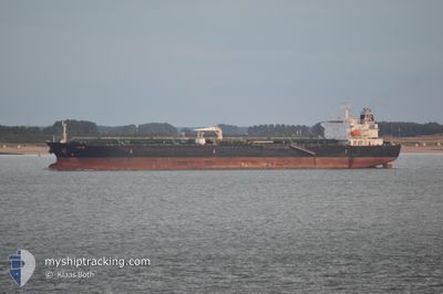
ATHIRI
Oil/Chemical Tanker
Current Trip
INNER ANCHORAGE
| Time Travelled | 3 days |
|---|---|
| Remaining Time | --- |
| Distance Travelled | 303.83 nm |
| Remaining Distance | --- |
| AVG Speed | 9.4 Noeuds |
| MAX Speed | 13 Noeuds |
| AVG Wind | 10.1 knots |
| MAX Wind | 23 knots |
| MIN Temp | 9.6°C / 49.28°F |
| MAX Temp | 18°C / 64.4°F |
| Tirant d eau | 11.8 m |
| Position reçue | 2 d depuis |
Current Position
| Longitude | 34.00217° |
|---|---|
| Latitude | 27.63830° |
| Etat | Under way using engine |
| Vitesse | 11.3 Noeuds |
| Parcours | 308.5° |
| Zone | Gulf of Suez |
| Station | T-AIS |
| Position reçue | 2 d depuis |
Info
Information
The current position of ATHIRI is in Gulf of Suez with coordinates 27.63830° / 34.00217° as reported on 2025-02-10 13:31 by AIS to our vessel tracker app. The vessel's current speed is 11.3 Noeuds
The vessel ATHIRI (IMO: 9457763, MMSI: 538003994) is a Oil/Chemical Tanker that was built in 2010 ( 15 Age ). It's sailing under the flag of [MH] Marshall Is.
In this page you can find informations about the vessels current position, last detected port calls, and current voyage information. If the vessels is not in coverage by AIS you will find the latest position.
The current position of ATHIRI is detected by our AIS receivers and we are not responsible for the reliability of the data. The last position was recorded while the vessel was in Coverage by the Ais receivers of our vessel tracking app.
The current draught of ATHIRI as reported by AIS is 11.8 meters
Weather
| Temperature | 16.8°C / 62.24°F |
|---|---|
| Wind Speed | 9 knots |
| Direction | 6° N |
| Pressure | 1022.6 hPa |
| Humidity | 38.8 % |
| Cloud Coverage | 1 % |
Featured Company
Last Port Calls
| Port | Arrival | Departure | Time In Port |
|---|---|---|---|
| 2025-02-08 13:45 | 2025-02-10 02:45 | 1 d | |
| 2025-02-02 19:32 | 2025-02-05 13:51 | 2 d | |
| 2025-01-24 07:07 | 2025-01-25 03:26 | 20 h | |
| 2025-01-21 02:52 | 2025-01-24 06:16 | 3 d | |
| 2025-01-07 22:40 | 2025-01-11 08:03 | 3 d | |
| 2025-01-05 22:00 | 2025-01-07 21:44 | 1 d | |
| 2025-01-01 10:11 | 2025-01-02 06:40 | 20 h | |
| 2024-12-30 10:33 | 2025-01-01 05:49 | 1 d | |
| 2024-12-22 09:46 | 2024-12-25 08:53 | 2 d | |
| 2024-12-17 16:34 | 2024-12-18 22:14 | 1 d |
Last Trips
| Origin | Departure | Destination | Arrival | Distance | |
|---|---|---|---|---|---|
| 2025-02-05 16:51 | 2025-02-08 15:45 | 461.48 nm | |||
| 2025-01-25 06:26 | 2025-02-02 22:32 | 1175.34 nm | |||
| 2025-01-24 09:16 | 2025-01-24 10:07 | 1.48 nm | |||
| 2025-01-11 11:03 | 2025-01-21 05:52 | 27.45 nm | |||
| 2025-01-08 00:44 | 2025-01-08 01:40 | 4.64 nm | |||
| 2025-01-02 09:40 | 2025-01-06 01:00 | 10.73 nm | |||
| 2025-01-01 08:49 | 2025-01-01 13:11 | 7.24 nm | |||
| 2024-12-25 11:53 | 2024-12-30 13:33 | 25.29 nm | |||
| 2024-12-19 01:14 | 2024-12-22 12:46 | 10.20 nm | |||
| 2024-12-17 04:23 | 2024-12-17 19:34 | 172.68 nm |
Events
| Heure | Evenement | Détails | Position/ Destination | Info |
|---|---|---|---|---|
| 2025-02-13 09:09 | Démarrage | 12.32 nm, South East of AL ADABIYAH |
29.71350 / 32.61005
INNER ANCHORAGE
|
Vitesse: 4.5 kn Parcours: 349° |
| 2025-02-11 09:16 | Arret | 12.55 nm, South East of AL ADABIYAH |
29.70985 / 32.61150
INNER ANCHORAGE
|
Vitesse: 0.2 kn Parcours: 293° |
| 2025-02-11 06:41 | Démarrage | 13.55 nm, East of SOKHNA |
29.67941 / 32.61765
INNER ANCHORAGE
|
Vitesse: 3.8 kn Parcours: 180° |
| 2025-02-11 03:44 | Arret | 12.71 nm, East of SOKHNA |
29.68056 / 32.60131
INNER ANCHORAGE
|
Vitesse: 0.2 kn Parcours: 113° |
| 2025-02-10 13:37 | Etat Changé | Default Under way using engine |
27.65084 / 33.98462
INNER ANCHORAGE
|
Vitesse: 11.3 kn Parcours: 308.5° |
| 2025-02-10 13:31 | Hors de la zone couverte |
27.63830 / 34.00217
Gulf of Suez
|
Vitesse: 11.3 kn Parcours: 308.5° |
|
| 2025-02-10 13:13 | Detecté en mer | Egyptian part of the Gulf of Suez |
27.60294 / 34.05172
Gulf of Suez
|
Vitesse: 11.7 kn Parcours: 308.8° |
| 2025-02-10 13:13 | Etat Changé | Under way using engine Default |
27.60229 / 34.05262
INNER ANCHORAGE
|
Vitesse: 11.7 kn Parcours: 314° |
| 2025-02-10 13:13 | Dans la zone couverte |
27.60294 / 34.05172
Gulf of Suez
|
Vitesse: 11.7 kn Parcours: 308.8° |
|
| 2025-02-10 02:59 | Démarrage | 2.46 nm, South West of AQABA INDUSTRIAL |
29.34865 / 34.92518
INNER ANCHORAGE
|
Vitesse: 11.7 kn Parcours: 214° |