
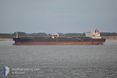
ATHIRI
Oil/Chemical Tanker
Current Trip
INNER ANCHORAGE
| Time Travelled | 5 days |
|---|---|
| Remaining Time | --- |
| Distance Travelled | 571.43 nm |
| Remaining Distance | --- |
| AVG Speed | 10.1 Knopen |
| MAX Speed | 13 Knopen |
| AVG Wind | 11.5 knots |
| MAX Wind | 23 knots |
| MIN Temp | 9.6°C / 49.28°F |
| MAX Temp | 20.5°C / 68.9°F |
| Diepgang | 11.8 M |
| Positie ontvangen | 9 h, 54 m geleden |
Current Position
| Lengtegraad | 34.25444° |
|---|---|
| Breedtegraat | 27.25810° |
| Status | Under way using engine |
| Snelheid | 11.3 Knopen |
| Koers | 144.1° |
| Gebied | Red Sea |
| Station | T-AIS |
| Positie ontvangen | 9 h, 54 m geleden |
Info
Information
The current position of ATHIRI is in Red Sea with coordinates 27.25810° / 34.25444° as reported on 2025-02-15 05:01 by AIS to our vessel tracker app. The vessel's current speed is 11.3 Knopen
The vessel ATHIRI (IMO: 9457763, MMSI: 538003994) is a Oil/Chemical Tanker that was built in 2010 ( 15 Jaar oud ). It's sailing under the flag of [MH] Marshall Is.
In this page you can find informations about the vessels current position, last detected port calls, and current voyage information. If the vessels is not in coverage by AIS you will find the latest position.
The current position of ATHIRI is detected by our AIS receivers and we are not responsible for the reliability of the data. The last position was recorded while the vessel was in Coverage by the Ais receivers of our vessel tracking app.
The current draught of ATHIRI as reported by AIS is 11.8 meters
Weather
| Temperature | 21°C / 69.8°F |
|---|---|
| Wind Speed | 11 knots |
| Direction | 346° NNW |
| Pressure | 1010.4 hPa |
| Humidity | 56.5 % |
| Cloud Coverage | --- |
Featured Company
Last Port Calls
| Port | Arrival | Departure | Time In Port |
|---|---|---|---|
| 2025-02-08 13:45 | 2025-02-10 02:45 | 1 d | |
| 2025-02-02 19:32 | 2025-02-05 13:51 | 2 d | |
| 2025-01-24 07:07 | 2025-01-25 03:26 | 20 h | |
| 2025-01-21 02:52 | 2025-01-24 06:16 | 3 d | |
| 2025-01-07 22:40 | 2025-01-11 08:03 | 3 d | |
| 2025-01-05 22:00 | 2025-01-07 21:44 | 1 d | |
| 2025-01-01 10:11 | 2025-01-02 06:40 | 20 h | |
| 2024-12-30 10:33 | 2025-01-01 05:49 | 1 d | |
| 2024-12-22 09:46 | 2024-12-25 08:53 | 2 d | |
| 2024-12-17 16:34 | 2024-12-18 22:14 | 1 d |
Last Trips
| Origin | Departure | Destination | Arrival | Distance | |
|---|---|---|---|---|---|
| 2025-02-05 16:51 | 2025-02-08 15:45 | 461.48 nm | |||
| 2025-01-25 06:26 | 2025-02-02 22:32 | 1175.34 nm | |||
| 2025-01-24 09:16 | 2025-01-24 10:07 | 1.48 nm | |||
| 2025-01-11 11:03 | 2025-01-21 05:52 | 27.45 nm | |||
| 2025-01-08 00:44 | 2025-01-08 01:40 | 4.64 nm | |||
| 2025-01-02 09:40 | 2025-01-06 01:00 | 10.73 nm | |||
| 2025-01-01 08:49 | 2025-01-01 13:11 | 7.24 nm | |||
| 2024-12-25 11:53 | 2024-12-30 13:33 | 25.29 nm | |||
| 2024-12-19 01:14 | 2024-12-22 12:46 | 10.20 nm | |||
| 2024-12-17 04:23 | 2024-12-17 19:34 | 172.68 nm |
Events
| Tijd | Evenement | Details | Positie / Bestemming | Info |
|---|---|---|---|---|
| 2025-02-15 05:02 | Status Changed | Default Under way using engine |
27.25430 / 34.25752
INNER ANCHORAGE
|
Snelheid: 11.3 kn Koers: 144.1° |
| 2025-02-15 05:01 | Status Changed | Under way using engine Default |
27.25810 / 34.25444
INNER ANCHORAGE
|
Snelheid: 11 kn Koers: 144° |
| 2025-02-15 05:01 | Buitenbereik |
27.25810 / 34.25444
Red Sea
|
Snelheid: 11.3 kn Koers: 144.1° |
|
| 2025-02-15 04:38 | Status Changed | Default Under way using engine |
27.31553 / 34.20767
INNER ANCHORAGE
|
Snelheid: 11 kn Koers: 142.5° |
| 2025-02-15 04:35 | Status Changed | Under way using engine Default |
27.32386 / 34.20090
INNER ANCHORAGE
|
Snelheid: 10.7 kn Koers: 144° |
| 2025-02-15 04:35 | Binnenbereik |
27.32386 / 34.20090
Red Sea
|
Snelheid: 11 kn Koers: 142.5° |
|
| 2025-02-15 04:35 | Gevonden in zee | Egyptian part of the Red Sea |
27.32386 / 34.20090
Red Sea
|
Snelheid: 11 kn Koers: 142.5° |
| 2025-02-14 12:55 | Start beweging | 12.38 nm, South East of AL ADABIYAH |
29.71057 / 32.60702
INNER ANCHORAGE
|
Snelheid: 6.1 kn Koers: 264° |
| 2025-02-13 09:09 | Start beweging | 12.32 nm, South East of AL ADABIYAH |
29.71350 / 32.61005
INNER ANCHORAGE
|
Snelheid: 4.5 kn Koers: 349° |
| 2025-02-11 09:16 | Stop beweging | 12.55 nm, South East of AL ADABIYAH |
29.70985 / 32.61150
INNER ANCHORAGE
|
Snelheid: 0.2 kn Koers: 293° |