
BLUE RIDGE HIGHWAY
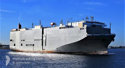
Vehicles Carrier
Current Trip
| Time Travelled | 1 day |
|---|---|
| Remaining Time | 1 h, 33 mins |
| Distance Travelled | 227.34 nm |
| Remaining Distance | 59.00 nm |
| AVG Speed | 14.4 Noeuds |
| MAX Speed | 17.9 Noeuds |
| AVG Wind | 14.6 knots |
| MAX Wind | 21 knots |
| MIN Temp | 6.2°C / 43.16°F |
| MAX Temp | 9.3°C / 48.74°F |
| Tirant d eau | 8.2 m |
| Position reçue | 3 h, 35 m depuis |
Current Position
| Longitude | 139.99646° |
|---|---|
| Latitude | 34.52320° |
| Etat | Under way using engine |
| Vitesse | 1.9 Noeuds |
| Parcours | 73° |
| Zone | North Pacific Ocean |
| Station | T-AIS |
| Position reçue | 3 h, 35 m depuis |
Info
Information
The current position of BLUE RIDGE HIGHWAY is in North Pacific Ocean with coordinates 34.52320° / 139.99646° as reported on 2025-02-24 07:52 by AIS to our vessel tracker app. The vessel's current speed is 1.9 Noeuds and is heading at the port of YOKOHAMA. The estimated time of arrival as calculated by MyShipTracking vessel tracking app is 2025-02-24 22:01 LT
The vessel BLUE RIDGE HIGHWAY (IMO: 9510151, MMSI: 355558000) is a Vehicles Carrier that was built in 2009 ( 16 Age ). It's sailing under the flag of [PA] Panama.
In this page you can find informations about the vessels current position, last detected port calls, and current voyage information. If the vessels is not in coverage by AIS you will find the latest position.
The current position of BLUE RIDGE HIGHWAY is detected by our AIS receivers and we are not responsible for the reliability of the data. The last position was recorded while the vessel was in Coverage by the Ais receivers of our vessel tracking app.
The current draught of BLUE RIDGE HIGHWAY as reported by AIS is 8.2 meters
Weather
| Temperature | 9.2°C / 48.56°F |
|---|---|
| Wind Speed | 17 knots |
| Direction | --- N |
| Pressure | 1019.9 hPa |
| Humidity | 37.4 % |
| Cloud Coverage | 38 % |
Featured Company
Last Port Calls
| Port | Arrival | Departure | Time In Port |
|---|---|---|---|
| 2025-02-23 06:33 | 2025-02-23 17:21 | 10 h | |
| 2025-02-14 21:19 | 2025-02-15 02:21 | 5 h | |
| 2025-02-12 13:16 | 2025-02-13 01:56 | 12 h | |
| 2025-01-29 23:50 | 2025-01-31 07:32 | 1 d | |
| 2025-01-18 08:46 | 2025-01-18 17:19 | 8 h | |
| 2025-01-16 15:51 | 2025-01-16 20:25 | 4 h | |
| 2025-01-12 06:03 | 2025-01-12 21:51 | 15 h | |
| 2025-01-07 16:53 | 2025-01-08 11:01 | 18 h | |
| 2025-01-06 08:40 | 2025-01-06 15:20 | 6 h | |
| 2025-01-04 14:35 | 2025-01-04 23:24 | 8 h |
Most Visited Ports (Last year)
| Port | Arrivals | |
|---|---|---|
| 22 | ||
| 19 | ||
| 10 | ||
| 10 | ||
| 9 | ||
| 2 |
Last Trips
| Origin | Departure | Destination | Arrival | Distance | |
|---|---|---|---|---|---|
| 2025-02-15 02:21 | 2025-02-23 06:33 | 2822.97 nm | |||
| 2025-02-13 01:56 | 2025-02-14 21:19 | 647.66 nm | |||
| 2025-01-31 07:32 | 2025-02-12 13:16 | 4588.29 nm | |||
| 2025-01-18 17:19 | 2025-01-29 23:50 | 4148.18 nm | |||
| 2025-01-16 20:25 | 2025-01-18 08:46 | 494.21 nm | |||
| 2025-01-12 21:51 | 2025-01-16 15:51 | 1391.53 nm | |||
| 2025-01-08 11:01 | 2025-01-12 06:03 | 1420.14 nm | |||
| 2025-01-06 15:20 | 2025-01-07 16:53 | 300.11 nm | |||
| 2025-01-04 23:24 | 2025-01-06 08:40 | 349.04 nm | |||
| 2025-01-04 08:28 | 2025-01-04 14:35 | 48.56 nm |
Events
| Heure | Evenement | Détails | Position/ Destination | Info |
|---|---|---|---|---|
| 2025-02-24 08:02 | Etat Changé | Default Under way using engine |
34.52032 / 140.00153
JP YOK
|
Vitesse: 1.9 kn Parcours: 73° |
| 2025-02-24 07:52 | Hors de la zone couverte |
34.52320 / 139.99646
North Pacific Ocean
JP YOK
|
Vitesse: 1.9 kn Parcours: 118.9° |
|
| 2025-02-24 07:46 | Etat Changé | Under way using engine Default |
34.52482 / 139.99251
JP YOK
|
Vitesse: 4.9 kn Parcours: 130° |
| 2025-02-24 07:34 | Etat Changé | Default Under way using engine |
34.52896 / 139.98180
JP YOK
|
Vitesse: 5.7 kn Parcours: 138.8° |
| 2025-02-24 07:06 | Etat Changé | Under way using engine Default |
34.53459 / 139.88621
JP YOK
|
Vitesse: 11.9 kn Parcours: 85° |
| 2025-02-24 07:01 | Dans la zone couverte |
34.53459 / 139.88621
North Pacific Ocean
JP YOK
|
Vitesse: 12 kn Parcours: 85° |
|
| 2025-02-24 00:25 | Etat Changé | Default Under way using engine |
34.59288 / 139.80215
JP YOK
|
Vitesse: 3 kn Parcours: 118° |
| 2025-02-24 00:17 | Hors de la zone couverte |
34.59390 / 139.81003
North Pacific Ocean
JP YOK
|
Vitesse: 3 kn Parcours: 262.6° |
|
| 2025-02-24 00:14 | Etat Changé | Under way using engine Default |
34.59427 / 139.81305
JP YOK
|
Vitesse: 3.3 kn Parcours: 117° |
| 2025-02-24 00:12 | Etat Changé | Default Under way using engine |
34.59458 / 139.81558
JP YOK
|
Vitesse: 3.4 kn Parcours: 117° |