

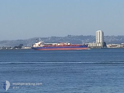
BOCHEM MARENGO
Tanker
Current Trip
| Time Travelled | 23 h, 28 mins |
|---|---|
| Remaining Time | --- |
| Distance Travelled | 261.69 nm |
| Remaining Distance | --- |
| AVG Speed | 11.1 Noeuds |
| MAX Speed | 13.2 Noeuds |
| AVG Wind | 12 knots |
| MAX Wind | 15.9 knots |
| MIN Temp | 28.2°C / 82.76°F |
| MAX Temp | 29.4°C / 84.92°F |
| Tirant d eau | 10 m |
| Position reçue | 7 d depuis |
Current Position
| Longitude | -79.54514° |
|---|---|
| Latitude | 8.91989° |
| Etat | Under way using engine |
| Vitesse | 7.9 Noeuds |
| Parcours | 321.5° |
| Zone | North Pacific Ocean |
| Station | T-AIS |
| Position reçue | 7 d depuis |
Information
The current position of BOCHEM MARENGO is in North Pacific Ocean with coordinates 8.91989° / -79.54514° as reported on 2025-06-03 02:22 by AIS to our vessel tracker app. The vessel's current speed is 7.9 Noeuds and is heading at the port of BALBOA. The estimated time of arrival as calculated by MyShipTracking vessel tracking app is 2025-06-01 23:00 LT
The vessel BOCHEM MARENGO (IMO: 9749025, MMSI: 477142500) is a Tanker It's sailing under the flag of [HK] Hong Kong.
In this page you can find informations about the vessels current position, last detected port calls, and current voyage information. If the vessels is not in coverage by AIS you will find the latest position.
The current position of BOCHEM MARENGO is detected by our AIS receivers and we are not responsible for the reliability of the data. The last position was recorded while the vessel was in Coverage by the Ais receivers of our vessel tracking app.
The current draught of BOCHEM MARENGO as reported by AIS is 10 meters
Weather
| Temperature | 28.9°C / 84.02°F |
|---|---|
| Wind Speed | 10 knots |
| Direction | 127° SE |
| Pressure | 1012.9 hPa |
| Humidity | 82.3 % |
| Cloud Coverage | 100 % |
Featured Company
Last Port Calls
| Port | Arrival | Departure | Time In Port |
|---|---|---|---|
| 2025-06-08 16:57 | 2025-06-09 10:46 | 17 h | |
| 2025-05-20 23:44 | 2025-05-22 14:08 | 1 d | |
| 2025-04-28 11:05 | 2025-04-29 10:28 | 23 h | |
| 2025-04-26 20:26 | 2025-04-28 06:42 | 1 d | |
| 2025-04-23 15:51 | 2025-04-24 12:17 | 20 h | |
| 2025-04-18 13:24 | 2025-04-19 12:14 | 22 h | |
| 2025-04-13 13:16 | 2025-04-16 11:38 | 2 d | |
| 2025-04-07 09:50 | 2025-04-07 22:02 | 12 h | |
| 2025-04-04 00:32 | 2025-04-04 12:26 | 11 h | |
| 2025-04-02 18:34 |
Most Visited Ports (Last year)
| Port | Arrivals | |
|---|---|---|
| 5 | ||
| 3 | ||
| 3 | ||
| 2 | ||
| 2 | ||
| 2 |
Last Trips
| Origin | Departure | Destination | Arrival | Distance | |
|---|---|---|---|---|---|
| 2025-05-22 14:08 | 2025-06-08 16:57 | 4643.01 nm | |||
| 2025-04-29 10:28 | 2025-05-20 23:44 | 5655.68 nm | |||
| 2025-04-28 06:42 | 2025-04-28 11:05 | 23.87 nm | |||
| 2025-04-24 12:17 | 2025-04-26 20:26 | 638.55 nm | |||
| 2025-04-19 12:14 | 2025-04-23 15:51 | 652.15 nm | |||
| 2025-04-16 11:38 | 2025-04-18 13:24 | 111.62 nm | |||
| 2025-04-07 22:02 | 2025-04-13 13:16 | 767.65 nm | |||
| 2025-04-04 12:26 | 2025-04-07 09:50 | 801.37 nm | |||
| 2025-04-02 18:34 | 2025-04-04 00:32 | 135.75 nm |
Events
| Heure | Evenement | Détails | Position/ Destination | Info |
|---|---|---|---|---|
| 2025-06-09 15:46 | PORT DE DEPART |
|
19.20217 / -96.11267
PABLB
|
Vitesse: 6.6 kn Parcours: 105° |
| 2025-06-09 15:37 | Démarrage |
19.20498 / -96.13033
[MX] VERACRUZ
|
Vitesse: 3.9 kn Parcours: 105° |
|
| 2025-06-08 22:00 | Arret |
19.21189 / -96.13851
[MX] VERACRUZ
|
Vitesse: 0.3 kn Parcours: 328° |
|
| 2025-06-08 21:57 | Port d'arrivée |
|
19.21180 / -96.13793
[MX] VERACRUZ
|
Vitesse: 10.4 kn Parcours: 274° |
| 2025-06-08 19:48 | Démarrage | 9.74 nm, North East of VERACRUZ |
19.32248 / -96.00906
PABLB
|
Vitesse: 3.7 kn Parcours: 160° |
| 2025-06-08 18:39 | Arret | 10.31 nm, North East of VERACRUZ |
19.33279 / -96.00600
PABLB
|
Vitesse: 0.2 kn Parcours: 158° |
| 2025-06-03 10:11 | Démarrage | 3.92 nm, South of CRISTOBAL |
9.28172 / -79.92141
PABLB
|
Vitesse: 3.4 kn Parcours: 5° |
| 2025-06-03 08:32 | Arret | 4.85 nm, South of CRISTOBAL |
9.26636 / -79.92363
PABLB
|
Vitesse: Parcours: 8° |
| 2025-06-03 05:21 | Démarrage | 4.88 nm, North West of RODMAN |
9.02308 / -79.61987
PABLB
|
Vitesse: 6.3 kn Parcours: 301° |
| 2025-06-03 04:37 | Arret | 4.1 nm, North West of RODMAN |
9.01434 / -79.60934
PABLB
|
Vitesse: 0.3 kn Parcours: 312° |