
CALIFORNIA
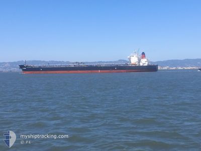
Tanker
Current Trip
| Time Travelled | 5 days |
|---|---|
| Remaining Time | 2 h, 5 mins |
| Distance Travelled | 1776.58 nm |
| Remaining Distance | 34.58 nm |
| AVG Speed | 13.9 Noeuds |
| MAX Speed | 15.6 Noeuds |
| AVG Wind | 13 knots |
| MAX Wind | 26 knots |
| MIN Temp | -2.5°C / 27.5°F |
| MAX Temp | 10.5°C / 50.9°F |
| Tirant d eau | 8.5 m |
| Position reçue | 5 d depuis |
Current Position
| Longitude | -123.14331° |
|---|---|
| Latitude | 37.56369° |
| Etat | Under way using engine |
| Vitesse | 13.9 Noeuds |
| Parcours | 268° |
| Zone | North Pacific Ocean |
| Station | T-AIS |
| Position reçue | 5 d depuis |
Info
Information
The current position of CALIFORNIA is in North Pacific Ocean with coordinates 37.56369° / -123.14331° as reported on 2025-02-08 14:19 by AIS to our vessel tracker app. The vessel's current speed is 13.9 Noeuds and is heading at the port of VALDEZ. The estimated time of arrival as calculated by MyShipTracking vessel tracking app is 2025-02-13 08:22 LT
The vessel CALIFORNIA (IMO: 9642095, MMSI: 338500000) is a Tanker It's sailing under the flag of [US] USA.
In this page you can find informations about the vessels current position, last detected port calls, and current voyage information. If the vessels is not in coverage by AIS you will find the latest position.
The current position of CALIFORNIA is detected by our AIS receivers and we are not responsible for the reliability of the data. The last position was recorded while the vessel was in Coverage by the Ais receivers of our vessel tracking app.
The current draught of CALIFORNIA as reported by AIS is 8.5 meters
Weather
| Temperature | -2.5°C / 27.5°F |
|---|---|
| Wind Speed | 7 knots |
| Direction | 45° NE |
| Pressure | 1001.4 hPa |
| Humidity | 61.5 % |
| Cloud Coverage | 20 % |
Featured Company
Last Port Calls
| Port | Arrival | Departure | Time In Port |
|---|---|---|---|
| 2025-02-07 06:27 | 2025-02-08 01:31 | 19 h | |
| 2025-02-02 14:13 | 2025-02-03 12:26 | 22 h | |
| 2025-01-26 22:35 | 2025-01-27 18:34 | 19 h | |
| 2025-01-19 02:58 | 2025-01-20 01:26 | 22 h | |
| 2025-01-15 21:36 | 2025-01-17 12:15 | 1 d | |
| 2025-01-06 14:23 | 2025-01-07 15:27 | 1 d | |
| 2024-12-30 02:19 | 2024-12-31 07:39 | 1 d | |
| 2024-12-16 06:34 | 2024-12-17 04:30 | 21 h | |
| 2024-12-13 11:42 | 2024-12-15 00:59 | 1 d | |
| 2024-12-11 02:34 | 2024-12-11 21:37 | 19 h |
Most Visited Ports (Last year)
| Port | Arrivals | |
|---|---|---|
| 17 | ||
| 6 | ||
| 5 | ||
| 4 | ||
| 4 | ||
| 4 |
Last Trips
| Origin | Departure | Destination | Arrival | Distance | |
|---|---|---|---|---|---|
| 2025-02-03 12:26 | 2025-02-07 06:27 | 53.45 nm | |||
| 2025-01-27 18:34 | 2025-02-02 14:13 | 1776.58 nm | |||
| 2025-01-20 01:26 | 2025-01-26 22:35 | 1830.98 nm | |||
| 2025-01-17 12:15 | 2025-01-19 02:58 | 497.26 nm | |||
| 2025-01-07 15:27 | 2025-01-15 21:36 | 2131.68 nm | |||
| 2024-12-31 07:39 | 2025-01-06 14:23 | 1805.70 nm | |||
| 2024-12-17 04:30 | 2024-12-30 02:19 | 2624.78 nm | |||
| 2024-12-15 00:59 | 2024-12-16 06:34 | 400.80 nm | |||
| 2024-12-11 21:37 | 2024-12-13 11:42 | 403.69 nm | |||
| 2024-12-03 12:28 | 2024-12-11 02:34 | 1919.54 nm |
Events
| Heure | Evenement | Détails | Position/ Destination | Info |
|---|---|---|---|---|
| 2025-02-08 14:27 | Etat Changé | Default Under way using engine |
37.56306 / -123.18645
US SFO > US VDZ
|
Vitesse: 13.9 kn Parcours: 268° |
| 2025-02-08 14:19 | Hors de la zone couverte |
37.56369 / -123.14331
North Pacific Ocean
US SFO > US VDZ
|
Vitesse: 13.9 kn Parcours: 268° |
|
| 2025-02-08 14:18 | Etat Changé | Under way using engine Default |
37.56376 / -123.14037
US SFO > US VDZ
|
Vitesse: 14.1 kn Parcours: 269° |
| 2025-02-08 14:11 | Etat Changé | Default Under way using engine |
37.56435 / -123.10702
US SFO > US VDZ
|
Vitesse: 14 kn Parcours: 255.9° |
| 2025-02-08 13:43 | Tirant d'eau modifié | 8.5 8.6 |
37.61127 / -122.97948
US SFO > US VDZ
|
Vitesse: 14.6 kn Parcours: 233.1° |
| 2025-02-08 13:32 | Changement de destination | US SFO > US VDZ US BNC4 > US VDZ |
37.63790 / -122.92925
US SFO > US VDZ
|
Vitesse: 14.4 kn Parcours: 235.6° |
| 2025-02-08 10:13 | Tirant d'eau modifié | 8.6 10 |
38.05725 / -122.29005
US BNC4 > US VDZ
|
Vitesse: 13.8 kn Parcours: 259.1° |
| 2025-02-08 10:13 | Changement de destination | US BNC4 > US VDZ US SFO A9 > US BNC4 |
38.05725 / -122.29005
US BNC4 > US VDZ
|
Vitesse: 13.8 kn Parcours: 259.1° |
| 2025-02-08 10:13 | Changement d'ETA | 2025/02/13 15:00 2025/02/07 14:00 |
38.05725 / -122.29005
US BNC4 > US VDZ
|
Vitesse: 13.8 kn Parcours: 259.1° |
| 2025-02-08 09:59 | Etat Changé | Under way using engine Default |
38.06257 / -122.22114
US SFO A9 > US BNC4
|
Vitesse: 13.3 kn Parcours: 285° |