
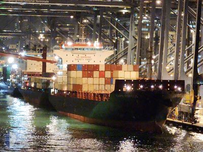
CAPE FORTIUS
Cargo
Current Trip
| Time Travelled | 1 day |
|---|---|
| Remaining Time | 2 mins |
| Distance Travelled | 637.17 nm |
| Remaining Distance | 6.59 nm |
| AVG Speed | 15.8 Noeuds |
| MAX Speed | 18.3 Noeuds |
| AVG Wind | 16.3 knots |
| MAX Wind | 28 knots |
| MIN Temp | 19°C / 66.2°F |
| MAX Temp | 26.7°C / 80.06°F |
| Tirant d eau | 9.6 m |
| Position reçue | 38 m depuis |
Current Position
| Longitude | 120.84201° |
|---|---|
| Latitude | 14.51975° |
| Etat | Under way using engine |
| Vitesse | 9.8 Noeuds |
| Parcours | 66.2° |
| Zone | South China Sea |
| Station | T-AIS |
| Position reçue | 38 m depuis |
Info
Information
The current position of CAPE FORTIUS is in South China Sea with coordinates 14.51975° / 120.84201° as reported on 2026-01-06 23:08 by AIS to our vessel tracker app. The vessel's current speed is 9.8 Noeuds and is heading at the port of MANILA. The estimated time of arrival as calculated by MyShipTracking vessel tracking app is 2026-01-07 07:48 LT
The vessel CAPE FORTIUS (IMO: 9734147, MMSI: 212540000) is a Cargo It's sailing under the flag of [CY] Cyprus.
In this page you can find informations about the vessels current position, last detected port calls, and current voyage information. If the vessels is not in coverage by AIS you will find the latest position.
The current position of CAPE FORTIUS is detected by our AIS receivers and we are not responsible for the reliability of the data. The last position was recorded while the vessel was in Coverage by the Ais receivers of our vessel tracking app.
The current draught of CAPE FORTIUS as reported by AIS is 9.6 meters
Weather
| Temperature | 25.6°C / 78.08°F |
|---|---|
| Wind Speed | 14 knots |
| Direction | 16° NNE |
| Pressure | 1013.3 hPa |
| Humidity | 76.9 % |
| Cloud Coverage | 88 % |
Featured Company
Last Port Calls
| Port | Arrival | Departure | Time In Port |
|---|---|---|---|
| 2026-01-04 23:08 | 2026-01-05 15:50 | 16 h | |
| 2026-01-03 07:41 | 2026-01-03 21:52 | 14 h | |
| 2025-12-29 08:10 | 2025-12-30 02:02 | 17 h | |
| 2025-12-28 07:21 | 2025-12-29 06:40 | 23 h | |
| 2025-12-26 17:39 | 2025-12-27 01:17 | 7 h | |
| 2025-12-26 07:44 | 2025-12-26 16:46 | 9 h | |
| 2025-12-20 10:33 | 2025-12-21 03:59 | 17 h | |
| 2025-12-19 21:07 | 2025-12-20 08:27 | 11 h | |
| 2025-12-16 23:10 | 2025-12-18 00:18 | 1 d | |
| 2025-12-13 08:01 | 2025-12-13 20:56 | 12 h |
Last Trips
| Origin | Departure | Destination | Arrival | Distance | |
|---|---|---|---|---|---|
| 2026-01-03 21:52 | 2026-01-04 23:08 | 360.21 nm | |||
| 2025-12-30 02:02 | 2026-01-03 07:41 | 1494.74 nm | |||
| 2025-12-29 06:40 | 2025-12-29 08:10 | 13.92 nm | |||
| 2025-12-27 01:17 | 2025-12-28 07:21 | 371.69 nm | |||
| 2025-12-26 16:46 | 2025-12-26 17:39 | 6.59 nm | |||
| 2025-12-21 03:59 | 2025-12-26 07:44 | 1460.69 nm | |||
| 2025-12-20 08:27 | 2025-12-20 10:33 | 18.78 nm | |||
| 2025-12-18 00:18 | 2025-12-19 21:07 | 709.68 nm | |||
| 2025-12-13 20:56 | 2025-12-16 23:10 | 673.27 nm | |||
| 2025-12-12 07:44 | 2025-12-13 08:01 | 353.72 nm |
Events
| Heure | Evenement | Détails | Position/ Destination | Info |
|---|---|---|---|---|
| 2026-01-06 23:33 | Arret | 6.3 nm, West of MANILA SOUTH HARBOR |
14.54204 / 120.86964
PHMNL
|
Vitesse: 0.3 kn Parcours: 25° |
| 2026-01-06 23:13 | Etat Changé | Default Under way using engine |
14.52463 / 120.85319
PHMNL
|
Vitesse: 9.8 kn Parcours: 66.2° |
| 2026-01-06 23:08 | Etat Changé | Under way using engine Default |
14.51975 / 120.84201
PHMNL
|
Vitesse: 10.3 kn Parcours: 66° |
| 2026-01-06 23:05 | Etat Changé | Default Under way using engine |
14.51637 / 120.83417
PHMNL
|
Vitesse: 11.2 kn Parcours: 63.8° |
| 2026-01-06 22:58 | Etat Changé | Under way using engine Default |
14.50783 / 120.81615
PHMNL
|
Vitesse: 11.2 kn Parcours: 62° |
| 2026-01-06 22:33 | Etat Changé | Default Under way using engine |
14.47456 / 120.73826
PHMNL
|
Vitesse: 14.6 kn Parcours: 63.3° |
| 2026-01-06 22:23 | Etat Changé | Under way using engine Default |
14.45749 / 120.70288
PHMNL
|
Vitesse: 15.1 kn Parcours: 62° |
| 2026-01-06 22:20 | Etat Changé | Default Under way using engine |
14.45214 / 120.69222
PHMNL
|
Vitesse: 15 kn Parcours: 62.7° |
| 2026-01-06 22:16 | Changement de zone | Philippines part of the South China Sea Chinese part of the South China Sea |
14.44289 / 120.67386
South China Sea
PHMNL
|
Vitesse: 15 kn Parcours: 62.7° |
| 2026-01-06 22:16 | Etat Changé | Under way using engine Default |
14.44289 / 120.67386
PHMNL
|
Vitesse: 14.7 kn Parcours: 64° |