
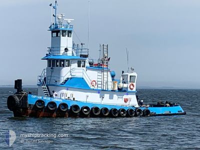
CAPT WILLIE LANDERS
Tug
Current Trip
NYC
| Time Travelled | 7 h, 30 mins |
|---|---|
| Remaining Time | --- |
| Distance Travelled | 4.43 nm |
| Remaining Distance | --- |
| AVG Speed | 5.9 Noeuds |
| MAX Speed | 6.1 Noeuds |
| AVG Wind | 9 knots |
| MAX Wind | 9.2 knots |
| MIN Temp | 23.8°C / 74.84°F |
| MAX Temp | 24.3°C / 75.74°F |
| Tirant d eau | 3.7 m |
| Position reçue | 1 m depuis |
Current Position
| Longitude | -77.08719° |
|---|---|
| Latitude | 37.31058° |
| Etat | Under way using engine |
| Vitesse | 7.1 Noeuds |
| Parcours | 305° |
| Zone | North Atlantic Ocean |
| Station | T-AIS |
| Position reçue | 1 m depuis |
Information
The current position of CAPT WILLIE LANDERS is in North Atlantic Ocean with coordinates 37.31058° / -77.08719° as reported on 2025-06-14 18:52 by AIS to our vessel tracker app. The vessel's current speed is 7.1 Noeuds
The vessel CAPT WILLIE LANDERS (IMO: 1108809, MMSI: 367596940) is a Tug It's sailing under the flag of [US] USA.
In this page you can find informations about the vessels current position, last detected port calls, and current voyage information. If the vessels is not in coverage by AIS you will find the latest position.
The current position of CAPT WILLIE LANDERS is detected by our AIS receivers and we are not responsible for the reliability of the data. The last position was recorded while the vessel was in Coverage by the Ais receivers of our vessel tracking app.
The current draught of CAPT WILLIE LANDERS as reported by AIS is 3.7 meters
Weather
| Temperature | 33.5°C / 92.3°F |
|---|---|
| Wind Speed | 5 knots |
| Direction | 254° WSW |
| Pressure | 1015 hPa |
| Humidity | 41.6 % |
| Cloud Coverage | 92 % |
Featured Company
Last Port Calls
| Port | Arrival | Departure | Time In Port |
|---|---|---|---|
| 2025-06-14 09:24 | 2025-06-14 11:24 | 1 h | |
| 2025-06-13 09:37 | 2025-06-13 11:55 | 2 h | |
| 2025-06-12 09:32 | 2025-06-12 12:24 | 2 h | |
| 2025-06-11 06:36 | 2025-06-11 12:16 | 5 h | |
| 2025-06-04 17:18 | 2025-06-04 18:15 | 56 m | |
| 2025-05-18 03:03 | 2025-06-04 13:00 | 17 d | |
| 2025-05-01 02:34 | 2025-05-17 13:53 | 16 d | |
| 2025-04-30 06:54 | 2025-04-30 13:57 | 7 h | |
| 2025-04-17 11:21 | 2025-04-29 17:07 | 12 d | |
| 2025-04-10 19:39 | 2025-04-16 21:42 | 6 d |
Most Visited Ports (Last year)
| Port | Arrivals | |
|---|---|---|
| 21 | ||
| 9 | ||
| 6 | ||
| 4 | ||
| 2 | ||
| 1 |
Last Trips
| Origin | Departure | Destination | Arrival | Distance | |
|---|---|---|---|---|---|
| 2025-06-13 07:55 | 2025-06-14 05:24 | 108.49 nm | |||
| 2025-06-12 08:24 | 2025-06-13 05:37 | 110.11 nm | |||
| 2025-06-11 08:16 | 2025-06-12 05:32 | 110.23 nm | |||
| 2025-06-04 14:15 | 2025-06-11 02:36 | 299.07 nm | |||
| 2025-06-04 09:00 | 2025-06-04 13:18 | 10.24 nm | |||
| 2025-05-17 09:53 | 2025-05-17 23:03 | 91.85 nm | |||
| 2025-04-30 09:57 | 2025-04-30 22:34 | 104.74 nm | |||
| 2025-04-29 13:07 | 2025-04-30 02:54 | 107.33 nm | |||
| 2025-04-16 17:42 | 2025-04-17 07:21 | 106.51 nm | |||
| 2025-04-10 08:24 | 2025-04-10 15:39 | 39.55 nm |
Events
| Heure | Evenement | Détails | Position/ Destination | Info |
|---|---|---|---|---|
| 2025-06-14 18:50 | Dans la zone couverte |
37.31058 / -77.08719
North Atlantic Ocean
|
Vitesse: 7.1 kn Parcours: 305° |
|
| 2025-06-14 12:11 | Etat Changé | Default Under way using engine |
37.03458 / -76.53097
NYC
|
Vitesse: 5.9 kn Parcours: 315.4° |
| 2025-06-14 12:11 | Hors de la zone couverte |
37.03419 / -76.53048
North Atlantic Ocean
|
Vitesse: 5.9 kn Parcours: 315.4° |
|
| 2025-06-14 11:35 | Etat Changé | Under way using engine Default |
37.00287 / -76.46883
NYC
|
Vitesse: 6 kn Parcours: 312° |
| 2025-06-14 11:32 | Etat Changé | Default Under way using engine |
37.00013 / -76.46486
NYC
|
Vitesse: 5.8 kn Parcours: 324.7° |
| 2025-06-14 11:24 | PORT DE DEPART |
|
36.98992 / -76.45450
NYC
|
Vitesse: 5.7 kn Parcours: 320° |
| 2025-06-14 11:22 | Etat Changé | Under way using engine Default |
36.98741 / -76.45204
[US] NORFOLK
|
Vitesse: 5.3 kn Parcours: 320° |
| 2025-06-14 11:17 | Etat Changé | Default Under way using engine |
36.98042 / -76.44561
[US] NORFOLK
|
Vitesse: 5.3 kn Parcours: 320° |
| 2025-06-14 11:16 | Etat Changé | Under way using engine Default |
36.97981 / -76.44503
[US] NORFOLK
|
Vitesse: 5.2 kn Parcours: 319° |
| 2025-06-14 11:09 | Etat Changé | Default Under way using engine |
36.97091 / -76.43647
[US] NORFOLK
|
Vitesse: 2 kn Parcours: 27° |