
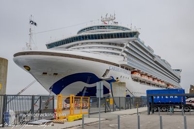
CARIBBEAN PRINCESS
Passengers Ship
Current Trip
DO AC4
| Time Travelled | 3 h, 46 mins |
|---|---|
| Remaining Time | --- |
| Distance Travelled | 13.87 nm |
| Remaining Distance | --- |
| AVG Speed | 18.2 Noeuds |
| MAX Speed | 18.4 Noeuds |
| AVG Wind | 11.9 knots |
| MAX Wind | 12.4 knots |
| MIN Temp | 23.8°C / 74.84°F |
| MAX Temp | 23.9°C / 75.02°F |
| Tirant d eau | 8.7 m |
| Position reçue | 12 h, 4 m depuis |
Current Position
| Longitude | -77.37788° |
|---|---|
| Latitude | 25.13470° |
| Etat | Under way using engine |
| Vitesse | 9 Noeuds |
| Parcours | 159° |
| Zone | North Atlantic Ocean |
| Station | T-AIS |
| Position reçue | 12 h, 4 m depuis |
Info
Information
The current position of CARIBBEAN PRINCESS is in North Atlantic Ocean with coordinates 25.13470° / -77.37788° as reported on 2025-02-07 14:16 by AIS to our vessel tracker app. The vessel's current speed is 9 Noeuds
The vessel CARIBBEAN PRINCESS (IMO: 9215490, MMSI: 310423000) is a Passengers Ship that was built in 2004 ( 21 Age ). It's sailing under the flag of [BM] Bermuda.
In this page you can find informations about the vessels current position, last detected port calls, and current voyage information. If the vessels is not in coverage by AIS you will find the latest position.
The current position of CARIBBEAN PRINCESS is detected by our AIS receivers and we are not responsible for the reliability of the data. The last position was recorded while the vessel was in Coverage by the Ais receivers of our vessel tracking app.
The current draught of CARIBBEAN PRINCESS as reported by AIS is 8.7 meters
Weather
| Temperature | 23.7°C / 74.66°F |
|---|---|
| Wind Speed | 10 knots |
| Direction | 85° E |
| Pressure | 1022.4 hPa |
| Humidity | 71.1 % |
| Cloud Coverage | --- |
Featured Company
Last Port Calls
| Port | Arrival | Departure | Time In Port |
|---|---|---|---|
| 2025-02-07 09:55 | 2025-02-07 17:35 | 7 h | |
| 2025-02-05 13:47 | 2025-02-05 19:06 | 5 h | |
| 2025-02-03 06:13 | 2025-02-03 16:07 | 9 h | |
| 2025-01-31 06:29 | 2025-01-31 16:34 | 10 h | |
| 2025-01-30 06:22 | 2025-01-30 17:13 | 10 h | |
| 2025-01-29 07:11 | 2025-01-29 18:39 | 11 h | |
| 2025-01-26 05:56 | 2025-01-26 16:04 | 10 h | |
| 2025-01-23 09:13 | 2025-01-23 17:58 | 8 h | |
| 2025-01-21 07:07 | 2025-01-21 14:42 | 7 h | |
| 2025-01-20 06:01 | 2025-01-20 16:01 | 10 h |
Most Visited Ports (Last year)
| Port | Arrivals | |
|---|---|---|
| 16 | ||
| 11 | ||
| 11 | ||
| 11 | ||
| 10 | ||
| 9 |
Last Trips
| Origin | Departure | Destination | Arrival | Distance | |
|---|---|---|---|---|---|
| 2025-02-05 19:06 | 2025-02-07 09:55 | 570.69 nm | |||
| 2025-02-03 16:07 | 2025-02-05 13:47 | 772.70 nm | |||
| 2025-01-31 16:34 | 2025-02-03 06:13 | 1021.29 nm | |||
| 2025-01-30 17:13 | 2025-01-31 06:29 | 193.62 nm | |||
| 2025-01-29 18:39 | 2025-01-30 06:22 | 113.86 nm | |||
| 2025-01-26 16:04 | 2025-01-29 07:11 | 1060.63 nm | |||
| 2025-01-23 17:58 | 2025-01-26 05:56 | 1015.31 nm | |||
| 2025-01-21 14:42 | 2025-01-23 09:13 | 784.03 nm | |||
| 2025-01-20 16:01 | 2025-01-21 07:07 | 272.98 nm | |||
| 2025-01-17 18:02 | 2025-01-20 06:01 | 777.71 nm |
Events
| Heure | Evenement | Détails | Position/ Destination | Info |
|---|---|---|---|---|
| 2025-02-07 22:35 | PORT DE DEPART |
|
25.09700 / -77.35960
DO AC4
|
Vitesse: 9.2 kn Parcours: 322° |
| 2025-02-07 22:27 | Démarrage |
25.08353 / -77.34808
[BS] NASSAU
|
Vitesse: 3.3 kn Parcours: 309° |
|
| 2025-02-07 14:55 | Arret |
25.08275 / -77.34028
[BS] NASSAU
|
Vitesse: 0.2 kn Parcours: 103° |
|
| 2025-02-07 14:55 | Port d'arrivée |
|
25.08275 / -77.34028
[BS] NASSAU
|
Vitesse: 2.1 kn Parcours: 98° |
| 2025-02-07 14:23 | Etat Changé | Default Under way using engine |
25.11994 / -77.37113
DO AC4
|
Vitesse: 9 kn Parcours: 159° |
| 2025-02-07 14:16 | Hors de la zone couverte |
25.13470 / -77.37788
North Atlantic Ocean
[BS] NASSAU
|
Vitesse: 9 kn Parcours: 159° |
|
| 2025-02-07 13:47 | Detecté en mer | Bahamas part of the North Atlantic Ocean |
25.23316 / -77.34072
North Atlantic Ocean
|
Vitesse: 16 kn Parcours: 223° |
| 2025-02-07 13:47 | Etat Changé | Under way using engine Default |
25.23316 / -77.34072
DO AC4
|
Vitesse: 16.8 kn Parcours: 223° |
| 2025-02-07 13:28 | Dans la zone couverte |
25.23316 / -77.34072
North Atlantic Ocean
|
Vitesse: 16 kn Parcours: 223° |
|
| 2025-02-06 16:42 | Hors de la zone couverte |
22.19760 / -71.86684
North Atlantic Ocean
|
Vitesse: 19.5 kn Parcours: 314.5° |