
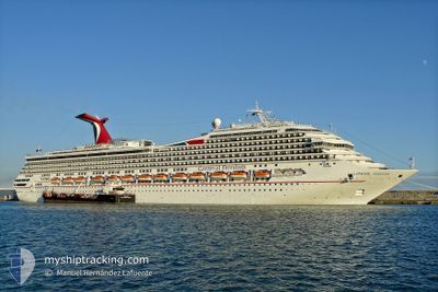
CARNIVAL FREEDOM
Passengers Ship
Current Trip
| Time Travelled | 2 h, 46 mins |
|---|---|
| Remaining Time | --- |
| Distance Travelled | 15.99 nm |
| Remaining Distance | --- |
| AVG Speed | 14.7 Noeuds |
| MAX Speed | 16.8 Noeuds |
| AVG Wind | 9.1 knots |
| MAX Wind | 9.8 knots |
| MIN Temp | 21.3°C / 70.34°F |
| MAX Temp | 22.8°C / 73.04°F |
| Tirant d eau | 8.4 m |
| Position reçue | 1 h, 38 m depuis |
Current Position
| Longitude | -80.31326° |
|---|---|
| Latitude | 28.28014° |
| Etat | Moored |
| Vitesse | 16.7 Noeuds |
| Parcours | 116.1° |
| Zone | North Atlantic Ocean |
| Station | T-AIS |
| Position reçue | 1 h, 38 m depuis |
Info
Information
The current position of CARNIVAL FREEDOM is in North Atlantic Ocean with coordinates 28.28014° / -80.31326° as reported on 2025-02-10 22:14 by AIS to our vessel tracker app. The vessel's current speed is 16.7 Noeuds
The vessel CARNIVAL FREEDOM (IMO: 9333149, MMSI: 371154000) is a Passengers Ship that was built in 2007 ( 18 Age ). It's sailing under the flag of [PA] Panama.
In this page you can find informations about the vessels current position, last detected port calls, and current voyage information. If the vessels is not in coverage by AIS you will find the latest position.
The current position of CARNIVAL FREEDOM is detected by our AIS receivers and we are not responsible for the reliability of the data. The last position was recorded while the vessel was in Coverage by the Ais receivers of our vessel tracking app.
The current draught of CARNIVAL FREEDOM as reported by AIS is 8.4 meters
Weather
| Temperature | 23.7°C / 74.66°F |
|---|---|
| Wind Speed | 9 knots |
| Direction | 72° ENE |
| Pressure | 1021.5 hPa |
| Humidity | 71.2 % |
| Cloud Coverage | --- |
Featured Company
Last Port Calls
| Port | Arrival | Departure | Time In Port |
|---|---|---|---|
| 2025-02-10 04:37 | 2025-02-10 16:06 | 11 h | |
| 2025-02-08 06:43 | 2025-02-08 16:23 | 9 h | |
| 2025-02-06 05:56 | 2025-02-06 15:48 | 9 h | |
| 2025-02-05 07:35 | 2025-02-05 16:23 | 8 h | |
| 2025-02-04 09:02 | 2025-02-04 17:14 | 8 h | |
| 2025-02-03 06:44 | 2025-02-03 14:35 | 7 h | |
| 2025-02-01 06:10 | 2025-02-01 16:01 | 9 h | |
| 2025-01-30 07:44 | 2025-01-30 16:07 | 8 h | |
| 2025-01-29 10:18 | 2025-01-29 19:27 | 9 h | |
| 2025-01-27 06:12 | 2025-01-27 15:55 | 9 h |
Most Visited Ports (Last year)
| Port | Arrivals | |
|---|---|---|
| 78 | ||
| 47 | ||
| 38 | ||
| 27 | ||
| 18 | ||
| 8 |
Last Trips
| Origin | Departure | Destination | Arrival | Distance | |
|---|---|---|---|---|---|
| 2025-02-08 16:23 | 2025-02-10 04:37 | 345.80 nm | |||
| 2025-02-06 15:48 | 2025-02-08 06:43 | 346.99 nm | |||
| 2025-02-05 16:23 | 2025-02-06 05:56 | 158.49 nm | |||
| 2025-02-04 17:14 | 2025-02-05 07:35 | 245.22 nm | |||
| 2025-02-03 14:35 | 2025-02-04 09:02 | 347.40 nm | |||
| 2025-02-01 16:01 | 2025-02-03 06:44 | 668.57 nm | |||
| 2025-01-30 16:07 | 2025-02-01 06:10 | 659.25 nm | |||
| 2025-01-29 19:27 | 2025-01-30 07:44 | 127.98 nm | |||
| 2025-01-27 15:55 | 2025-01-29 10:18 | 761.80 nm | |||
| 2025-01-26 16:35 | 2025-01-27 06:12 | 273.57 nm |
Events
| Heure | Evenement | Détails | Position/ Destination | Info |
|---|---|---|---|---|
| 2025-02-10 22:16 | Etat Changé | Default Moored |
28.27562 / -80.30299
TCGDT
|
Vitesse: 16.7 kn Parcours: 116.1° |
| 2025-02-10 22:14 | Etat Changé | Moored Default |
28.28014 / -80.31326
TCGDT
|
Vitesse: 16.6 kn Parcours: 116° |
| 2025-02-10 22:14 | Hors de la zone couverte |
28.28014 / -80.31326
North Atlantic Ocean
TCGDT
|
Vitesse: 16.7 kn Parcours: 116.1° |
|
| 2025-02-10 21:59 | Etat Changé | Default Moored |
28.31091 / -80.38375
TCGDT
|
Vitesse: 16.6 kn Parcours: 116.3° |
| 2025-02-10 21:06 | PORT DE DEPART |
|
28.40967 / -80.58641
TCGDT
|
Vitesse: 8.1 kn Parcours: 91° |
| 2025-02-10 20:48 | Démarrage |
28.41232 / -80.62257
[US] CAPE CANAVERAL
|
Vitesse: 3.6 kn Parcours: 125° |
|
| 2025-02-10 17:48 | Etat Changé | Moored Default |
28.41572 / -80.62947
[US] CAPE CANAVERAL
|
Vitesse: Parcours: 270° |
| 2025-02-10 17:45 | Etat Changé | Default Moored |
28.41573 / -80.62947
[US] CAPE CANAVERAL
|
Vitesse: Parcours: 270° |
| 2025-02-10 13:12 | Changement d'ETA | 2025/02/12 13:00 2025/02/12 09:15 |
28.41574 / -80.62946
[US] CAPE CANAVERAL
|
Vitesse: Parcours: 271° |
| 2025-02-10 12:59 | Changement de destination | TCGDT USPCV |
28.41574 / -80.62946
[US] CAPE CANAVERAL
|
Vitesse: Parcours: 271° |