

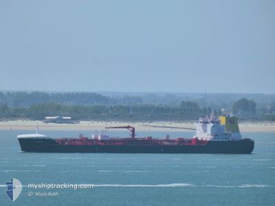
CB CARIBIC
Tanker

Current Trip
| Time Travelled | 4 days |
|---|---|
| Remaining Time | 19 h, 4 mins |
| Distance Travelled | 1053.87 nm |
| Remaining Distance | 249.02 nm |
| AVG Speed | 11.9 Noeuds |
| MAX Speed | 13.4 Noeuds |
| AVG Wind | 7.3 knots |
| MAX Wind | 17 knots |
| MIN Temp | 14.9°C / 58.82°F |
| MAX Temp | 28.8°C / 83.84°F |
| Tirant d eau | 10 m |
| Position reçue | 26 m depuis |
Current Position
| Longitude | 11.29125° |
|---|---|
| Latitude | 37.97295° |
| Etat | Under way using engine |
| Vitesse | 12.1 Noeuds |
| Parcours | 299.7° |
| Zone | Mediterranean Sea - Western Basin |
| Station | T-AIS |
| Position reçue | 26 m depuis |
Information
The current position of CB CARIBIC is in Mediterranean Sea - Western Basin with coordinates 37.97295° / 11.29125° as reported on 2025-06-07 20:23 by AIS to our vessel tracker app. The vessel's current speed is 12.1 Noeuds and is heading at the port of AUGUSTA. The estimated time of arrival as calculated by MyShipTracking vessel tracking app is 2025-06-08 17:53 LT
The vessel CB CARIBIC (IMO: 9851713, MMSI: 255806264) is a Tanker It's sailing under the flag of [PT] Portugal.
In this page you can find informations about the vessels current position, last detected port calls, and current voyage information. If the vessels is not in coverage by AIS you will find the latest position.
The current position of CB CARIBIC is detected by our AIS receivers and we are not responsible for the reliability of the data. The last position was recorded while the vessel was in Coverage by the Ais receivers of our vessel tracking app.
The current draught of CB CARIBIC as reported by AIS is 10 meters
Weather
| Temperature | 22.6°C / 72.68°F |
|---|---|
| Wind Speed | 14 knots |
| Direction | 186° S |
| Pressure | 1016.1 hPa |
| Humidity | 80.4 % |
| Cloud Coverage | --- |


Featured Company
Most Visited Ports (Last year)
| Port | Arrivals | |
|---|---|---|
| 2 | ||
| 2 | ||
| 2 | ||
| 2 | ||
| 2 | ||
| 2 |
Last Trips
| Origin | Departure | Destination | Arrival | Distance | |
|---|---|---|---|---|---|
| 2025-05-20 03:37 | 2025-06-01 04:05 | 1759.56 nm | |||
| 2025-05-06 14:55 | 2025-05-18 13:14 | 188.13 nm | |||
| 2025-04-16 16:07 | 2025-04-25 07:48 | 1839.96 nm | |||
| 2025-04-09 02:33 | 2025-04-14 12:08 | 1502.59 nm | |||
| 2025-03-27 22:38 | 2025-04-06 03:51 | 176.63 nm |
Events
| Heure | Evenement | Détails | Position/ Destination | Info |
|---|---|---|---|---|
| 2025-06-07 20:31 | Etat Changé | Default Under way using engine |
37.98602 / 11.26199
ITAUG
|
Vitesse: 12.1 kn Parcours: 299.7° |
| 2025-06-07 20:13 | Etat Changé | Under way using engine Default |
37.95558 / 11.32756
ITAUG
|
Vitesse: 12.2 kn Parcours: 302° |
| 2025-06-07 19:47 | Etat Changé | Default Under way using engine |
37.90982 / 11.42334
ITAUG
|
Vitesse: 12.2 kn Parcours: 300.3° |
| 2025-06-07 19:28 | Etat Changé | Under way using engine Default |
37.87631 / 11.49534
ITAUG
|
Vitesse: 12.3 kn Parcours: 300° |
| 2025-06-07 18:54 | Etat Changé | Default Under way using engine |
37.81691 / 11.62475
ITAUG
|
Vitesse: 12.8 kn Parcours: 298.6° |
| 2025-06-07 17:04 | Changement de zone | Italian part of the Mediterranean Sea - Western Basin Italian part of the Mediterranean Sea - Eastern Basin |
37.61237 / 12.05235
Mediterranean Sea - Western Basin
|
Vitesse: 12.3 kn Parcours: 305.2° |
| 2025-06-07 16:47 | Etat Changé | Under way using engine Default |
37.57929 / 12.11525
ITAUG
|
Vitesse: 12.8 kn Parcours: 303° |
| 2025-06-07 16:27 | Etat Changé | Default Under way using engine |
37.54127 / 12.19583
ITAUG
|
Vitesse: 13 kn Parcours: 300° |
| 2025-06-07 16:26 | Etat Changé | Under way using engine Default |
37.54093 / 12.19656
ITAUG
|
Vitesse: 13 kn Parcours: 300° |
| 2025-06-07 15:49 | Etat Changé | Default Under way using engine |
37.47812 / 12.34898
ITAUG
|
Vitesse: 12.9 kn Parcours: 298.1° |