
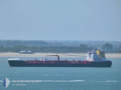
CB CARIBIC
Tanker
Current Trip
| Trip Time | 12 days |
|---|---|
| Trip Distance | 1759.56 nm |
| AVG Speed | 10.5 Knots |
| MAX Speed | 14 Knots |
| Draught | 7.4 m |
| AVG Wind | 8.3 knots |
| MAX Wind | 28 knots |
| MIN Temp | 13.2°C / 55.76°F |
| MAX Temp | 23°C / 73.4°F |
| Position Received | 4 m ago |
Current Position
| Longitude | 29.74923° |
|---|---|
| Latitude | 40.75382° |
| Status | Moored |
| Speed | |
| Course | 247° |
| Area | Sea of Marmara |
| Station | T-AIS |
| Position Received | 4 m ago |
Information
The current position of CB CARIBIC is in Sea of Marmara with coordinates 40.75382° / 29.74923° as reported on 2025-06-01 03:39 by AIS to our vessel tracker app. The vessel's current speed is 0 Knots and is currently inside the port of KORFEZ.
The vessel CB CARIBIC (IMO: 9851713, MMSI: 255806264) is a Tanker It's sailing under the flag of [PT] Portugal.
In this page you can find informations about the vessels current position, last detected port calls, and current voyage information. If the vessels is not in coverage by AIS you will find the latest position.
The current position of CB CARIBIC is detected by our AIS receivers and we are not responsible for the reliability of the data. The last position was recorded while the vessel was in Coverage by the Ais receivers of our vessel tracking app.
The current draught of CB CARIBIC as reported by AIS is 7.4 meters
Weather
| Temperature | 14.3°C / 57.74°F |
|---|---|
| Wind Speed | 3 knots |
| Direction | 66° ENE |
| Pressure | 1017.5 hPa |
| Humidity | 89.9 % |
| Cloud Coverage | 100 % |
Featured Company
Most Visited Ports (Last year)
| Port | Arrivals | |
|---|---|---|
| 2 | ||
| 2 | ||
| 2 | ||
| 2 | ||
| 2 | ||
| 2 |
Last Trips
| Origin | Departure | Destination | Arrival | Distance | |
|---|---|---|---|---|---|
| 2025-05-20 03:37 | 2025-06-01 04:05 | 1759.56 nm | |||
| 2025-05-06 14:55 | 2025-05-18 13:14 | 188.13 nm | |||
| 2025-04-16 16:07 | 2025-04-25 07:48 | 1839.96 nm | |||
| 2025-04-09 02:33 | 2025-04-14 12:08 | 1502.59 nm | |||
| 2025-03-27 22:38 | 2025-04-06 03:51 | 176.63 nm |
Events
| Time | Event | Details | Position / Dest | Info |
|---|---|---|---|---|
| 2025-06-01 01:27 | Status Changed | Moored Under way using engine |
40.75384 / 29.74922
[TR] KORFEZ
|
Speed: Course: 247° |
| 2025-06-01 01:05 | PORT ARRIVAL |
|
40.75357 / 29.74917
[TR] KORFEZ
|
Speed: 0.6 kn Course: 247° |
| 2025-06-01 00:52 | STOP Moving | 0.33 nm, South West of KORFEZ |
40.75116 / 29.74369
TRIZT
|
Speed: 0.3 kn Course: 239° |
| 2025-06-01 00:19 | ETA Changed | 2026/05/31 08:45 2025/05/31 08:45 |
40.74736 / 29.69926
TRIZT
|
Speed: 7.3 kn Course: 84° |
| 2025-06-01 00:03 | START Moving | 2.36 nm, South West of EVYAP |
40.75691 / 29.66402
TRIZT
|
Speed: 3.4 kn Course: 140° |
| 2025-05-31 23:58 | Status Changed | Under way using engine At anchor |
40.75876 / 29.66114
TRIZT
|
Speed: 0.6 kn Course: 106° |
| 2025-05-31 10:54 | Status Changed | At anchor Under way using engine |
40.75772 / 29.65995
TRIZT
|
Speed: 0.4 kn Course: 19° |
| 2025-05-31 10:50 | STOP Moving | 2.49 nm, West of EVYAP |
40.75767 / 29.66061
TRIZT
|
Speed: 0.3 kn Course: 44° |
| 2025-05-31 07:13 | ETA Changed | 2025/05/31 08:45 2025/05/31 08:00 |
40.74086 / 29.01783
TRIZT
|
Speed: 11.1 kn Course: 100.8° |
| 2025-05-31 05:37 | START Moving | 2.29 nm, South West of YESILKOY |
40.93932 / 28.77997
TRIZT
|
Speed: 3.1 kn Course: 132° |