
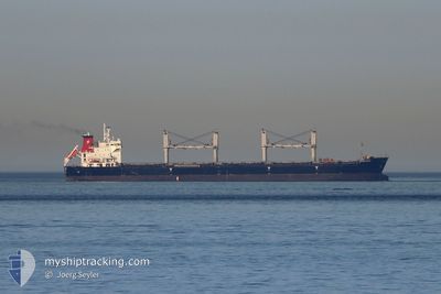
CELESTE
Bulk Carrier
Current Trip
| Trip Time | 7 days |
|---|---|
| Trip Distance | 48.14 nm |
| AVG Speed | 6.9 Noeuds |
| MAX Speed | 9.5 Noeuds |
| Tirant d eau | 9.9 m |
| AVG Wind | 6 knots |
| MAX Wind | 12 knots |
| MIN Temp | 22.9°C / 73.22°F |
| MAX Temp | 26.9°C / 80.42°F |
| Position reçue | 22 d depuis |
Current Position
| Longitude | 103.57890° |
|---|---|
| Latitude | 1.19911° |
| Etat | Under way using engine |
| Vitesse | 9.7 Noeuds |
| Parcours | 285.5° |
| Zone | Singapore Strait |
| Station | T-AIS |
| Position reçue | 22 d depuis |
Info
Information
The current position of CELESTE is in Singapore Strait with coordinates 1.19911° / 103.57890° as reported on 2025-01-17 18:12 by AIS to our vessel tracker app. The vessel's current speed is 9.7 Noeuds and is currently inside the port of VISAKHAPATNAM.
The vessel CELESTE (IMO: 9588419, MMSI: 636019313) is a Bulk Carrier that was built in 2012 ( 13 Age ). It's sailing under the flag of [LR] Liberia.
In this page you can find informations about the vessels current position, last detected port calls, and current voyage information. If the vessels is not in coverage by AIS you will find the latest position.
The current position of CELESTE is detected by our AIS receivers and we are not responsible for the reliability of the data. The last position was recorded while the vessel was in Coverage by the Ais receivers of our vessel tracking app.
The current draught of CELESTE as reported by AIS is 9.9 meters
Weather
| Temperature | 25.2°C / 77.36°F |
|---|---|
| Wind Speed | 2 knots |
| Direction | 335° NNW |
| Pressure | 1014.9 hPa |
| Humidity | 78.2 % |
| Cloud Coverage | 29 % |
Featured Company
Last Port Calls
| Port | Arrival | Departure | Time In Port |
|---|---|---|---|
| 2025-02-07 23:58 | |||
| 2025-01-24 04:58 | 2025-01-31 16:29 | 7 d | |
| 2024-12-30 22:33 | 2025-01-07 04:29 | 7 d | |
| 2024-12-25 15:28 | 2024-12-30 05:20 | 4 d |
Most Visited Ports (Last year)
| Port | Arrivals | |
|---|---|---|
| 2 | ||
| 2 | ||
| 2 | ||
| 1 | ||
| 1 | ||
| 1 |
Last Trips
| Origin | Departure | Destination | Arrival | Distance | |
|---|---|---|---|---|---|
| 2025-01-31 21:59 | 2025-02-08 05:28 | 48.14 nm | |||
| 2025-01-07 12:29 | 2025-01-24 10:28 | 4078.99 nm | |||
| 2024-12-30 13:20 | 2024-12-31 06:33 | 124.24 nm | |||
| 2024-10-12 08:01 | 2024-12-25 23:28 | 10968.59 nm |
Events
| Heure | Evenement | Détails | Position/ Destination | Info |
|---|---|---|---|---|
| 2025-02-08 00:58 | Arret |
17.70473 / 83.28052
[IN] VISAKHAPATNAM
|
Vitesse: 0.3 kn Parcours: 170° |
|
| 2025-02-07 23:58 | Port d'arrivée |
|
17.68653 / 83.31094
[IN] VISAKHAPATNAM
|
Vitesse: 4.7 kn Parcours: 330° |
| 2025-02-07 22:27 | Démarrage | 5.59 nm, East of VISAKHAPATNAM |
17.66596 / 83.39832
GANGAVARAM
|
Vitesse: 8.9 kn Parcours: 237° |
| 2025-02-07 16:48 | Arret | 6.63 nm, East of VISAKHAPATNAM |
17.68478 / 83.41892
GANGAVARAM
|
Vitesse: 0.2 kn Parcours: 261° |
| 2025-02-07 15:50 | Démarrage | 12.82 nm, East of VISAKHAPATNAM |
17.67059 / 83.52635
GANGAVARAM
|
Vitesse: 3.7 kn Parcours: 258° |
| 2025-02-03 18:35 | Arret | 13.09 nm, East of VISAKHAPATNAM |
17.67296 / 83.53125
GANGAVARAM
|
Vitesse: 0.2 kn Parcours: 222° |
| 2025-02-03 17:29 | Démarrage | 13.56 nm, East of VISAKHAPATNAM |
17.65239 / 83.53713
GANGAVARAM
|
Vitesse: 7.5 kn Parcours: 278° |
| 2025-01-31 19:06 | Arret | 14.33 nm, East of VISAKHAPATNAM |
17.65300 / 83.55089
GANGAVARAM
|
Vitesse: 0.2 kn Parcours: 178° |
| 2025-01-31 16:29 | PORT DE DEPART |
|
17.62730 / 83.26425
GANGAVARAM
|
Vitesse: 5 kn Parcours: 83° |
| 2025-01-31 16:13 | Démarrage |
17.62458 / 83.23725
[IN] GANGAVARAM
|
Vitesse: 3.5 kn Parcours: 80° |