
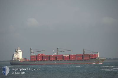
CHIQUITA FARMER
Container Ship
Current Trip
| Time Travelled | 9 days |
|---|---|
| Remaining Time | --- |
| Distance Travelled | 3533.19 nm |
| Remaining Distance | --- |
| AVG Speed | 16.6 Noeuds |
| MAX Speed | 18 Noeuds |
| AVG Wind | 15.3 knots |
| MAX Wind | 24 knots |
| MIN Temp | 16°C / 60.8°F |
| MAX Temp | 26.9°C / 80.42°F |
| Tirant d eau | 10.1 m |
| Position reçue | 5 h, 9 m depuis |
Current Position
| Longitude | -27.89018° |
|---|---|
| Latitude | 40.17077° |
| Etat | Under way using engine |
| Vitesse | 16 Noeuds |
| Parcours | 59.9° |
| Zone | North Atlantic Ocean |
| Station | T-AIS |
| Position reçue | 5 h, 9 m depuis |
Info
Information
The current position of CHIQUITA FARMER is in North Atlantic Ocean with coordinates 40.17077° / -27.89018° as reported on 2025-02-11 04:35 by AIS to our vessel tracker app. The vessel's current speed is 16 Noeuds and is heading at the port of SHEERNESS. The estimated time of arrival as calculated by MyShipTracking vessel tracking app is 2025-02-15 10:30 LT
The vessel CHIQUITA FARMER (IMO: 9336189, MMSI: 211256150) is a Container Ship that was built in 2007 ( 18 Age ). It's sailing under the flag of [DE] Germany.
In this page you can find informations about the vessels current position, last detected port calls, and current voyage information. If the vessels is not in coverage by AIS you will find the latest position.
The current position of CHIQUITA FARMER is detected by our AIS receivers and we are not responsible for the reliability of the data. The last position was recorded while the vessel was in Coverage by the Ais receivers of our vessel tracking app.
The current draught of CHIQUITA FARMER as reported by AIS is 10.1 meters
Weather
| Temperature | 16°C / 60.8°F |
|---|---|
| Wind Speed | 15 knots |
| Direction | 231° SW |
| Pressure | 1014.3 hPa |
| Humidity | 89.2 % |
| Cloud Coverage | 100 % |
Featured Company
Last Port Calls
| Port | Arrival | Departure | Time In Port |
|---|---|---|---|
| 2025-01-30 11:26 | 2025-02-01 17:56 | 2 d | |
| 2025-01-12 20:08 | 2025-01-14 23:41 | 2 d | |
| 2025-01-11 21:00 | 2025-01-12 08:23 | 11 h | |
| 2024-12-30 02:42 | 2024-12-30 07:53 | 5 h | |
| 2024-12-26 14:05 | 2024-12-27 21:04 | 1 d | |
| 2024-12-08 17:47 | 2024-12-11 02:33 | 2 d |
Most Visited Ports (Last year)
| Port | Arrivals | |
|---|---|---|
| 23 | ||
| 10 | ||
| 9 |
Last Trips
| Origin | Departure | Destination | Arrival | Distance | |
|---|---|---|---|---|---|
| 2025-01-15 00:41 | 2025-01-30 06:26 | 5485.28 nm | |||
| 2025-01-12 08:23 | 2025-01-12 21:08 | 122.05 nm | |||
| 2024-12-30 02:53 | 2025-01-11 21:00 | 5068.22 nm | |||
| 2024-12-27 16:04 | 2024-12-29 21:42 | 1.24 nm | |||
| 2024-12-11 03:33 | 2024-12-26 09:05 | 5529.61 nm | |||
| 2024-11-24 23:49 | 2024-12-08 18:47 | 5104.15 nm |
Events
| Heure | Evenement | Détails | Position/ Destination | Info |
|---|---|---|---|---|
| 2025-02-11 04:42 | Etat Changé | Default Under way using engine |
40.18687 / -27.85199
GBSHS
|
Vitesse: 16 kn Parcours: 59.9° |
| 2025-02-11 04:35 | Hors de la zone couverte |
40.17077 / -27.89018
North Atlantic Ocean
GBSHS
|
Vitesse: 16 kn Parcours: 59.9° |
|
| 2025-02-11 04:33 | Etat Changé | Under way using engine Default |
40.16707 / -27.89888
GBSHS
|
Vitesse: 16.1 kn Parcours: 60° |
| 2025-02-11 04:22 | Etat Changé | Default Under way using engine |
40.14221 / -27.95820
GBSHS
|
Vitesse: 16.2 kn Parcours: 62.3° |
| 2025-02-10 20:30 | Tirant d'eau modifié | 10.1 8.8 |
39.09698 / -30.43960
GBSHS
|
Vitesse: 16.5 kn Parcours: 61.6° |
| 2025-02-10 20:30 | Changement de destination | GBSHS CR MOB |
39.09698 / -30.43960
GBSHS
|
Vitesse: 16.5 kn Parcours: 61.6° |
| 2025-02-10 20:30 | Changement d'ETA | 2025/02/15 10:30 2025/01/29 19:00 |
39.09698 / -30.43960
GBSHS
|
Vitesse: 16.5 kn Parcours: 61.6° |
| 2025-02-10 20:06 | Changement de zone | Portuguese (Azores) part of the North Atlantic Ocean Puerto Rican part of the North Atlantic Ocean |
39.04664 / -30.56115
North Atlantic Ocean
|
Vitesse: 16.5 kn Parcours: 62.6° |
| 2025-02-10 20:06 | Etat Changé | Under way using engine Default |
39.04664 / -30.56115
CR MOB
|
Vitesse: 16.6 kn Parcours: 60° |
| 2025-02-10 19:57 | Dans la zone couverte |
39.04664 / -30.56115
North Atlantic Ocean
|
Vitesse: 16.5 kn Parcours: 62.6° |