
CHIQUITA FARMER
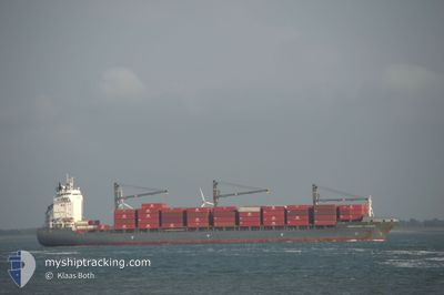
Container Ship
Current Trip
| Time Travelled | 4 days |
|---|---|
| Remaining Time | --- |
| Distance Travelled | 1523.60 nm |
| Remaining Distance | --- |
| AVG Speed | 16.6 Knop |
| MAX Speed | 17.9 Knop |
| AVG Wind | 18.2 knots |
| MAX Wind | 24 knots |
| MIN Temp | 22.2°C / 71.96°F |
| MAX Temp | 26.9°C / 80.42°F |
| Djupgående | 8.8 m |
| Position mottagen | 1 d sen |
Current Position
| Longitud | -67.72810° |
|---|---|
| Latitude | 18.83221° |
| Status | Under way using engine |
| Fart | 17.3 Knop |
| Kurs | 31.8° |
| Område | North Atlantic Ocean |
| Station | T-AIS |
| Position mottagen | 1 d sen |
Info
Information
The current position of CHIQUITA FARMER is in North Atlantic Ocean with coordinates 18.83221° / -67.72810° as reported on 2025-02-05 02:53 by AIS to our vessel tracker app. The vessel's current speed is 17.3 Knop and is heading at the port of MOIN. The estimated time of arrival as calculated by MyShipTracking vessel tracking app is 2025-01-29 19:00 LT
The vessel CHIQUITA FARMER (IMO: 9336189, MMSI: 211256150) is a Container Ship that was built in 2007 ( 18 År gammal ). It's sailing under the flag of [DE] Germany.
In this page you can find informations about the vessels current position, last detected port calls, and current voyage information. If the vessels is not in coverage by AIS you will find the latest position.
The current position of CHIQUITA FARMER is detected by our AIS receivers and we are not responsible for the reliability of the data. The last position was recorded while the vessel was in Coverage by the Ais receivers of our vessel tracking app.
The current draught of CHIQUITA FARMER as reported by AIS is 8.8 meters
Weather
| Temperature | 23.3°C / 73.94°F |
|---|---|
| Wind Speed | 15 knots |
| Direction | 51° NE |
| Pressure | 1019.7 hPa |
| Humidity | 78.7 % |
| Cloud Coverage | 37 % |
Featured Company
Last Port Calls
| Port | Arrival | Departure | Time In Port |
|---|---|---|---|
| 2025-01-30 11:26 | 2025-02-01 17:56 | 2 d | |
| 2025-01-12 20:08 | 2025-01-14 23:41 | 2 d | |
| 2025-01-11 21:00 | 2025-01-12 08:23 | 11 h | |
| 2024-12-30 02:42 | 2024-12-30 07:53 | 5 h | |
| 2024-12-26 14:05 | 2024-12-27 21:04 | 1 d | |
| 2024-12-08 17:47 | 2024-12-11 02:33 | 2 d |
Most Visited Ports (Last year)
| Port | Arrivals | |
|---|---|---|
| 23 | ||
| 10 | ||
| 9 |
Last Trips
| Origin | Departure | Destination | Arrival | Distance | |
|---|---|---|---|---|---|
| 2025-01-15 00:41 | 2025-01-30 06:26 | 5485.28 nm | |||
| 2025-01-12 08:23 | 2025-01-12 21:08 | 122.05 nm | |||
| 2024-12-30 02:53 | 2025-01-11 21:00 | 5068.22 nm | |||
| 2024-12-27 16:04 | 2024-12-29 21:42 | 1.24 nm | |||
| 2024-12-11 03:33 | 2024-12-26 09:05 | 5529.61 nm | |||
| 2024-11-24 23:49 | 2024-12-08 18:47 | 5104.15 nm |
Events
| Tid | Event | Detaljer | Position / Dest | Information |
|---|---|---|---|---|
| 2025-02-05 02:57 | Status ändrad | Default Under way using engine |
18.84851 / -67.71785
CR MOB
|
Fart: 17.3 kn Kurs: 31.8° |
| 2025-02-05 02:53 | UTANFÖR täckningsområde |
18.83221 / -67.72810
North Atlantic Ocean
|
Fart: 17.3 kn Kurs: 31.8° |
|
| 2025-02-05 02:10 | Upptäckt i hav | Puerto Rican part of the North Atlantic Ocean |
18.64775 / -67.83886
North Atlantic Ocean
|
Fart: 17.7 kn Kurs: 28.4° |
| 2025-02-05 02:08 | Status ändrad | Under way using engine Default |
18.63905 / -67.84386
CR MOB
|
Fart: 17.4 kn Kurs: 29° |
| 2025-02-05 02:08 | I täckningsområde |
18.64775 / -67.83886
North Atlantic Ocean
|
Fart: 17.7 kn Kurs: 28.4° |
|
| 2025-02-01 17:56 | AVGÅTT HAMN |
|
9.27706 / -82.38820
CR MOB
|
Fart: Kurs: 283° |
| 2025-01-30 11:26 | ANLÄNDER HAMN |
|
9.28744 / -82.38965
[PA] ALMIRANTE
|
Fart: 9 kn Kurs: 128° |
| 2025-01-29 19:58 | STOPPAR förflyttning | 1.09 nm, West of MOIN |
10.01021 / -83.09708
CR MOB
|
Fart: 0.1 kn Kurs: 106° |