

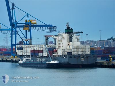
CMA CGM BEIRA
Container Ship

Current Trip
PAPCN
| Time Travelled | 2 days |
|---|---|
| Remaining Time | --- |
| Distance Travelled | 667.44 nm |
| Remaining Distance | --- |
| AVG Speed | 13.5 Noeuds |
| MAX Speed | 17.8 Noeuds |
| AVG Wind | 7.3 knots |
| MAX Wind | 16 knots |
| MIN Temp | 24.4°C / 75.92°F |
| MAX Temp | 30.8°C / 87.44°F |
| Tirant d eau | 10.3 m |
| Position reçue | 20 h, 59 m depuis |
Current Position
| Longitude | -79.54154° |
|---|---|
| Latitude | 8.91288° |
| Etat | Under way using engine |
| Vitesse | 8.4 Noeuds |
| Parcours | 141.1° |
| Zone | Caribbean Sea |
| Station | T-AIS |
| Position reçue | 20 h, 59 m depuis |
Information
The current position of CMA CGM BEIRA is in Caribbean Sea with coordinates 8.91288° / -79.54154° as reported on 2025-06-09 04:50 by AIS to our vessel tracker app. The vessel's current speed is 8.4 Noeuds
The vessel CMA CGM BEIRA (IMO: 9302956, MMSI: 215891000) is a Container Ship that was built in 2006 ( 19 Age ). It's sailing under the flag of [MT] Malta.
In this page you can find informations about the vessels current position, last detected port calls, and current voyage information. If the vessels is not in coverage by AIS you will find the latest position.
The current position of CMA CGM BEIRA is detected by our AIS receivers and we are not responsible for the reliability of the data. The last position was recorded while the vessel was in Coverage by the Ais receivers of our vessel tracking app.
The current draught of CMA CGM BEIRA as reported by AIS is 10.3 meters
Weather
| Temperature | 26.3°C / 79.34°F |
|---|---|
| Wind Speed | 4 knots |
| Direction | 281° W |
| Pressure | 1011.2 hPa |
| Humidity | 84.1 % |
| Cloud Coverage | 100 % |


Featured Company
Last Port Calls
| Port | Arrival | Departure | Time In Port |
|---|---|---|---|
| 2025-06-07 01:28 | 2025-06-07 02:12 | 44 m | |
| 2025-06-07 01:09 | 2025-06-07 01:18 | 9 m | |
| 2025-06-06 06:40 | 2025-06-07 00:14 | 17 h | |
| 2025-05-31 18:14 | 2025-05-31 19:09 | 55 m | |
| 2025-05-30 22:13 | 2025-05-30 23:24 | 1 h | |
| 2025-05-29 15:38 | 2025-05-30 04:40 | 13 h | |
| 2025-05-26 07:52 | 2025-05-27 00:27 | 16 h | |
| 2025-05-26 07:31 | 2025-05-26 07:42 | 10 m | |
| 2025-05-22 08:10 | 2025-05-23 02:37 | 18 h | |
| 2025-05-16 22:25 | 2025-05-17 22:25 | 23 h |
Most Visited Ports (Last year)
| Port | Arrivals | |
|---|---|---|
| 16 | ||
| 8 | ||
| 8 | ||
| 5 | ||
| 5 | ||
| 5 |
Last Trips
| Origin | Departure | Destination | Arrival | Distance | |
|---|---|---|---|---|---|
| 2025-06-06 20:18 | 2025-06-06 20:28 | 7.36 nm | |||
| 2025-06-06 19:14 | 2025-06-06 20:09 | 6.90 nm | |||
| 2025-05-31 15:09 | 2025-06-06 01:40 | 1883.39 nm | |||
| 2025-05-30 19:24 | 2025-05-31 14:14 | 2.77 nm | |||
| 2025-05-30 00:40 | 2025-05-30 18:13 | 242.10 nm | |||
| 2025-05-26 20:27 | 2025-05-29 11:38 | 957.08 nm | |||
| 2025-05-26 03:42 | 2025-05-26 03:52 | 0.66 nm | |||
| 2025-05-22 21:37 | 2025-05-26 03:31 | 1165.96 nm | |||
| 2025-05-17 17:25 | 2025-05-22 03:10 | 1143.45 nm | |||
| 2025-05-14 08:59 | 2025-05-16 17:25 | 727.61 nm |
Events
| Heure | Evenement | Détails | Position/ Destination | Info |
|---|---|---|---|---|
| 2025-06-09 04:54 | Etat Changé | Default Under way using engine |
8.90725 / -79.53715
PAPCN
|
Vitesse: 8.4 kn Parcours: 141.1° |
| 2025-06-09 04:50 | Etat Changé | Under way using engine Default |
8.91288 / -79.54154
PAPCN
|
Vitesse: 13.1 kn Parcours: 143° |
| 2025-06-09 04:50 | Hors de la zone couverte |
8.91288 / -79.54154
Caribbean Sea
|
Vitesse: 8.4 kn Parcours: 141.1° |
|
| 2025-06-09 04:37 | Dans la zone couverte |
8.91288 / -79.54154
Caribbean Sea
|
Vitesse: 8.4 kn Parcours: 141.1° |
|
| 2025-06-09 04:21 | Démarrage | 1.36 nm, North of RODMAN |
8.97757 / -79.57943
PAPCN
|
Vitesse: 6.5 kn Parcours: 163° |
| 2025-06-09 03:25 | Arret | 2.81 nm, North West of RODMAN |
8.99823 / -79.59342
PAPCN
|
Vitesse: Parcours: 135° |
| 2025-06-09 02:45 | Démarrage | 4.05 nm, North West of RODMAN |
9.01352 / -79.60907
PAPCN
|
Vitesse: 3.7 kn Parcours: 133° |
| 2025-06-09 02:24 | Arret | 4.35 nm, North West of RODMAN |
9.01702 / -79.61299
PAPCN
|
Vitesse: Parcours: 131° |
| 2025-06-08 22:45 | Démarrage | 4.95 nm, South of CRISTOBAL |
9.26483 / -79.92436
PAPCN
|
Vitesse: 3.5 kn Parcours: 179° |
| 2025-06-08 21:41 | Arret | 4.2 nm, South of CRISTOBAL |
9.27723 / -79.92255
PAPCN
|
Vitesse: Parcours: 187° |