
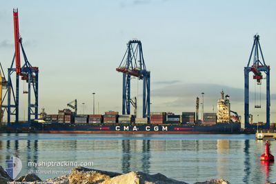
CMA CGM PEMBA
Container Ship
Current Trip
| Time Travelled | 8 h, 18 mins |
|---|---|
| Remaining Time | --- |
| Distance Travelled | 51.94 nm |
| Remaining Distance | 907.63 nm |
| AVG Speed | 9.9 Noeuds |
| MAX Speed | 14.4 Noeuds |
| AVG Wind | 11.2 knots |
| MAX Wind | 16 knots |
| MIN Temp | 21°C / 69.8°F |
| MAX Temp | 26.2°C / 79.16°F |
| Tirant d eau | 8 m |
| Position reçue | 3 d depuis |
Current Position
| Longitude | -75.77188° |
|---|---|
| Latitude | 10.37575° |
| Etat | Under way using engine |
| Vitesse | 15.7 Noeuds |
| Parcours | 319.9° |
| Zone | Caribbean Sea |
| Station | T-AIS |
| Position reçue | 3 d depuis |
Info
Information
The current position of CMA CGM PEMBA is in Caribbean Sea with coordinates 10.37575° / -75.77188° as reported on 2025-02-04 08:34 by AIS to our vessel tracker app. The vessel's current speed is 15.7 Noeuds and is heading at the port of CARTAGENA.
The vessel CMA CGM PEMBA (IMO: 9374442, MMSI: 229956000) is a Container Ship that was built in 2008 ( 17 Age ). It's sailing under the flag of [MT] Malta.
In this page you can find informations about the vessels current position, last detected port calls, and current voyage information. If the vessels is not in coverage by AIS you will find the latest position.
The current position of CMA CGM PEMBA is detected by our AIS receivers and we are not responsible for the reliability of the data. The last position was recorded while the vessel was in Coverage by the Ais receivers of our vessel tracking app.
The current draught of CMA CGM PEMBA as reported by AIS is 8 meters
Weather
| Temperature | 20.9°C / 69.62°F |
|---|---|
| Wind Speed | --- |
| Direction | 112° ESE |
| Pressure | 1016.3 hPa |
| Humidity | 98.5 % |
| Cloud Coverage | 60 % |
Featured Company
Last Port Calls
| Port | Arrival | Departure | Time In Port |
|---|---|---|---|
| 2025-02-06 13:10 | 2025-02-07 16:35 | 1 d | |
| 2025-02-02 21:41 | 2025-02-04 02:18 | 1 d | |
| 2025-01-21 23:16 | 2025-01-24 22:57 | 2 d | |
| 2025-01-20 11:26 | 2025-01-21 10:24 | 22 h | |
| 2025-01-15 20:03 | 2025-01-18 02:39 | 2 d | |
| 2025-01-11 19:58 | 2025-01-12 09:38 | 13 h | |
| 2025-01-11 19:34 | 2025-01-11 19:48 | 13 m | |
| 2025-01-08 08:48 | 2025-01-09 07:23 | 22 h | |
| 2025-01-07 16:45 | 2025-01-08 03:37 | 10 h | |
| 2025-01-01 08:59 | 2025-01-03 19:49 | 2 d |
Most Visited Ports (Last year)
| Port | Arrivals | |
|---|---|---|
| 16 | ||
| 16 | ||
| 16 | ||
| 15 | ||
| 15 | ||
| 14 |
Last Trips
| Origin | Departure | Destination | Arrival | Distance | |
|---|---|---|---|---|---|
| 2025-02-04 02:18 | 2025-02-06 13:10 | 910.05 nm | |||
| 2025-01-24 22:57 | 2025-02-02 21:41 | 979.60 nm | |||
| 2025-01-21 10:24 | 2025-01-21 23:16 | 82.89 nm | |||
| 2025-01-18 02:39 | 2025-01-20 11:26 | 735.05 nm | |||
| 2025-01-12 09:38 | 2025-01-15 20:03 | 788.48 nm | |||
| 2025-01-11 19:48 | 2025-01-11 19:58 | 0.58 nm | |||
| 2025-01-11 19:48 | 2025-01-11 19:34 | 0.58 nm | |||
| 2025-01-08 03:37 | 2025-01-08 08:48 | 60.96 nm | |||
| 2025-01-03 19:49 | 2025-01-07 16:45 | 1313.70 nm | |||
| 2024-12-31 10:39 | 2025-01-01 08:59 | 66.16 nm |
Events
| Heure | Evenement | Détails | Position/ Destination | Info |
|---|---|---|---|---|
| 2025-02-07 22:35 | PORT DE DEPART |
|
15.85527 / -87.96774
COCTG
|
Vitesse: 5.5 kn Parcours: 260° |
| 2025-02-07 22:22 | Démarrage |
15.84079 / -87.95543
[HN] PUERTO CORTES
|
Vitesse: 5.5 kn Parcours: 260° |
|
| 2025-02-06 19:10 | Arret |
15.83561 / -87.96214
[HN] PUERTO CORTES
|
Vitesse: 0.1 kn Parcours: 56° |
|
| 2025-02-06 19:10 | Port d'arrivée |
|
15.83561 / -87.96214
[HN] PUERTO CORTES
|
Vitesse: 1.3 kn Parcours: 68° |
| 2025-02-06 17:43 | Démarrage | 7.29 nm, North of PUERTO CORTES |
15.95106 / -87.92265
COCTG
|
Vitesse: 6.6 kn Parcours: 185° |
| 2025-02-06 16:54 | Arret | 7.53 nm, North of PUERTO CORTES |
15.95538 / -87.92345
COCTG
|
Vitesse: 0.1 kn Parcours: 165° |
| 2025-02-04 08:38 | Etat Changé | Default Under way using engine |
10.38854 / -75.78219
COCTG
|
Vitesse: 15.7 kn Parcours: 319.9° |
| 2025-02-04 08:34 | Etat Changé | Under way using engine Default |
10.37575 / -75.77188
COCTG
|
Vitesse: 15.7 kn Parcours: 319° |
| 2025-02-04 08:34 | Hors de la zone couverte |
10.37575 / -75.77188
Caribbean Sea
|
Vitesse: 15.7 kn Parcours: 319.9° |
|
| 2025-02-04 08:27 | Etat Changé | Default Under way using engine |
10.35103 / -75.75128
COCTG
|
Vitesse: 15.7 kn Parcours: 313.3° |