
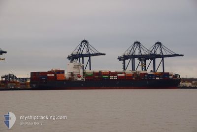
CMA CGM TOKYO
Container Ship
Current Trip
| Time Travelled | 1 day |
|---|---|
| Remaining Time | --- |
| Distance Travelled | 293.70 nm |
| Remaining Distance | --- |
| AVG Speed | 10.7 Noeuds |
| MAX Speed | 19.9 Noeuds |
| AVG Wind | 12.7 knots |
| MAX Wind | 23.5 knots |
| MIN Temp | -1.1°C / 30.02°F |
| MAX Temp | 4°C / 39.2°F |
| Tirant d eau | 12.7 m |
| Position reçue | 32 m depuis |
Current Position
| Longitude | 3.65574° |
|---|---|
| Latitude | 52.17856° |
| Etat | At anchor |
| Vitesse | 0.1 Noeuds |
| Parcours | 30° |
| Zone | North Sea |
| Station | T-AIS |
| Position reçue | 32 m depuis |
Info
Information
The current position of CMA CGM TOKYO is in North Sea with coordinates 52.17856° / 3.65574° as reported on 2025-02-13 06:38 by AIS to our vessel tracker app. The vessel's current speed is 0.1 Noeuds
The vessel CMA CGM TOKYO (IMO: 9629380, MMSI: 249172000) is a Container Ship that was built in 2013 ( 12 Age ). It's sailing under the flag of [MT] Malta.
In this page you can find informations about the vessels current position, last detected port calls, and current voyage information. If the vessels is not in coverage by AIS you will find the latest position.
The current position of CMA CGM TOKYO is detected by our AIS receivers and we are not responsible for the reliability of the data. The last position was recorded while the vessel was in Coverage by the Ais receivers of our vessel tracking app.
The current draught of CMA CGM TOKYO as reported by AIS is 12.7 meters
Weather
| Temperature | 3.3°C / 37.94°F |
|---|---|
| Wind Speed | 17 knots |
| Direction | 51° NE |
| Pressure | 1020.4 hPa |
| Humidity | 82.1 % |
| Cloud Coverage | 100 % |
Featured Company
Last Port Calls
| Port | Arrival | Departure | Time In Port |
|---|---|---|---|
| 2025-02-10 09:42 | 2025-02-11 22:12 | 1 d | |
| 2025-02-08 09:42 | 2025-02-09 08:40 | 22 h | |
| 2025-02-03 02:27 | 2025-02-04 07:39 | 1 d | |
| 2025-01-27 05:30 | 2025-01-28 18:32 | 1 d | |
| 2025-01-20 22:49 | 2025-01-22 22:31 | 1 d | |
| 2025-01-16 21:29 | 2025-01-18 13:39 | 1 d | |
| 2025-01-09 01:37 | 2025-01-11 04:54 | 2 d | |
| 2024-12-31 18:49 | 2025-01-02 21:08 | 2 d | |
| 2024-12-25 19:15 | 2024-12-30 11:34 | 4 d | |
| 2024-12-23 21:33 | 2024-12-24 14:03 | 16 h |
Most Visited Ports (Last year)
| Port | Arrivals | |
|---|---|---|
| 4 | ||
| 3 | ||
| 2 | ||
| 2 | ||
| 2 | ||
| 2 |
Last Trips
| Origin | Departure | Destination | Arrival | Distance | |
|---|---|---|---|---|---|
| 2025-02-09 08:40 | 2025-02-10 10:42 | 378.12 nm | |||
| 2025-02-04 08:39 | 2025-02-08 09:42 | 1389.02 nm | |||
| 2025-01-28 19:32 | 2025-02-03 03:27 | 1090.40 nm | |||
| 2025-01-23 00:31 | 2025-01-27 06:30 | 1050.67 nm | |||
| 2025-01-18 16:39 | 2025-01-21 00:49 | 257.49 nm | |||
| 2025-01-11 05:54 | 2025-01-17 00:29 | 1284.49 nm | |||
| 2025-01-02 22:08 | 2025-01-09 02:37 | 2204.98 nm | |||
| 2024-12-30 12:34 | 2024-12-31 19:49 | 269.82 nm | |||
| 2024-12-24 15:03 | 2024-12-25 20:15 | 140.60 nm | |||
| 2024-12-22 10:25 | 2024-12-23 22:33 | 324.40 nm |
Events
| Heure | Evenement | Détails | Position/ Destination | Info |
|---|---|---|---|---|
| 2025-02-13 02:23 | Etat Changé | At anchor Under way using engine |
52.18087 / 3.66112
NLRTM
|
Vitesse: 0.4 kn Parcours: 267° |
| 2025-02-13 02:21 | Arret | 20.02 nm, North West of MAASVLAKTE - ROTTERDAM |
52.18055 / 3.66119
NLRTM
|
Vitesse: 0.3 kn Parcours: 259° |
| 2025-02-12 23:56 | Tirant d'eau modifié | 12.7 12.8 |
52.43725 / 3.83766
NLRTM
|
Vitesse: 10.9 kn Parcours: 192.4° |
| 2025-02-12 12:44 | Changement d'ETA | 2025/02/14 04:00 2025/02/14 02:00 |
53.73021 / 5.79878
NLRTM
|
Vitesse: 11 kn Parcours: 251.3° |
| 2025-02-12 11:07 | Detecté en mer | Dutch part of the North Sea |
53.82603 / 6.25341
North Sea
NLRTM
|
Vitesse: 10.1 kn Parcours: 247° |
| 2025-02-12 11:07 | Dans la zone couverte |
53.82603 / 6.25341
North Sea
NLRTM
|
Vitesse: 10.1 kn Parcours: 247° |
|
| 2025-02-12 09:31 | Hors de la zone couverte |
53.89241 / 6.67795
North Sea
NLRTM
|
Vitesse: 9.4 kn Parcours: 256.9° |
|
| 2025-02-11 23:02 | Tirant d'eau modifié | 12.8 12 |
53.56533 / 9.70256
NLRTM
|
Vitesse: 7.8 kn Parcours: 279.5° |
| 2025-02-11 23:02 | Changement d'ETA | 2025/02/14 02:00 |
53.56533 / 9.70256
NLRTM
|
Vitesse: 7.8 kn Parcours: 279.5° |
| 2025-02-11 22:56 | Tirant d'eau modifié | 12 12.8 |
53.56350 / 9.72378
NLRTM
|
Vitesse: 7.4 kn Parcours: 277° |