

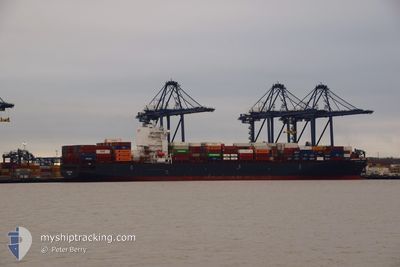
CMA CGM TOKYO
Container Ship

Current Trip
| Trip Time | 10 h, 50 mins |
|---|---|
| Trip Distance | 129.94 nm |
| AVG Speed | 12 Knopen |
| MAX Speed | 12 Knopen |
| Diepgang | 10.4 M |
| AVG Wind | 20.2 knots |
| MAX Wind | 24.6 knots |
| MIN Temp | 11.3°C / 52.34°F |
| MAX Temp | 16.6°C / 61.88°F |
| Positie ontvangen | 2 m geleden |
Current Position
| Lengtegraad | 4.33279° |
|---|---|
| Breedtegraat | 51.32545° |
| Status | Moored |
| Snelheid | |
| Koers | 81° |
| Gebied | North Sea |
| Station | T-AIS |
| Positie ontvangen | 2 m geleden |
Information
The current position of CMA CGM TOKYO is in North Sea with coordinates 51.32545° / 4.33279° as reported on 2025-06-09 10:23 by AIS to our vessel tracker app. The vessel's current speed is 0 Knopen and is currently inside the port of ANTWERP.
The vessel CMA CGM TOKYO (IMO: 9629380, MMSI: 249172000) is a Container Ship that was built in 2013 ( 12 Jaar oud ). It's sailing under the flag of [MT] Malta.
In this page you can find informations about the vessels current position, last detected port calls, and current voyage information. If the vessels is not in coverage by AIS you will find the latest position.
The current position of CMA CGM TOKYO is detected by our AIS receivers and we are not responsible for the reliability of the data. The last position was recorded while the vessel was in Coverage by the Ais receivers of our vessel tracking app.
The current draught of CMA CGM TOKYO as reported by AIS is 10.4 meters
Weather
| Temperature | 17.6°C / 63.68°F |
|---|---|
| Wind Speed | 9 knots |
| Direction | 235° SW |
| Pressure | 1022.4 hPa |
| Humidity | 56.6 % |
| Cloud Coverage | 34 % |


Featured Company
Last Port Calls
| Port | Arrival | Departure | Time In Port |
|---|---|---|---|
| 2025-06-08 15:27 | |||
| 2025-06-07 06:33 | 2025-06-08 04:37 | 22 h | |
| 2025-05-30 03:43 | 2025-05-31 10:21 | 1 d | |
| 2025-05-26 22:10 | 2025-05-27 19:57 | 21 h | |
| 2025-05-21 19:04 | 2025-05-22 17:26 | 22 h | |
| 2025-05-17 08:20 | 2025-05-18 13:03 | 1 d | |
| 2025-05-07 15:03 | 2025-05-08 04:04 | 13 h | |
| 2025-05-05 15:33 | 2025-05-06 17:54 | 1 d | |
| 2025-05-05 15:19 | 2025-05-05 15:26 | 6 m | |
| 2025-05-04 05:05 | 2025-05-05 01:31 | 20 h |
Most Visited Ports (Last year)
| Port | Arrivals | |
|---|---|---|
| 8 | ||
| 5 | ||
| 5 | ||
| 5 | ||
| 4 | ||
| 4 |
Last Trips
| Origin | Departure | Destination | Arrival | Distance | |
|---|---|---|---|---|---|
| 2025-06-08 06:37 | 2025-06-08 17:27 | 129.94 nm | |||
| 2025-05-31 12:21 | 2025-06-07 08:33 | 336.47 nm | |||
| 2025-05-27 20:57 | 2025-05-30 05:43 | 391.83 nm | |||
| 2025-05-22 18:26 | 2025-05-26 23:10 | 1358.46 nm | |||
| 2025-05-18 15:03 | 2025-05-21 20:04 | 1039.46 nm | |||
| 2025-05-06 20:54 | 2025-05-07 17:03 | 262.51 nm | |||
| 2025-05-05 18:26 | 2025-05-05 18:33 | 0.45 nm | |||
| 2025-05-05 04:31 | 2025-05-05 18:19 | 189.85 nm | |||
| 2025-05-03 23:36 | 2025-05-04 08:05 | 88.28 nm | |||
| 2025-04-27 20:09 | 2025-05-02 15:59 | 1122.70 nm |
Events
| Tijd | Evenement | Details | Positie / Bestemming | Info |
|---|---|---|---|---|
| 2025-06-08 23:18 | Destination Changed | FRLEH BEANR |
51.32534 / 4.33278
[BE] ANTWERP
|
Snelheid: Koers: 81° |
| 2025-06-08 23:18 | ETA Changed | 2025/06/10 20:00 2025/06/08 10:00 |
51.32534 / 4.33278
[BE] ANTWERP
|
Snelheid: Koers: 81° |
| 2025-06-08 17:38 | Status Changed | Moored Under way using engine |
51.32536 / 4.33275
[BE] ANTWERP
|
Snelheid: 0.2 kn Koers: 81° |
| 2025-06-08 17:33 | Stop beweging |
51.32543 / 4.33230
[BE] ANTWERP
|
Snelheid: 0.3 kn Koers: 82° |
|
| 2025-06-08 17:02 | Start beweging |
51.34401 / 4.28721
[BE] ANTWERP
|
Snelheid: 3.2 kn Koers: 96° |
|
| 2025-06-08 15:56 | Stop beweging |
51.34421 / 4.28418
[BE] ANTWERP
|
Snelheid: 0.3 kn Koers: 98° |
|
| 2025-06-08 15:27 | Aankomsthaven |
|
51.36619 / 4.22025
[BE] ANTWERP
|
Snelheid: 10.7 kn Koers: 159.4° |
| 2025-06-08 12:19 | Wijzig zee gebeid | Dutch part of the North Sea Belgian part of the North Sea |
51.40324 / 3.33632
North Sea
BEANR
|
Snelheid: 19.2 kn Koers: 82.4° |
| 2025-06-08 11:07 | Wijzig zee gebeid | Belgian part of the North Sea Dutch part of the North Sea |
51.53037 / 3.10468
North Sea
BEANR
|
Snelheid: 15.9 kn Koers: 218.4° |
| 2025-06-08 09:39 | Start beweging | 19.3 nm, North West of NEELTJE JANS |
51.78454 / 3.25253
BEANR
|
Snelheid: 3.1 kn Koers: 219° |