
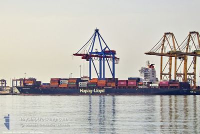
DACHAN BAY EXPRESS
Container Ship
Current Trip
| Time Travelled | 17 h, 22 mins |
|---|---|
| Remaining Time | 16 h, 10 mins |
| Distance Travelled | 287.57 nm |
| Remaining Distance | 218.70 nm |
| AVG Speed | 16.7 Noeuds |
| MAX Speed | 18 Noeuds |
| AVG Wind | 4.9 knots |
| MAX Wind | 11.3 knots |
| MIN Temp | 21.5°C / 70.7°F |
| MAX Temp | 23.6°C / 74.48°F |
| Tirant d eau | 9.9 m |
| Position reçue | 1 m depuis |
Current Position
| Longitude | 3.98112° |
|---|---|
| Latitude | 41.28883° |
| Etat | Under way using engine |
| Vitesse | 13.4 Noeuds |
| Parcours | 237° |
| Zone | Mediterranean Sea - Western Basin |
| Station | T-AIS |
| Position reçue | 1 m depuis |
Information
The current position of DACHAN BAY EXPRESS is in Mediterranean Sea - Western Basin with coordinates 41.28883° / 3.98112° as reported on 2025-06-13 11:28 by AIS to our vessel tracker app. The vessel's current speed is 13.4 Noeuds and is heading at the port of SAGUNTO. The estimated time of arrival as calculated by MyShipTracking vessel tracking app is 2025-06-14 03:40 LT
The vessel DACHAN BAY EXPRESS (IMO: 9539664, MMSI: 636092696) is a Container Ship that was built in 2012 ( 13 Age ). It's sailing under the flag of [LR] Liberia.
In this page you can find informations about the vessels current position, last detected port calls, and current voyage information. If the vessels is not in coverage by AIS you will find the latest position.
The current position of DACHAN BAY EXPRESS is detected by our AIS receivers and we are not responsible for the reliability of the data. The last position was recorded while the vessel was in Coverage by the Ais receivers of our vessel tracking app.
The current draught of DACHAN BAY EXPRESS as reported by AIS is 9.9 meters
Weather
| Temperature | 23.3°C / 73.94°F |
|---|---|
| Wind Speed | 10 knots |
| Direction | 165° SSE |
| Pressure | 1018.8 hPa |
| Humidity | 83.1 % |
| Cloud Coverage | 100 % |
Featured Company
Last Port Calls
| Port | Arrival | Departure | Time In Port |
|---|---|---|---|
| 2025-06-11 16:05 | 2025-06-12 18:08 | 1 d | |
| 2025-06-09 13:52 | 2025-06-11 02:04 | 1 d | |
| 2025-06-07 03:22 | 2025-06-07 22:40 | 19 h | |
| 2025-06-04 13:18 | 2025-06-06 10:00 | 1 d | |
| 2025-05-31 07:27 | 2025-05-31 16:32 | 9 h | |
| 2025-05-16 22:56 | 2025-05-20 05:22 | 3 d | |
| 2025-05-12 14:36 | 2025-05-13 04:00 | 13 h | |
| 2025-05-01 05:17 | 2025-05-01 15:00 | 9 h | |
| 2025-04-27 19:40 | 2025-04-28 05:23 | 9 h | |
| 2025-04-24 06:15 | 2025-04-26 15:40 | 2 d |
Last Trips
| Origin | Departure | Destination | Arrival | Distance | |
|---|---|---|---|---|---|
| 2025-06-11 04:04 | 2025-06-11 18:05 | 226.10 nm | |||
| 2025-06-08 00:40 | 2025-06-09 15:52 | 318.37 nm | |||
| 2025-06-06 12:00 | 2025-06-07 05:22 | 300.08 nm | |||
| 2025-05-31 17:32 | 2025-06-04 15:18 | 1046.76 nm | |||
| 2025-05-20 01:22 | 2025-05-31 08:27 | 3484.81 nm | |||
| 2025-05-13 01:00 | 2025-05-16 18:56 | 1279.30 nm | |||
| 2025-05-01 17:00 | 2025-05-12 11:36 | 3220.89 nm | |||
| 2025-04-28 07:23 | 2025-05-01 07:17 | 589.52 nm | |||
| 2025-04-26 17:40 | 2025-04-27 21:40 | 512.43 nm | |||
| 2025-04-21 23:38 | 2025-04-24 08:15 | 297.98 nm |
Events
| Heure | Evenement | Détails | Position/ Destination | Info |
|---|---|---|---|---|
| 2025-06-13 07:26 | Changement de zone | Spanish part of the Mediterranean Sea - Western Basin French part of the Mediterranean Sea - Western Basin |
41.83444 / 5.05480
Mediterranean Sea - Western Basin
IT GOA>ES SAG
|
Vitesse: 16.9 kn Parcours: 233.5° |
| 2025-06-12 23:11 | Changement de zone | French part of the Mediterranean Sea - Western Basin Monégasque part of the Mediterranean Sea - Western Basin |
43.39268 / 7.52556
Mediterranean Sea - Western Basin
IT GOA>ES SAG
|
Vitesse: 17.7 kn Parcours: 230.7° |
| 2025-06-12 23:02 | Changement de zone | Monégasque part of the Mediterranean Sea - Western Basin French part of the Mediterranean Sea - Western Basin |
43.41713 / 7.57583
Mediterranean Sea - Western Basin
IT GOA>ES SAG
|
Vitesse: 17.7 kn Parcours: 241° |
| 2025-06-12 22:47 | Changement de zone | French part of the Mediterranean Sea - Western Basin Italian part of the Mediterranean Sea - Western Basin |
43.45424 / 7.66377
Mediterranean Sea - Western Basin
IT GOA>ES SAG
|
Vitesse: 17.7 kn Parcours: 234.6° |
| 2025-06-12 21:59 | Changement de zone | Italian part of the Mediterranean Sea - Western Basin Italian part of the Ligurian Sea |
43.61260 / 7.90618
Mediterranean Sea - Western Basin
IT GOA>ES SAG
|
Vitesse: 17.9 kn Parcours: 227.2° |
| 2025-06-12 18:08 | PORT DE DEPART |
|
44.38407 / 8.94371
IT GOA>ES SAG
|
Vitesse: 9 kn Parcours: 160° |
| 2025-06-12 17:49 | Démarrage |
44.40215 / 8.89641
[IT] GENOVA
|
Vitesse: 3.2 kn Parcours: 130° |
|
| 2025-06-12 17:45 | Etat Changé | Under way using engine Default |
44.40464 / 8.89614
[IT] GENOVA
|
Vitesse: Parcours: 172° |
| 2025-06-12 17:42 | Etat Changé | Default Moored |
44.40486 / 8.89633
[IT] GENOVA
|
Vitesse: Parcours: 172° |
| 2025-06-12 17:15 | Etat Changé | Moored Default |
44.40482 / 8.89631
[IT] GENOVA
|
Vitesse: Parcours: 172° |